Castro Urdiales

Last updated • 4 min readFrom Wikipedia, The Free Encyclopedia
Castro Urdiales
Puerto de Castro-Urdiales.jpg
Port of Castro Urdiales, with the Church of Santa María de la Asunción in the background
Bandera de Castro Urdiales.png
Coat of Arms of Castro Urdiales.svg
Castro Urdiales (Cantabria) Mapa.svg
Location of Castro Urdiales municipality in Cantabria
Spain location map with provinces.svg
Red pog.svg
Castro Urdiales
Location in Spain
Spain Cantabria location map.svg
Red pog.svg
Castro Urdiales
Castro Urdiales (Cantabria)
Coordinates: 43°23′4″N3°12′54″W / 43.38444°N 3.21500°W / 43.38444; -3.21500
CountryFlag of Spain.svg  Spain
Autonomous community Flag of Cantabria.svg  Cantabria
Province Cantabria
Comarca Eastern coast of Cantabria
Founded Flaviobriga 74 AD
Government
   Alcalde Susana Herrán Martín (2019) (PSOE)
Area
  Total
96.72 km2 (37.34 sq mi)
Elevation
19 m (62 ft)
Population
 (2018) [1]
  Total
31,977
  Density330/km2 (860/sq mi)
Demonym Castreños
Time zone UTC+1 (CET)
  Summer (DST) UTC+2 (CEST)
Postal code
39700
Website Official website

Castro Urdiales (Spanish pronunciation: [ˈkastɾowɾˈðjales] ) is a seaport of northern Spain, in the autonomous community of Cantabria, situated on the Bay of Biscay. Castro Urdiales is a modern town, although its castle and the Gothic-style parish church of Santa María de la Asunción, date from the Middle Ages. Its chief industries are tourism, fishing, and oil-packing of fish, especially sardines and anchovies. [2] The Lolin and La Castreña anchovy canning factories serve as a reminder of the town's closeness to this industry and its proximity to the sea.

Contents

Although the number of people registered in the town is around 32,000, the summer population can double or even triple this figure. The town is popular because of its beaches and scenic harbor.

History

Figure of a young Neptune from Mount Cueto Museum of Prehistory and Archaeology of Cantabria 19 - Figure of a young Neptune (Castro Urdiales).JPG
Figure of a young Neptune from Mount Cueto
View of Brazomar beach. Castro Urdiales.jpg
View of Brazomar beach.

Castro Urdiales was originally called Portus Amanum, and was the chief city of the Autrigones. In AD 74 a Roman colony was established under the name Flaviobriga, during the reign of emperor Vespasian. It was most likely established to mine the abundant iron in the area. [3]

In 1163 the town of Castro Urdiales received its municipal charter. [4] It lay at the western tip of the coastline of Navarre until 1200, when the kingdom was invaded by Alfonso VIII of Castile. [5] [6] Castro Urdiales benefited much from its location at a crossroads in the trade between northern Europe and Castile. It remained in Biscay until 1476 at least, but it is not cited in the seigneury's assemblies thereafter. [7] Until the 18th century, the town recurrently attempted a reincorporation to Biscay (attested in 1799), but its attempts were met with the frontal refusal of Bilbao on account that it could tip the scale against its own trade balance. [8]

It was destroyed by the French in 1813, but was speedily rebuilt and fortified. Its rapid rise in population and prosperity dates from the increased development of iron mining and railway communication which took place after 1879. [2]

Main sights

The monument complex of Castro Urdiales, also known as Puebla Vieja, has medieval origins and is located near the sea. It was declared a Conjunto histórico in 1978.

Santa Maria de la Asuncion Church, apse Sta Maria de la Asuncion - Castro Urdiales.jpg
Santa María de la Asuncion Church, apse

The Church of Santa María de la Asunción is in Gothic style. Built under the protection of King Alfonso VIII of Castile in the 13th century (though it was finished in the 15th century), it is a basilica church with three naves. In the interior are the images of the White Virgin and the Reclining Christ, and three Gothic carvings of the Magi. It was declared a National Monument in 1931.

The Castle of Santa Ana is located near the port and the church of Santa María de la Asunción. In modern times it housed a lighthouse.

Other sights include:

Monument on the waterfront in Castro Urdiales CastroUrdiales-v12.JPG
Monument on the waterfront in Castro Urdiales
Lighthouse, church and Santa Ana Faro e Iglesia de Castro Urdiales.jpg
Lighthouse, church and Santa Ana

Twin towns

See also

Notes

  1. Municipal Register of Spain 2018. National Statistics Institute.
  2. 1 2 Wikisource-logo.svg One or more of the preceding sentences incorporates text from a publication now in the public domain :  Chisholm, Hugh, ed. (1911). "Castro Urdiales". Encyclopædia Britannica . Vol. 5 (11th ed.). Cambridge University Press. p. 484.
  3. http://www.muskiz.org/english/historia.php Archived 2008-05-09 at the Wayback Machine 30 May 2008
  4. ".: Heritage and History - Cantabria". Archived from the original on 2008-05-12. Retrieved 2008-06-02. 1 June 2008
  5. Urzainqui, Tomás; Olaizola, Juan Maria (1998). La Navarra marítima. Pamplona: Pamiela. p. 108. ISBN   84-7681-293-0.
  6. Read the Division of kingdoms of Navarre and Spain, "et durat usque ad aquam quae dicitur Castre (quae dividit terram regis Navarrae a terra regis Castellae)"
  7. "Castro-Urdiales". Auñamendi Eusko Entziklopedia. EuskoMedia Fundazioa. Retrieved 16 February 2014.
  8. Urzainqui, Tomás; Olaizola, Juan Maria (1998). La Navarra marítima. Pamplona: Pamiela. p. 109. ISBN   84-7681-293-0.
  9. Government of Cantabria, notificación del decreto

Related Research Articles

<span class="mw-page-title-main">Cantabria</span> Autonomous community and province of Spain

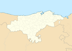
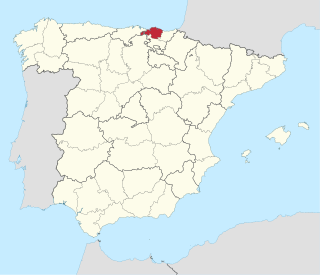
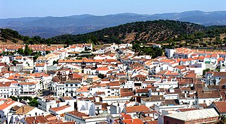
Cantabria is an autonomous community and province in northern Spain with Santander as its capital city. It is called a comunidad histórica, a historic community, in its current Statute of Autonomy. It is bordered on the east by the Basque autonomous community, on the south by Castile and León, on the west by the Principality of Asturias, and on the north by the Cantabrian Sea, which forms part of the Bay of Biscay.

<span class="mw-page-title-main">Biscay</span> Province of Spain

Biscay or Bizkaia, is a province of the Basque Autonomous Community, heir of the ancient Lordship of Biscay, lying on the south shore of the eponymous bay. The capital and largest city is Bilbao.

<span class="mw-page-title-main">Basque nationalism</span> Nationalist movement

Basque nationalism is a form of nationalism that asserts that Basques, an ethnic group indigenous to the western Pyrenees, are a nation and promotes the political unity of the Basques, today scattered between Spain and France. Since its inception in the late 19th century, Basque nationalism has included Basque independence movements.

<span class="mw-page-title-main">Labourd</span> Province in Pays Basque, France

Labourd is a former French province and part of the present-day Pyrénées Atlantiques département of Nouvelle-Aquitaine region. It is one of the traditional Basque provinces, and identified as one of the territorial component parts of the Basque Country by many, especially by the Basque nationalists.

<span class="mw-page-title-main">Kingdom of Navarre</span> Medieval kingdom around the Pyrenees

The Kingdom of Navarre, originally the Kingdom of Pamplona occupied lands on both sides of the western Pyrenees, with its northernmost areas originally reaching the Atlantic Ocean, between present-day Spain and France.

<span class="mw-page-title-main">Aranda de Duero</span> Municipality in Castile and León, Spain

Aranda de Duero is a city and municipality, capital of the Ribera del Duero comarca, in the south of the province of Burgos, in Castile and León, Spain. It has a population of roughly 33,000 people and lies on the River Duero.

<span class="mw-page-title-main">Balmaseda</span> Municipality in Basque Country, Spain

Balmaseda is a town and municipality located in the province of Biscay, in the Basque Country. Balmaseda is the capital city of the comarca of Enkarterri, in western Biscay and serves an important role in the province thanks to its proximity to the capital city of Bilbao and the regions of Cantabria and Castile and León.

<span class="mw-page-title-main">Durango, Spain</span> Municipality in Basque Country, Spain

Durango is a town and municipality of the historical territory and province of Biscay, located in the Basque Country, Spain. It is the main town of Durangaldea, one of the comarcas of Biscay. Because of its economical activities and population, Durango is considered one of the largest towns in Biscay after the ones that compose the conurbation of Greater Bilbao.

<span class="mw-page-title-main">Cuéllar</span> Municipality in the Province of Segovia, Castile and León, Spain

Cuéllar is a municipality in the Province of Segovia, within the autonomous community of Castile and León, Spain.

<span class="mw-page-title-main">Aracena</span> Place in Andalusia, Spain

Aracena is a town and municipality located in the province of Huelva, southwestern Spain. As of 2012, the city has a population of 7,814 inhabitants. The town derived its name from the Sierra de Aracena, which is part of the Sierra Morena system.

<span class="mw-page-title-main">BizkaiBus</span> Bus service in Spain

BizkaiBus is the name for bus services serving the province of Biscay, Spain. It is named after the Basque name of the province, Bizkaia. The buses can be identified by their distinctive green livery.

<span class="mw-page-title-main">History of the Basques</span>

The Basques are an indigenous ethno-linguistic group mainly inhabiting the Basque Country. Their history is therefore interconnected with Spanish and French history and also with the history of many other past and present countries, particularly in Europe and the Americas, where a large number of their descendants keep attached to their roots, clustering around Basque clubs which are centers for Basque people.

<span class="mw-page-title-main">Frías, Province of Burgos</span> Municipality and city in Castile and León, Spain

Frías is a town located in the northern part of the province of Burgos, in Castile and León, Spain. In 2010 it had a population of only 275 inhabitants.

<span class="mw-page-title-main">Roman Catholic Diocese of Bilbao</span> Roman Catholic diocese in Spain

The Diocese of Bilbao is a Latin Church diocese of the Catholic Church located in the city of Bilbao and Province of Biscay in Northern Spain. It is part of the ecclesiastical province of Burgos.

<span class="mw-page-title-main">Trainera</span>

A trainera is a traditional boat of the Cantabrian Sea coast at the southern end of the Bay of Biscay, propelled by oars, and formerly sailing. It is a boat of fine lines with raised prow and rounded stern, to resist the waves of the Cantabrian sea. Traineras were originally used by fishermen to bring in the day’s catch of anchovies and sardines from sea to market, usually competing to sell their caught fish before others came in. Today, this historical tradition has become a major sport of coastal boat racing.

<span class="mw-page-title-main">Pamplona Cathedral</span> Cathedral in Pamplona, Spain

Pamplona Cathedral(Santa María de la Asunción) is a Roman Catholic church in the archdiocese of Pamplona, Spain. The current 15th century Gothic church replaced an older Romanesque one. Archaeological excavations have revealed the existence of another two earlier churches. The Neoclassical façade was designed by Ventura Rodríguez in 1783. It has a 13th-14th-century Gothic cloister that provides access to two other Gothic rooms: the Barbazan chapel and the refectory. The Mediaeval kings of Navarre were crowned and some also buried there. The Navarrese Cortes (Parliament) was held there during the early modern ages.

The Peace of Támara also known as the Pact of Támara was a peace treaty signed in Támara de Campos in June 1127 which delimited the territorial domains of Kings Alfonso I of Aragón and Alfonso VII of Castile.

<span class="mw-page-title-main">Nuestra Señora de la Asunción, Bujalance</span> Roman Catholic church in Andalusia, Spain

Nuestra Señora de la Asunción is a Roman Catholic church in Bujalance, Andalusia, southern Spain.

<span class="mw-page-title-main">Defensive towers of Cantabria</span>

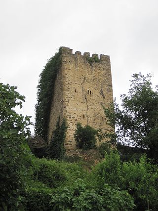
In Cantabria, there is a big number of fortified towers that fulfilled functions of housing and defense. These buildings, generally battlements, were erected mostly between the 13th and 15th centuries by noble families and influenced significantly in the architecture of Cantabria, passing some to be forts-houses, prelude to the future casona montañesa. A curious fact is that there are not in the region circular towers, as yes happens in the neighboring community of Asturias. Currently of the towers that survives several are in a deplorable condition.

<span class="mw-page-title-main">Hermandad de las Cuatro Villas</span>

The Hermandad of the Cuatro Villas de la Costa de la Mar, also cited under the name Cuatro Villas de la Costa de Cantabria, was a medieval and modern administrative entity that grouped the coastal cities of the north of the kingdom of Castile, all of them part of present-day Cantabria; namely, from west to east: San Vicente de la Barquera, Santander, Laredo, and Castro-Urdiales. At the end of the 15th century, it became part of the corregimiento of the Cuatro Villas along with other territories in the north of the Iberian Peninsula. In 1514 the province was renamed the corregimiento de las Tres Villas de la Costa, by separation from the town of San Vicente, which rejoined in 1521. Towns twinned since the 13th century, its foundation as a corregimiento dates back to the reign of the Catholic Monarchs, around 1496, surviving until its inclusion in the province of Cantabria in 1778.

References