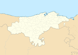
Cantabria is an autonomous community in northern Spain with Santander as its capital city. It is recognized as a historic community and is bordered on the east by the Basque Autonomous Community, on the south by Castile and León, on the west by the Principality of Asturias, and on the north by the Cantabrian Sea.
Palencia is a province of northern Spain, in the northern part of the autonomous community of Castile and León in the northwest of the Iberian Peninsula. It is bordered by the provinces of León, Cantabria, Burgos, and Valladolid.
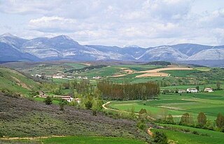
Celada Marlantes is a locality in the municipality of Campoo de Enmedio, in the northern Spanish autonomous community of Cantabria.
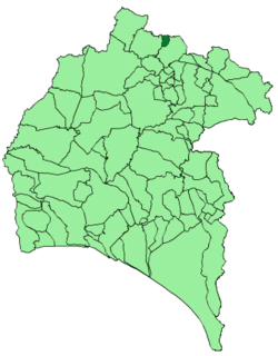
Cumbres de Enmedio is a town and municipality located in the province of Huelva, Spain. According to the 2005 census, it has a population of 47 inhabitants and covers a 14 km² area(3.4 people/km²). It sits at an altitude of 593m above sea level, and is 140 km from the capital.
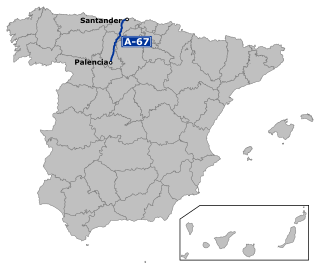
The Autovía A-67 is a highway in north west Spain. It connects the Cantabrian Atlantic Coast at Santander to Palencia. It follows the route of the N-611.

Reinosa is a municipality in Cantabria, Spain. As of 2009, it has 10,307 inhabitants. The municipality, one of the smallest by land area in Cantabria, is notable for being one of the nearest towns to the headwaters of the Ebro River. It is completely surrounded by the municipality of Campoo de Enmedio and was created a city by King Alfonso XIII in 1927, being one of only three urban centres in Cantabria with that honour, the others being Santander and Torrelavega.

Liébana is a comarca of Cantabria (Spain). It covers 575 square kilometres and is located in the far southwest of Cantabria, bordering Asturias, León and Palencia. It is made up of the municipalities of: Cabezón de Liébana, Camaleño, Cillorigo de Liébana, Pesaguero, Potes, Tresviso and Vega de Liébana.

Campoo is a comarca of Cantabria (Spain) located in the High Ebro, with a surface little bigger than 1,000 km2, and including the municipalities of Hermandad de Campoo de Suso, Campoo de Enmedio, Campoo de Yuso, Valdeolea, Valdeprado del Río, Valderredible, Reinosa, Las Rozas de Valdearroyo, Santiurde de Reinosa, Pesquera, and San Miguel de Aguayo. Their inhabitants are called Campurrians . Its highest elevation is the Cuchillón peak, and the lowest is Pesquera, with the capital, Reinosa at 850 m.

The Valleys of the Saja and Nansa Rivers comprise an administrative comarca in Cantabria, Spain. It is formed by the valleys of said rivers, each one being a natural comarca of its own.

Campoo de Yuso is a municipality located in the autonomous community of Cantabria, Spain. According to the 2007 census, the city has a population of 759 inhabitants. Its capital is La Costana.

Hermandad de Campoo de Suso is a municipality located in the autonomous community of Cantabria, Spain. The municipality's seat is in Espinilla.

Juliobriga (Spanish: Julióbriga, was the most important urban centre in Roman Cantabria, as stated by numerous Latin authors including Pliny the Elder. The site has traditionally been identified with ruins in the village of Retortillo and its Villafría district, in the municipality of Campoo de Enmedio.

Moraleja de Enmedio is a municipality of the Community of Madrid, Spain.

Galletas Gullón is a Spanish food sector company dedicated to the manufacture of crackers and biscuits. Founded in 1892 in Aguilar de Campoo in the province of Palencia surrounded by wheat fields, Gullón has been the leading producer of biscuits in Spain. In 2009 it had an annual production of 102 million kg and a turnover of 163 million euros.and in 2014 with a turnover of 286.6 million euros.

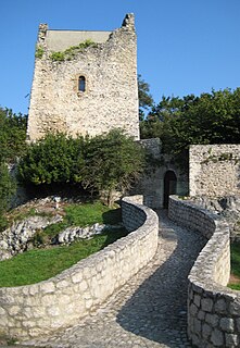
The Siege of Aracillum was a siege of the Cantabrian Wars that occurred in 25 BC. The battle took place between the forces of the Roman Empire, which consisted of five Roman legions commanded by Gaius Antistius Vetus and the forces of the Cantabri people, who had fortified the hill fort at Aracillum. The battle resulted in a Roman victory.
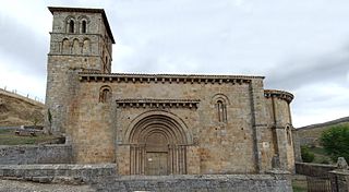
The Collegiate church of San Pedro de Cervatos is a collegiate church located in Campoo de Enmedio, Spain. The church was built around 1129. It has been protected by a heritage listing since 1895.
Val de San Vicente is a municipality located in the autonomous community of Cantabria, Spain.
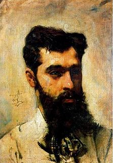
Casimiro Sainz y Saiz was a Spanish painter, known for his landscapes and portraits with interior scenes.
Marlantes is a surname. Notable people with the surname include:
Aracillum was a fortified Cantabrian city, scene of the third of the great battles of the Cantabrian wars between the Roman Empire and Cantabrian indigenous tribes. It would be located in the territory of present-day Cantabria, with two possible locations: Aradillos, near Reinosa and the Roman city of Julióbriga; the second possible location would be the castro of the Galician Thorn, in the Mountains of the Shield. According to Roman historiography it belonged to the blendii.