Cantabria is an autonomous community in northern Spain with Santander as its capital city. It is called a comunidad histórica, a historic community, in its current Statute of Autonomy. It is bordered on the east by the Basque autonomous community, on the south by Castile and León, on the west by the Principality of Asturias, and on the north by the Cantabrian Sea.

Santander is the capital of the autonomous community and historical region of Cantabria situated on the north coast of Spain. It is a port city located east of Gijón and west of Bilbao with a population of 172,000 (2017).

Cantabrian cuisine includes seafood from the Cantabrian Sea, salmon and trout from the upper basins of the rivers, vegetables and dairy products from the valleys, and veal and game from the Cantabrian mountains.

Peñamellera Baja is a municipality in the Autonomous Community of the Principality of Asturias, Spain. It is borderered to the north by Llanes and Ribadedeva, to the west by Peñamellera Alta, and to the east and south by the Autonomous Community of Cantabria.

The designation artede (la) repoblación was first proposed by José Camón Aznar in 1949 to replace the term Mozarabic as applied to certain works of architecture from the Christian kingdoms of northern Spain between the end of the 9th and beginning of the 11th centuries. Camón argued that these buildings were related stylistically to the architecture of Asturias and owed little to Andalusian styles. Moreover, since they were built by Christians living under Christian rule, neither were they Mozarabic.

The Western Coast of Cantabria is a comarca of said Spanish autonomous community which comprises the municipalities of Val de San Vicente, San Vicente de la Barquera, Valdáliga, Comillas, Udías, Ruiloba, Alfoz de Lloredo and Santillana del Mar.

Valles Pasiegos is an administrative comarca in Cantabria, Spain. It is formed by the valleys of the Pas and Miera rivers, each one being a natural comarca of its own.

Arenas de Iguña is a municipality located in the autonomous community of Cantabria, Spain. According to the 2007 census, the city has a population of 1,927 inhabitants.
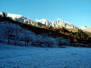
Camaleño is a municipality located in the autonomous community of Cantabria, Spain. According to the 2007 census, the city had 1,096 inhabitants.

Corvera de Toranzo is a municipality located in the autonomous community of Cantabria, Spain. According to the 2007 census, the city has a population of 2,202 inhabitants. Its capital is San Vicente de Toranzo.

Hermandad de Campoo de Suso is a municipality located in the autonomous community of Cantabria, Spain. The municipality's seat is in Espinilla.

Luena is a municipality located in the autonomous community of Cantabria, Spain. According to the 2007 census, the municipality has a population of 831 inhabitants. Its capital is San Miguel de Luena. The municipality consists of a valley which runs from the Cantabrian Mountains to the North, until it reaches the valley of the river Pas. It is a markedly rural area, where the traditional economic activity evolves around the cow.

El Soplao is a cave located in the municipalities of Rionansa, Valdáliga and Herrerías in Cantabria, Spain. It is considered unique for the quality and quantity of geological formations (speleothems) in its 17 miles length, 6 of which are open to the public. In it are formations such as helictites and curtains. Its formation dates back to the Mesozoic, in particular the Cretaceous period 240 million years ago. The entrance is at 540 metres in the Sierra Soplao Arnero.

Potes is a municipality in the autonomous community of Cantabria in Spain. It is the capital of the Comarca of Liébana and is located in the centre of it. It is bordered to the north by Cillorigo de Liébana, to the west by Camaleño, to the south by Vega de Liébana and to the east by Cabezón de Liébana.
Val de San Vicente is a municipality located in the autonomous community of Cantabria, Spain.

Miengo is a municipality in Cantabria, Spain.

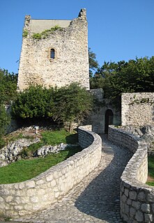
In Cantabria, there is a big number of fortified towers that fulfilled functions of housing and defense. These buildings, generally battlements, were erected mostly between the 13th and 15th centuries by noble families and influenced significantly in the architecture of Cantabria, passing some to be forts-houses, prelude to the future casona montañesa. A curious fact is that there are not in the region circular towers, as yes happens in the neighboring community of Asturias. Currently of the towers that survives several are in a deplorable condition.

Asturias de Santillana is a historical comarca whose territory in large part corresponded to the central and western part of today's autonomous community of Cantabria, as well as the extreme east of Asturias. Most of the province of Asturias belonged to the comarca of Asturias de Oviedo. Also known also as a merindad and documented since the 13th century, Asturias de Santillana comprised the western part of Cantabria including the Saja River valley and the Nansa River. Its borders used to go along the coast from the council of Ribadedeva to the municipality of El Astillero, to the shores of the Bay of Santander), which leads to the administrative division of Trasmiera. From the south it went up to the Cantabrian cordillera. All of the valleys of this comarca are perpendicular to the coast.
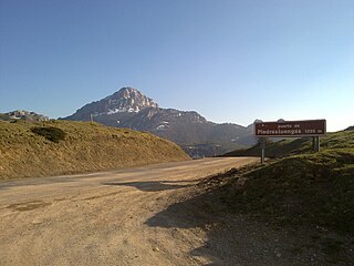
The Camino Real de la Valdavia is a historical route in Spain that joins the Way of St. James as it passes through Carrión de los Condes, with the Piedrasluengas pass through the valley of the Valdavia, and which was known and represented as such on maps until recent times.

Club Deportivo Barquereño is a Spanish football team based in San Vicente de la Barquera, in the autonomous community of Cantabria. Founded in 1953, it plays in Tercera División – Group 3, holding home matches at Campo Municipal El Castañar, with a capacity of 3,500 people.