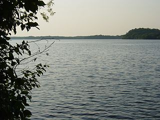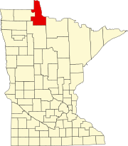
Lake of the Woods County is a county in the northwestern part of the U.S. state of Minnesota. As of the 2010 United States Census, the population was 4,045, making it the second-least populous county in Minnesota. Its county seat is Baudette.

Ellisburg is a town in Jefferson County, New York, United States. The population was 3,474 at the 2010 census. The town is in the southwestern corner of the county and is south of Watertown. Ellisburg is named after early European-American landowners. Among the villages in the town is Ellisburg.

The Jersey Shore is the coastal region of the U.S. state of New Jersey. Geographically, the term encompasses about 141 miles (227 km) of oceanfront bordering the Atlantic Ocean, from Perth Amboy in the north to Cape May Point in the south. The region includes Middlesex, Monmouth, Ocean, Atlantic, and Cape May counties, which are in the central and southern parts of the state.

Southwick Beach State Park is a New York State park that lies along an unusual stretch of sandy beach on the eastern shore of Lake Ontario. The park is 464 acres (188 ha) in size with a 3,500 foot (1,100 m) length of beach, and is visited annually by about 100,000 people. Immediately to the south is the Lakeview Wildlife Management Area, which extends the publicly accessible beach by several miles. They are in the Town of Ellisburg in Jefferson County, New York south of the lakeside community of Jefferson Park.

Lake Bemidji is a small glacially-formed lake, approximately 11 square miles in area, in northern Minnesota in the United States. Located less than 50 miles (80 km) downstream from the source of the Mississippi River, it both receives and is drained by the Mississippi.
North Shore may refer to:

Minnesota State Highway 7, or Trunk Highway 7, is a state highway in Minnesota, which runs from its intersection with MN 28 near Beardsley and continues east to its terminus with MN 100 and County Road 25 (CR 25) in St. Louis Park. The highway runs east–west for approximately 194.2 miles (312.5 km) through mostly rural farmland in the central part of the state. On its western end, it is part of the Minnesota River Scenic Byway where it runs northwest–southeast along the Minnesota River and associated lakes near the border with the adjoining state of South Dakota. For roughly 24 miles (39 km) of its route, it runs concurrently with U.S. Highway 59 (US 59) between Appleton and Montevideo. In Montevideo, the highway turns to the east cutting across the state. It passes through several small towns before entering the Twin Cities metropolitan area. In the metro area, MN 7 follows an expressway through several suburbs before terminating in St. Louis Park. Two different segments have been listed on the National Highway System, system of roads considered important to the country.

Okamanpeedan Lake, partially located in Martin County, Minnesota, and Emmet County, Iowa, is also known as Tuttle Lake. Okamanpeedan Lake is a roughly 2,300-acre (9.3 km²) riverine lake located on the East Fork of the Des Moines River. It has an average depth of about four to six feet. The lake has a contributing watershed of approximately 120,056 acres (486 km²) and watershed:lake ratio on the order of about 50:1. The lake is situated in a glacial till plain and is generally in an area dominated by loamy, poorly drained soils. The area is primarily level but does have some rolling hills.
Sandy Lake Band of Mississippi Chippewa are a historical Ojibwa tribe located in the upper Mississippi River basin, on and around Big Sandy Lake in what today is in Aitkin County, Minnesota. Though politically folded into the Mille Lacs Band of Ojibwe, thus no longer independently federally recognized, for decades, Sandy Lake Band members have been leading efforts to restore their independent Federal recognition.

The Leech Lake Indian Reservation is an Indian reservation located in the north-central Minnesota counties of Cass, Itasca, Beltrami, and Hubbard. The reservation forms the land base for the federally recognized Leech Lake Band of Ojibwe, one of six bands comprising the Minnesota Chippewa Tribe, organized in 1934. The Leech Lake Reservation has the highest population of any reservation in Minnesota, with a resident population of 10,660 indicated by the 2010 United States census.
Mille Lacs Indian Reservation is the popular name for the land-base for the Mille Lacs Band of Ojibwe in Central Minnesota, about 100 miles (160 km) north of Minneapolis-St. Paul. The contemporary Mille Lacs Band reservation has significant land holdings in Mille Lacs, Pine, Aitkin and Crow Wing counties, as well as other land holdings in Kanabec, Morrison, and Otter Tail Counties. Mille Lacs Indian Reservation is also the name of a formal Indian reservation established in 1855. It is one of the two formal reservations on which the contemporary Mille Lacs Band retains land holdings. The contemporary Mille Lacs band includes several aboriginal Ojibwe bands and villages, whose members reside in communities throughout central Minnesota.

Superior National Forest, part of the United States National Forest system, is located in the Arrowhead Region of the state of Minnesota between the Canada–United States border and the north shore of Lake Superior. The area is part of the greater Boundary Waters region along the border of Minnesota and the Canadian province of Ontario, a historic and important thoroughfare in the fur trading and exploring days of New France and British North America.

The North Shore of Lake Superior runs from Duluth, Minnesota, United States, at the southwestern end of the lake, to Thunder Bay and Nipigon, Ontario, Canada, in the north to Sault Ste. Marie, Ontario, in the east. The shore is characterized by alternating rocky cliffs and cobblestone beaches, with forested hills and ridges through which scenic rivers and waterfalls descend as they flow to Lake Superior.

Zippel Bay State Park is a state park in Lake of the Woods County, Minnesota in the United States. It is on the white sand beach shoreline of the Lake of the Woods, near the United States border with Canada. The park is open for year-round recreation including camping, hiking, fishing and cross-country skiing.

Britt is an unincorporated area in Saint Louis County, Minnesota, United States.

Big Sandy Lake is a lake in Aitkin County, Minnesota, approximately nine miles north of McGregor. The lake is considered fertile walleye ground with several habitat types, including the open main basin, the deep, cold eastern basin, and a shallow, more isolated south basin. Shallow bays containing dense beds of wild rice are found on south, west, and northwest sides of the lake.

Sandy Lake is an unincorporated community Native American village located in Turner Township, Aitkin County, Minnesota, United States. Its name in the Ojibwe language is Gaa-mitaawangaagamaag, meaning "Place of the Sandy-shored Lake". The village is administrative center for the Sandy Lake Band of Mississippi Chippewa, though the administration of the Mille Lacs Indian Reservation, District II, is located in the nearby East Lake.

Silver Creek is an unincorporated community in Silver Creek Township, Lake County, Minnesota, United States.

Birch Beach is an unincorporated community approximately 15 miles north of Williams, Lake of the Woods County, Minnesota, United States. It lies along the southern shore of Lake of the Woods, southeast of Long Point.
The Superior National Forest Scenic Byway (SNFSB), also known as Forest Highway 11, is a combination of state and county highways in Minnesota that travel between the historic communities of the Iron Range and Lake Superior's North Shore. The byway is 78 miles (126 km) of paved, two-lane roads and is marked by navigational signs with the SNFSB logo. The route was given State Scenic Byway status in 1999.


