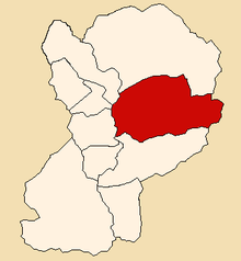
Santa Cruz | |
---|---|
Country | Peru |
Region | Ancash |
Province | Huaylas |
Founded | July 10, 1945 |
Capital | Huaripampa |
Government | |
• Mayor | Gustavo Odiel Chavez Crispin |
Area | |
• Total | 332.78 km2 (128.49 sq mi) |
Elevation | 2,900 m (9,500 ft) |
Time zone | UTC-5 (PET) |
UBIGEO | 021208 |
Website | munisantacruz.gob.pe |
The Santa Cruz District (Spanish : Distrito de Santa Cruz) is one of 10 districts of the Huaylas Province in the Ancash Region of Peru. [1] The capital of the district is Huaripampa. [2]
The district is located in the central-eastern part of the province at an elevation of 2,900 m.
The Cordillera Blanca traverses the district. Some of the highest mountains of the district are listed below: [3]
The people in the district are mainly indigenous citizens of Quechua descent. Quechua is the language which the majority of the population (86.95%) learnt to speak in childhood, 12.63% of the residents started speaking using the Spanish language (2007 Peru Census). [4]
The Corongo Province is one of 20 provinces of the Ancash Region in Peru. Its capital is Corongo located at an altitude of 3,141 m (10,305 ft).
The Huaraz Province is one of twenty provinces of the Ancash Region in Peru. It was created on August 5, 1857 during the presidency of Ramón Castilla. Geographically, the province is located over the Callejón de Huaylas and the western slopes of the Cordillera Negra.
The Huaylas Province is one of 20 provinces of the Ancash Region in Peru.
The Caraz District is one of 10 districts of the Huaylas Province in the Ancash Region of Peru. The capital of the district is Caraz. Its elevation is 2,285 m. In Caraz, the paved road comes from Pativilca.
The Mato District is one of 10 districts of the Huaylas Province in the Ancash Region of Peru. The capital of the district is the village of Villa Sucre.
The Yungay Province is one of twenty provinces of the Ancash Region in Peru.
The Sihuas Province is one of twenty provinces of the Ancash Region in Peru.This province was created by Law nº 13485, dated at January 9 of 1961, when was president of Perou: Manuel Prado. It is bordered by provinces of Huaylas and Corongo on the west, Pallasca Province on the north, La Libertad Region on the east, and Pomabamba Province on the south.
The Pomabamba Province is one of twenty provinces of the Ancash Region in Peru. It was formerly called Pumapampa and today it is also known as "The City of Cedars". It is located at the left bank of the Pomabamba river, at 3,063 meters (10,049 ft) above sea level. It was created by law on February 21, 1861.
Pomabamba is the largest of 4 districts in the Pomabamba Province of the Ancash Region in Peru.
The Pamparomas District is one of 10 districts of the Huaylas Province in the Ancash Region of Peru. The capital of the district is the village of Pamparomas. The district was founded on January 2, 1857.
Yuracmarca or Yuraq Marka is one of 10 districts of the Huaylas Province in the Ancash Region of Peru. The capital of the district is the village of Yuracmarca.
Parobamba District is one of 4 districts in the Pomabamba Province of the Ancash Region in Peru.
Huayllán District is one of 4 districts in the Pomabamba Province of the Ancash Region in Peru.
The Dos de Mayo Province is one of eleven provinces of the Huánuco Region in Peru. The capital of this province is the city of La Unión.
The Huamalíes Province is one of eleven provinces of the Huánuco Region in Peru. The capital of this province is the city of Llata.
Yungay district is a district in the Province of Yungay in the Ancash region, Peru. It was created by law on October 28, 1904.
The Huaylas District is the smallest of 10 districts of the Huaylas Province in the Ancash Region of Peru. The capital of the district is the village of Huaylas.
Mancos District is one of eight districts of the Yungay Province in Ancash Region, Peru. Mancos is called ``El corazón del Callejón de Huaylas´´ for being located in the centre of Callejón de Huaylas.
Quillo is one of eight districts of the Yungay Province in Peru.
Hatunqucha may refer to:
8°52′14″S77°54′19″W / 8.87056°S 77.90528°W