Santana, Sabana Grande, Puerto Rico

Last updated
Santana
Barrio
Carretera PR-102, Sabana Grande, Puerto Rico.jpg
Puerto Rico Highway 102 between Santana and Rayo barrios
Santana, Sabana Grande, Puerto Rico locator map.png
Location of Santana within the municipality of Sabana Grande shown in red
Caribbean location map.svg
Red pog.svg
Santana
Location of Puerto Rico
Coordinates: 18°06′39″N66°57′57″W / 18.110863°N 66.965722°W / 18.110863; -66.965722 [1]
Commonwealth Flag of Puerto Rico.svg  Puerto Rico
Municipality SabanaGrande.jpg Sabana Grande
Area
[1]
  Total7.3 sq mi (19 km2)
  Land7.3 sq mi (19 km2)
  Water0 sq mi (0 km2)
Elevation
[2]
1,037 ft (316 m)
Population
 (2010)
  Total7,291
  Density998.8/sq mi (385.6/km2)
 Source: 2010 Census
Time zone UTC−4 (AST)

Santana is a barrio in the municipality of Sabana Grande, Puerto Rico. Its population in 2010 was 7,291. [3] [4] [5]

Contents

History

Santana was in Spain's gazetteers [6] until Puerto Rico was ceded by Spain in the aftermath of the Spanish–American War under the terms of the Treaty of Paris of 1898 and became an unincorporated territory of the United States. In 1899, the United States Department of War conducted a census of Puerto Rico finding that the population of Santana barrio was 921. [7]

Historical population
CensusPop.Note
1900 921
1910 1,43856.1%
1920 1,4531.0%
1930 1,5083.8%
1940 1,69912.7%
1950 2,21430.3%
1960 2,130−3.8%
1980 4,675
1990 6,75344.4%
2000 7,66713.5%
2010 7,291−4.9%
U.S. Decennial Census
1899 (shown as 1900) [8] 1910-1930 [9]
1930-1950 [10] 1980-2000 [11] 2010 [12]

See also

Related Research Articles

<span class="mw-page-title-main">Dajaos, Bayamón, Puerto Rico</span> Barrio of Puerto Rico

Dajaos is a barrio in the municipality of Bayamón, Puerto Rico. Its population in 2010 was 2,831.

<span class="mw-page-title-main">Nuevo, Bayamón, Puerto Rico</span> Barrio of Puerto Rico

Nuevo is a barrio in the municipality of Bayamón, Puerto Rico. Its population in 2010 was 2,965.

<span class="mw-page-title-main">Turabo, Caguas, Puerto Rico</span> Barrio of Puerto Rico

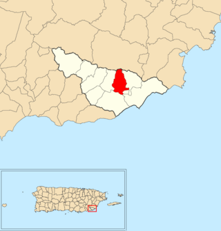
Turabo or Villa Turabo is a barrio in the municipality of Caguas, Puerto Rico. Its population in 2010 was 15,739.

<span class="mw-page-title-main">Montoso, Mayagüez, Puerto Rico</span> Barrio of Puerto Rico

Montoso is a barrio in the municipality of Mayagüez, Puerto Rico. Its population in 2010 was 1049.

<span class="mw-page-title-main">Palmarejo, Coamo, Puerto Rico</span> Barrio of Puerto Rico

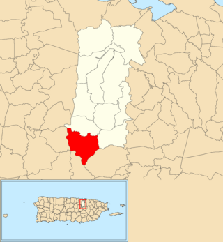
Palmarejo is a barrio in the municipality of Coamo, Puerto Rico. Its population in 2010 was 3650.

<span class="mw-page-title-main">Leguísamo</span> Barrio of Mayagüez, Puerto Rico

Leguísamo is a barrio in the municipality of Mayagüez, Puerto Rico. Its population in 2010 was 2096.

<span class="mw-page-title-main">Lirios</span> Barrio of Juncos, Puerto Rico

Lirios is a barrio in the municipality of Juncos, Puerto Rico. Its population in 2010 was 5,646.

<span class="mw-page-title-main">Río Arriba, Fajardo, Puerto Rico</span> Barrio of Puerto Rico

Río Arriba is a barrio in the municipality of Fajardo, Puerto Rico. Its population in 2010 was 1,377.

<span class="mw-page-title-main">Jobos, Guayama, Puerto Rico</span> Barrio of Puerto Rico

Jobos is a barrio in the municipality of Guayama, Puerto Rico. Its population in 2010 was 8,286.

<span class="mw-page-title-main">Santana, Arecibo, Puerto Rico</span> Barrio of Puerto Rico

Santana is a barrio in the municipality of Arecibo, Puerto Rico. Its population in 2010 was 5,253.

<span class="mw-page-title-main">Vegas, Cayey, Puerto Rico</span> Barrio of Puerto Rico

Vegas is a barrio in the municipality of Cayey, Puerto Rico. Its population in 2010 was 4,083.

<span class="mw-page-title-main">Carmen, Guayama, Puerto Rico</span> Barrio of Puerto Rico

Carmen is a barrio in the municipality of Guayama, Puerto Rico, with a 2010 population of 619.

<span class="mw-page-title-main">Guamaní</span> Barrio of Guayama, Puerto Rico

Guamaní is a barrio in the municipality of Guayama, Puerto Rico. Its population in 2010 was 1,455.

<span class="mw-page-title-main">Guamá, San Germán, Puerto Rico</span> Barrio of Puerto Rico

Guamá is a barrio in the municipality of San Germán, Puerto Rico. Its population in 2010 was 2,126.

<span class="mw-page-title-main">Sabana Abajo, Carolina, Puerto Rico</span> Barrio of Puerto Rico

Sabana Abajo is a barrio in the municipality of Carolina, Puerto Rico. Its population in 2010 was 55,600.

<span class="mw-page-title-main">Trujillo Bajo, Carolina, Puerto Rico</span> Barrio of Puerto Rico

Trujillo Bajo is a barrio in the municipality of Carolina, Puerto Rico. Its population in 2010 was 8,805.

<span class="mw-page-title-main">Farallón, Cayey, Puerto Rico</span> Barrio of Puerto Rico

Farallón is a barrio in the municipality of Cayey, Puerto Rico. Its population in 2010 was 451.

<span class="mw-page-title-main">Tijeras, Juana Díaz, Puerto Rico</span> Barrio of Puerto Rico

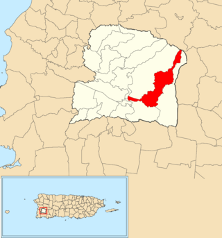
Tijeras is a barrio in the municipality of Juana Díaz, Puerto Rico. Its population in 2010 was 5,670.

<span class="mw-page-title-main">Costa, Lajas, Puerto Rico</span> Barrio of Puerto Rico

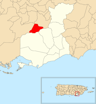
Costa is a barrio in the municipality of Lajas, Puerto Rico. Its population in 2010 was 1,628.

<span class="mw-page-title-main">Talante</span> Barrio of Maunabo, Puerto Rico

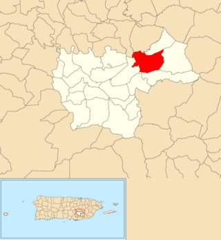
Talante is a barrio in the municipality of Maunabo, Puerto Rico. Its population in 2010 was 1,381.

References

  1. 1 2 "US Gazetteer 2019". US Census. US Government.
  2. U.S. Geological Survey Geographic Names Information System: Santana barrio
  3. Picó, Rafael; Buitrago de Santiago, Zayda; Berrios, Hector H. Nueva geografía de Puerto Rico: física, económica, y social, por Rafael Picó. Con la colaboración de Zayda Buitrago de Santiago y Héctor H. Berrios. San Juan Editorial Universitaria, Universidad de Puerto Rico,1969.
  4. Gwillim Law (20 May 2015). Administrative Subdivisions of Countries: A Comprehensive World Reference, 1900 through 1998. McFarland. p. 300. ISBN   978-1-4766-0447-3 . Retrieved 25 December 2018.
  5. Puerto Rico: 2010 Population and Housing Unit Counts.pdf (PDF). U.S. Dept. of Commerce, Economics and Statistics Administration, U.S. Census Bureau. 2010.
  6. "Anuario del comercio, de la industria, de la magistratura y de la administración. 1881". Biblioteca Nacional de España (in Spanish). p. 1614. Retrieved 4 April 2023.
  7. Joseph Prentiss Sanger; Henry Gannett; Walter Francis Willcox (1900). Informe sobre el censo de Puerto Rico, 1899, United States. War Dept. Porto Rico Census Office (in Spanish). Imprenta del gobierno. p.  164.
  8. "Report of the Census of Porto Rico 1899". War Department Office Director Census of Porto Rico. Archived from the original on July 16, 2017. Retrieved September 21, 2017.
  9. "Table 3-Population of Municipalities: 1930 1920 and 1910" (PDF). United States Census Bureau. Archived (PDF) from the original on August 17, 2017. Retrieved September 21, 2017.
  10. "Table 4-Area and Population of Municipalities Urban and Rural: 1930 to 1950" (PDF). United States Census Bureau. Archived (PDF) from the original on August 30, 2015. Retrieved September 21, 2014.
  11. "Table 2 Population and Housing Units: 1960 to 2000" (PDF). United States Census Bureau. Archived (PDF) from the original on July 24, 2017. Retrieved September 21, 2017.
  12. Puerto Rico: 2010 Population and Housing Unit Counts.pdf (PDF). U.S. Dept. of Commerce Economics and Statistics Administration U.S. Census Bureau. 2010. Archived (PDF) from the original on 2017-02-20. Retrieved 2019-08-02.