Sattari, West Bengal

Last updated

Sattari
Village
Sattari View.jpg
Sattari View
Nickname(s): 
Mango City
West Bengal location map.svg
Red pog.svg
Sattari
Location in West Bengal, India
Coordinates: 24°59′37″N88°02′24″E / 24.9937°N 88.0400°E / 24.9937; 88.0400 Coordinates: 24°59′37″N88°02′24″E / 24.9937°N 88.0400°E / 24.9937; 88.0400
Country India
State West Bengal
District Malda
Police station English Bazar
Railway Station Malda Town railway station
Sub-Divisional Magistrate Malda Sadar subdivision
Block English Bazar (community development block)
Government
  Type Panchayati raj (India)
  Body Binodpur Gram Panchayat
   Pradhan Rita Chowdhury
  Deputy Pradhan Amin Mian
Area
  Total2.36 km2 (0.91 sq mi)
Area rank32nd
Elevation
17 m (56 ft)
Population
 (2011 census) [1]
  Total10,538
  Rank4th in E.B Block
  Density4,465/km2 (11,560/sq mi)
Demonym(s) Sattaria
Languages
  Official Bengali [2] [3]
  Additional official English [2]
Food
  Main Fish Rice
Time zone UTC+5:30 (IST)
PIN
732208
Post Office
Sattari B.O
Telephone code913512
ISO 3166 code IN-WB
Vehicle registration WB-65,66
Major Highway NH 81
Mouza J.L No.Sattari (011)
Sex ratio 5458 : 5080 (2011 census) /
Lok Sabha constituency Maldaha Dakshin
Vidhan Sabha constituency English Bazar (Vidhan Sabha constituency)
Mosque/ WorshipSattari Jame Masjid
School Sattari High School
Website malda.nic.in

Sattari is a village in Malda district of the state of West Bengal, India. Sattari is known for producing mango (aam) supply, lace (gamchha), and carpet work.[ not verified in body ] It is the headquarters of Binodpur Gram Panchayat (village council) on which it is represented by 6 of the 13 seats.

Contents

Geography

Cities, towns and locations in the southern portion of Malda district (including Kaliachak I, Kaliachak II, Kaliachak III, Manikchak and English Bazar CD blocks)
M: municipal town, CT: census town, R: rural/ urban centre, F: Facility, H: historical centre
Owing to space constraints in the small map, the actual locations in a larger map may vary slightly

Location

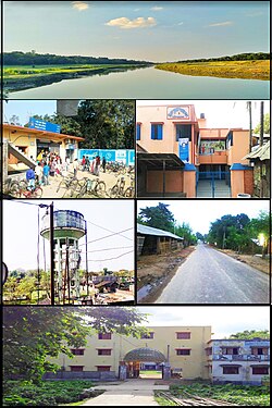
Sattari is located at 24°59′37″N88°02′24″E / 24.9937°N 88.0400°E / 24.9937; 88.0400 the English Bazar tehsil (transl.administrative unit) or community development block of Maldah district in West Bengal, India. It is situated 14.4 kilometres (8.9 mi) from sub-district headquarter Malda and 15.1 kilometres (9.4 mi) from the district headquarters of the English Bazar.[ citation needed ] It is at the border of English Bazar and Mothabari on the Pagla River, a tributary of the Ganges.

Area overview

The area shown in the adjoining map is the physiographic sub-region known as the diara. It “is a relatively well drained flat land formed by the fluvial deposition of newer alluvium.” The most note-worthy feature is the Farakka Barrage across the Ganges. [4] The area is a part of the Malda Sadar subdivision, which is an overwhelmingly rural region, but the area shown in the map has pockets of urbanization with 17 census towns, concentrated mostly in the Kaliachak I CD block. [5] [6] The bank of the Ganges between Bhutni and Panchanandapur (both the places are marked on the map), is the area worst hit by left bank erosion, a major problem in the Malda area. [7] The ruins of Gauda, capital of several empires, is located in this area. [8]

Note: The map alongside presents some of the notable locations in the area. All places marked in the map are linked in the larger full screen map.

Weather

Climate

The accurate weather of Sattari is normally to other places in West Bengal, with a tropical climate, specifically a tropical wet and dry climate(Aw) under the Köppen climate classification, with seven months of dryness and peak of rains in July to October.The cooler season from December to February is followed by the summer season from March to June.RealFeel®: 34° Winds: 7 km/h SEGusts: 11 km/h Humidity: 88%Dew Point: 26° UVIndex: 0(Low)Cloud Cover: 99% Rain: 2 mmSnow: 0 CM Ice: 0mmVisibility: 6 km Ceiling: 9144 mWet Bulb: 27° [9]

Demographics

As of 2011 Indian Census, Sattari had a total population of 10,538, of which 5,458 were males and 5,080 were females, with a sex ratio of 930. Population within the age group of 0 to 6 years was 1,575. The total number of literates in Sattari was 4,977, which constituted 47.2% of the population with male literacy of 52.9% and female literacy of 41.1%. The effective literacy rate of 7+ population of Sattari was 55.5%, of which male literacy rate was 62.0% and female literacy rate was 48.5%. The Scheduled Castes population was 3,043. Sattari had 2318 households in 2011. [1]

Administration

Sattari village is administrated by Binodpur Gram Panchayat (transl.Bindopur village council) of the English Bazar community development block of Malda district. Sattari is the headquarters of the village council and is represented by six of the thirteen seats;[ citation needed ] four are Muslim and two are Hindu.[ citation needed ] Sattari falls under the jurisdiction of the English Bazar Police Station.Sattari's four peoples nabs by NIA from Kolkata for possession of fake currency. [10]

Part and seat name
Part namePart no.Type
NatunparaPart-IX/9Most Rural
Jarlahipara, BazarparaPart-X/10Rural
MasjidparaPart-XI/11Rural
Basantapur, NimtalaPart-XII/12Rural
Nagarpara, Tiarpara, HeluparaPart-XIII/13Rural
Puratan Choudhurypara, Natun Choudhurypara, KhatiyatangaPart-XIV/14Rural
Titipara, Dakshin ChandipurPart-XV/15Rural
Kagmari HatparaPart-XVI/16Rural

Festivals

Almost all of the major religious festivals are celebrated, like

Fairs

Some of the mostly reputed cultural fairs of the town are .

Places of interest

Education

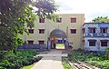
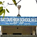
Sattari High School is a Bengali-medium coeducational institution established in 1971. It has facilities for teaching from class V to class XII. It has a playground, a library with 2050 books, and 10 computers for teaching and learning purposes. [11]

Transport

Taxi cabs and buses are the best way to get around this city, with public and private bus service available within the town.[ according to whom? ] There are options to rent cars and bicycles. Malda Town railway station is 15.5 kilometres (9.6 mi) away, and there are no local trains.[ citation needed ]

See also

Related Research Articles

Malda district District of West Bengal in India

Malda district, also spelt Maldah or Maldaha (Bengali: [malda], [maldɔɦ], often [maldɔɦo]; is a district in West Bengal, India. It lies 347 km north of Kolkata, the capital of West Bengal. Mango, jute and silk are the most notable products of this district. The special variety of mango, Fazli, produced in this region is popularly known by the name of the district and is exported across the world and is internationally acclaimed. The folk culture of gombhira is a feature of the district, being a unique way of representation of joy and sorrow in daily life of the common people, as well as the unique medium of presentation on national and international matters. According to the National Investigation Agency Malda is believed to be a hub of a fake currency racket. It is reported that 90 percent of the fake currency that enters India originates in Malda.

Ratua I Community development block in West Bengal, India

Ratua I is a community development block that forms an administrative division in Chanchal subdivision of Malda district in the Indian state of West Bengal.

Chanchal subdivision Subdivision in West Bengal, India

Chanchal subdivision is an administrative subdivision of the Malda district in the Indian state of West Bengal.

Malda Sadar subdivision Subdivision in West Bengal, India

Malda Sadar subdivision is an administrative subdivision of the Malda district in the Indian state of West Bengal.

Kaliachak I Community development block in West Bengal, India

Kaliachak I is a community development block that forms an administrative division in Malda Sadar subdivision of Malda district in the Indian state of West Bengal.

Manikchak Community development block in West Bengal, India

Manikchak is a community development block that forms an administrative division in Malda Sadar subdivision of Malda district in the Indian state of West Bengal.

Bamangola (community development block) Community development block in West Bengal, India

Bamangola is a community development block that forms an administrative division in Malda Sadar subdivision of Malda district in the Indian state of West Bengal.

Kaliachak II Community development block in West Bengal, India

Kaliachak II is a community development block that forms an administrative division in Malda Sadar subdivision of Malda district in the Indian state of West Bengal.

Kaliachak III Community development block in West Bengal, India 87.9776

Kaliachak III is a community development block that forms an administrative division in Malda Sadar subdivision of Malda district in the Indian state of West Bengal.

Old Malda (community development block) Community development block in West Bengal, India

Old Malda is a community development block that forms an administrative division in Malda Sadar subdivision of Malda district in the Indian state of West Bengal.

English Bazar (community development block) Community development block in West Bengal, India

English Bazar is a community development block that forms an administrative division in Malda Sadar subdivision of Malda district in the Indian state of West Bengal.

Chanchal I Community development block in West Bengal, India

Chanchal I is a community development block that forms an administrative division in Chanchal subdivision of Malda district in the Indian state of West Bengal.

Ratua II Community development block in West Bengal, India

Ratua II is a Community Development Block that forms an administrative division in Chanchal subdivision of Malda district in the Indian state of West Bengal.

Binodpur Gram Panchayat Government office in West Bengal

The Gram Panchayat of Sattari or Sattari Gram Panchayat also known as Binodpur Gram Panchayat(abbreviated as BGP), is a government office and local self-government body that governs the village of Sattari and 8 nearby villages with 13 G.P constituencies or three Panchayat Samity constituencies in English Bazar Block of District Malda in the state of West Bengal, India. It has control of The English Bazar police station serves this panchayat, with its headquarters at Sattari village.

Milki, West Bengal Census Town in West Bengal, India

Milki is a census town in the English Bazar CD block in the Malda Sadar subdivision of Malda district in the Indian state of West Bengal.

Sonatala, Malda Census Town in West Bengal, India

Sonatala is a census town in the English Bazar CD block in the Malda Sadar subdivision of Malda district in the state of West Bengal, India.

Bagbari Census Town in West Bengal, India

Bagbari is a census town in the English Bazar CD block in the Malda Sadar subdivision of Malda district in the state of West Bengal, India.

Jalalpur, Malda Census Town in West Bengal, India

Jalalpur is a census town and gram panchayat in the Kaliachak I CD block in the Malda Sadar subdivision of Malda district in the state of West Bengal, India.

Bamangram Census Town in West Bengal, India

Bamangram is a census town and gram panchayat in the Kaliachak I CD block in the Malda Sadar subdivision of Malda district in the state of West Bengal, India.

Bangitola Populated place in West Bengal, India

Bangitola is a populated place, not identified as a separate place in 2011 census, in the Kaliachak II CD block in the Malda Sadar subdivision of Malda district in the state of West Bengal, India.

References

  1. 1 2 "Census of India: Sattari". www.censusindia.gov.in. Retrieved 8 December 2019.
  2. 1 2 "Fact and Figures". www.wb.gov.in. Retrieved 2 April 2019.
  3. "52nd REPORT OF THE COMMISSIONER FOR LINGUISTIC MINORITIES IN INDIA" (PDF). nclm.nic.in. Ministry of Minority Affairs. p. 85. Archived from the original (PDF) on 25 May 2017. Retrieved 2 April 2019.
  4. "District Census Handbook Maldah, Series 20, Part XII A" (PDF). Census of India 2011, Pages 13-15: Physiography. Directorate of Census Operations, West Bengal. Retrieved 9 November 2018.
  5. "District Statistical Handbook 2014 Malda". Table 2.1 , 2.2, 2.4b. Department of Statistics and Programme Implementation, Government of West Bengal. Retrieved 9 November 2018.
  6. "C.D. Block Wise Primary Census Abstract Data(PCA)". West Bengal – District-wise CD Blocks. Registrar General and Census Commissioner, India. Retrieved 9 November 2018.
  7. Banerjee, Manisha. "A Report on the Impact of Farakka Barrage on the Human Fabric, November 1999" (PDF). The social impact of erosion, pp 13-14. South Asia Network On Dams, Rivers and People, New Delhi: 110 088 India. Archived from the original (PDF) on 8 August 2017. Retrieved 16 August 2021.
  8. "District Human Development Report, Malda". pages 3-4: Malda in Historical Perspective. Department of Planning, Statistics and Programme Monitoring, Government of West Bengal. Retrieved 6 November 2018.
  9. "Weather of Sattari Village". m.accuweather.com. Retrieved 11 November 2018.
  10. "NIA nabs four from Kolkata for possession of fake curency". www.newindianexpress.com. Retrieved 22 February 2019.
  11. "Sattari High School". Schools.org. Retrieved 17 August 2021.