Scary, West Virginia

Last updated

Scary
USA West Virginia location map.svg
Red pog.svg
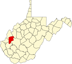
Scary
Location within the state of West Virginia
Usa edcp location map.svg
Red pog.svg
Scary
Scary (the United States)
Coordinates: 38°26′5″N81°51′11″W / 38.43472°N 81.85306°W / 38.43472; -81.85306
Country United States
State West Virginia
County Putnam
Time zone UTC-5 (Eastern (EST))
  Summer (DST) UTC-4 (EDT)
GNIS feature ID1555581 [1]

Scary is an unincorporated community in Putnam County, West Virginia, United States.

Contents

History

During the Civil War, the area that would become Scary, West Virginia was the site of the first Confederate victory in Kanawha Valley on July 17, 1861. [2] [3] This is commemorated by two distinct plaques, very near to each other, in the town today. [4]

A post office was established as Scary in 1886, [5] and remained in operation until it was discontinued in 1931. [6] [7] [8]

Geography

Scary sits at 670 feet above sea level. [5] The community is located at the mouth of Scary Creek on the Kanawha River along U.S. Route 35.

Related Research Articles

Red House is a small unincorporated community located in Putnam County in the U.S. state of West Virginia. The community is divided into two distinct areas: Red House (Proper) which follows the Kanawha River Valley along WV 62, and Red House Hill along WV 34 which is in the hills just off the Kanawha River Valley. The Red House Post Office is still in service and was founded on September 26, 1840. Some say the town was named for a red house which stood at the town site, while others believe nearby red rock formations account for the name.

<span class="mw-page-title-main">Quick, West Virginia</span> Unincorporated community in West Virginia, United States

Quick is a small unincorporated community in Kanawha County, West Virginia, United States. It is located along Indian Creek Road. The community is where Whitoak Fork and Blue Creek come together and meet. It is also where the abandoned railroad that follows Blue Creek joins the road, and follows it all the way to the community of Hitop, along Pond Fork. Its post office is closed.

Hansford is an unincorporated community in Kanawha County, West Virginia, United States. Hansford is located along the Kanawha River and West Virginia Route 61, adjacent to Pratt. Hansford has a post office with ZIP code 25103.

Kanawha Falls is an unincorporated community in Fayette County, West Virginia, United States. Kanawha Falls is located on the east bank of the Kanawha River, 2 miles (3.2 km) southwest of Gauley Bridge and 0.6 miles (0.97 km) downstream from the waterfall of the same name. Kanawha Falls had a post office, which opened on March 26, 1856, and closed on November 2, 2002.

Peytona is an unincorporated community in Boone County, West Virginia, United States. Peytona is located on the Big Coal River and West Virginia Route 3, 9 miles (14 km) northeast of Madison. Peytona has a post office with ZIP code 25154.

Robertsburg is an unincorporated community in Putnam County, West Virginia, United States. Robertsburg is located on the east bank of the Kanawha River along West Virginia Route 62, 3 miles (4.8 km) north-northeast of Buffalo. Robertsburg had a post office, which opened on August 6, 1900, and closed on May 10, 1997.

Cinco is an unincorporated community in Kanawha County, West Virginia, United States.

Olcott is an unincorporated community and coal town in Kanawha County, West Virginia, United States. Its post office is closed.

Sattes is an unincorporated community in Kanawha County, West Virginia, United States. Its post office is closed.

Indian was an unincorporated community in Kanawha County, West Virginia, United States. It once had a post office but it is now closed.

Three Mile is an unincorporated community in Kanawha County, West Virginia, United States. Its post office is closed.

Weir is an unincorporated community in Kanawha County, West Virginia, United States. Its post office is called Falling Rock.

Legg is an unincorporated community in Kanawha County, West Virginia, United States. Its post office is closed.

Carney was an unincorporated community in Kanawha County, West Virginia, United States. Its post office is closed.

Notomine is an unincorporated community in Kanawha County, West Virginia, United States. Its post office is closed.

Copenhaver was an unincorporated community in Kanawha County, West Virginia, United States. Its post office is closed.

Putney is an unincorporated community in Kanawha County, West Virginia, United States. Its post office is closed.

Rensford is an unincorporated community in Kanawha County, West Virginia, United States. Its post office is closed. It was also known as Point Lick.

Republic is an unincorporated community in Kanawha County, West Virginia, United States, along Cabin Creek. It was also known as Jochin. Its post office is closed.

Wevaco is an unincorporated community and former coal town in Kanawha County, West Virginia, United States. It had a post office but is now closed.

References

  1. U.S. Geological Survey Geographic Names Information System: Scary, West Virginia
  2. "Generation III". appalachian_home.tripod.com. Retrieved May 7, 2023.
  3. "Battle of Scary Historical Marker".
  4. "Battle of Scary Historical Marker".
  5. 1 2 "Scary (Putnam County, WV)". roadsidethoughts.com. Retrieved October 22, 2023.
  6. U.S. Geological Survey Geographic Names Information System: Scary WV post office
  7. "Postmaster Finder - Who We Are - USPS".
  8. "Putnam County". Jim Forte Postal History. Retrieved October 3, 2014.