Schmitten im Taunus

Last updated
Schmitten im Taunus
DEU Schmitten im Taunus Banner.svg
DEU Schmitten im Taunus COA.svg
Location of Schmitten im Taunus within Hochtaunuskreis district
Schmitten in HG.svgGlashütten
Germany adm location map.svg
Red pog.svg
Schmitten im Taunus
Hesse location map.svg
Red pog.svg
Schmitten im Taunus
Coordinates: 50°16′N8°27′E / 50.267°N 8.450°E / 50.267; 8.450
Country Germany
State Hesse
Admin. region Darmstadt
District Hochtaunuskreis
Government
   Mayor (202026) Julia Krügers [1] (CDU)
Area
  Total36 km2 (14 sq mi)
Highest elevation
879 m (2,884 ft)
Lowest elevation
357 m (1,171 ft)
Population
 (2022-12-31) [2]
  Total9,563
  Density270/km2 (690/sq mi)
Time zone UTC+01:00 (CET)
  Summer (DST) UTC+02:00 (CEST)
Postal codes
61389
Dialling codes 06082, 06084
Vehicle registration HG, USI
Website www.schmitten.de

Schmitten im Taunus (until 25 August 2021 Schmitten) is a municipality in the Hochtaunuskreis in Hessen, Germany.

Contents

Geography

Schmitten is the highest community in the Taunus, approximately 24km north of Frankfurt am Main, within which is the Großer Feldberg (881m).

Schmitten Schmitten (Hochtaunus) 02.jpg
Schmitten
View over Schmitten with mountains Pfaffenrod (596,2 m; left) and Sangelberg (665 m; in the middle); town hall on the right DSC00400 Blick vom Wiegerfelsen auf Schmitten im Taunus.jpg
View over Schmitten with mountains Pfaffenrod (596,2 m; left) and Sängelberg (665 m; in the middle); town hall on the right

Neighbouring communities

Schmitten borders in the north on the community of Weilrod and the town of Usingen, in the east on the towns of Neu-Anspach and Bad Homburg, in the south on the towns of Oberursel and Königstein, and in the west on the communities of Glashütten and Waldems (Rheingau-Taunus-Kreis).

Constituent communities

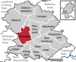
The greater community has nine centres (until municipal reform in 1972, all independent communities) named Arnoldshain, Brombach, Dorfweil, Hunoldstal, Niederreifenberg, Oberreifenberg, Schmitten, Seelenberg and Treisberg.

History

Hattstein Castle's ruins in 2004 with ditch in the foreground and a piece of wall on the knoll through the trees Burgruine-Hattstein-Taunus-B-17-JR-2004-03-28.jpg
Hattstein Castle's ruins in 2004 with ditch in the foreground and a piece of wall on the knoll through the trees

Schmitten had its first documented mention in 1399 as Waldschmidt. The name comes from a nail-making smith in the woods nearby (Wald is German for "forest"; Schmidt has the same root as Schmiede – smith) which were attached to Hattstein Castle(mentioned in 1215). The Hattstein Knights ("Hazechenstein") were akin to the Reifenbergers ("Riffinberg"), possibly even the same. These families' origins were either in the Westerwald area north of the Lahn or the Limburg area. In the Walsdorfer Gründungsurkunde ("Walsdorf Founding Document") of 1156, a "Guntramus de Hazechenstein" is named.

The Hattstein Knights, whose castle was destroyed several times, had property in Bad Camberg, Usingen ("Hattsteiner Weiher"), Stockheim, Weilbach, Aschaffenburg, Mainaschaff, Königstein and Frankfurt am Main. The Hattsteiners also participated in the founding of Münzenberg Castle in the Wetterau.

The noble family von Hattstein was throughout the Middle Ages one of Hesse's most influential families. Baron Marquard von Hattstein was Bishop of Speyer (1560–1581).

Together with the Knights of Kronberg, the Hattsteiners and Reiffenbergers declared the so-called "Kronberg Feud" in 1389. When on 13 May a great force from Frankfurt swept to Kronberg Castle, Hanau and Electorate of the Palatinate troops rushed to help those being beset, driving the Frankfurt forces off on 14 May in the Battle of Eschborn and taking 620 prisoners, among them the mayor, a few noble council members and all the town's bakers, butchers, locksmiths and shoemakers. Only a ransom payment of 73,000 golden guilders ended the fight with Frankfurt and laid the groundwork for the Frankfurter Landwehr fortifications and Frankfurt's four watchtowers.

The noble family of the Hattstein Knights, which was inseparably bound with Schmitten's history, came to an end with Johann Constantin Philipp von Hattstein's death in 1767.

Arnoldshain

Arnoldshain: Saint Lawrence's Church (Laurentiuskirche) with Junkernberg mountain (636 m) and Arnoldshainer Wiesenhang (Arnoldshain meadow slope, on the right) DSC09411 Arnoldshain Blick auf Junkernberg und Arnoldshainer Wiesenhang.jpg
Arnoldshain: Saint Lawrence's Church (Laurentiuskirche) with Junkernberg mountain (636 m) and Arnoldshainer Wiesenhang (Arnoldshain meadow slope, on the right)

Saint Lawrence's Church (Laurentiuskirche) at Arnoldshain was first mentioned early in the 13th century in the Rotulus omnium iurium (Directory of all rights). A few expansions to the once eight-sided chapel notwithstanding, the old part is preserved to this day. The Laurentiuskirche is thereby one of the oldest buildings still in use in the Hochtaunus. In a glass window from 1480 one can still clearly see the Reifenberg family's coat of arms.

Politically Arnoldshain belonged to the Lords of Hattstein, but later partly under Reifenberg (Bassenheim) rule.

Dorfweil

Dorfweil had its first documentary mention in 772. Lying 410 m above sea level in the Weil Valley, the community has many hiking trails. With an area of 367ha and 684 inhabitants (as of the end of 2004), Dorfweil is one of Schmitten's smallest constituent communities.

Sightseeing

Großer Feldberg

The Taunus's highest mountain attracts hundreds of thousands of visitors every year, especially from the Frankfurt Rhein-Main Region.

In Oberreifenberg lifts for skiing and sledding are abundant. The main attraction, however, is the Taunus's nature and many kilometres of hiking trails.

Treisberg

Observation tower Pferdskopf TS.jpg
Observation tower

The lookout tower on the 663-m-high Pferdskopf ("Horse's Head") near Treisberg affords a fantastic view of the Taunus landscape and is the object of many outings. In the winter, skiers and tobogganers are drawn to the Taunus's most attractive skilifts.

Weiltal

Rising on the Feldberg, the little brook Weil snakes its way through the Hochtaunus Nature Park through to Weilburg. Alongside the Weil runs the Weiltalwanderweg (Weil Valley Hiking Trail). A Weil Valley visit is popular among families and nature lovers, but also for cyclists and motorcyclists.

Besides the yearly Weiltal-Marathon, the traditional "Rund um den Henninger-Turm" bicycle race also runs through the Weil Valley.

Limes

The Roman Empire's old border runs above Niederreifenberg and Oberreifenberg across the crest of the Taunus. Within Schmitten's municipal limits lies the Limeskastell Kleiner Feldberg, a Roman fort. The preserved foundation walls offer a glimpse into Roman history.

Reifenberg Castle ruins

Oberreifenberg and Reifenberg Castle with Sangelberg in the back DSC05898 Sangelberg uber Oberreifenberg vom Huhnerberg gesehen.jpg
Oberreifenberg and Reifenberg Castle with Sängelberg in the back

The castle's keep and tower are preserved and loom over Oberreifenberg and the Weil Valley.

Politics

Municipal council

The municipal elections on 26 March 2006 yielded the following results:

Note: FWG is a citizens' coalition.

Partnerships

Schmitten maintains partnerships with the following places, all in France:

Flag of France.svg Courtomer (1981)
Flag of France.svg Moulins-la-Marche (1981)
Flag of France.svg Sainte-Gauburge (1981)

Public institutions

Educational institutions

The community of Schmitten has two primary schools.

Furthermore, there exists in Arnoldshain an Evangelical Academy called the "Martin Niemöller" Haus.

Sports and leisure

Personalities

Notable residents

Related Research Articles

<span class="mw-page-title-main">Taunus</span> Mountain range in Germany

The Taunus is a mountain range in Hesse, Germany, located north west of Frankfurt and north of Wiesbaden. The tallest peak in the range is Großer Feldberg at 878 m; other notable peaks are Kleiner Feldberg and Altkönig.

The Hochtaunuskreis is a Kreis (district) in the middle of Hesse, Germany and is part of the Frankfurt/Rhine-Main Metropolitan Region. Neighbouring districts are Lahn-Dill, Wetteraukreis, district-free Frankfurt, Main-Taunus, Rheingau-Taunus, Limburg-Weilburg.

<span class="mw-page-title-main">Oberursel (Taunus)</span> Town in Hesse, Germany

Oberursel (Taunus) (German:[oː.bɐ.ˈʊʁ.zl̩] ) is a town in Germany and part of the Frankfurt Rhein-Main urban area. It is located to the north west of Frankfurt, in the Hochtaunuskreis county. It is the 13th largest town in Hesse. In 2011, the town hosted the 51st Hessentag state festival.

<span class="mw-page-title-main">Neu-Anspach</span> Town in Hesse, Germany

Neu-Anspach is a town in the Hochtaunuskreis in Hesse, Germany.

<span class="mw-page-title-main">Kronberg im Taunus</span> Town in Hesse, Germany

Kronberg im Taunus is a town in the Hochtaunuskreis district, Hesse, Germany and part of the Frankfurt Rhein-Main urban area. Before 1866, it was in the Duchy of Nassau; in that year the whole Duchy was absorbed into Prussia. Kronberg lies at the foot of the Taunus, flanked in the north and southwest by forests. A mineral water spring also rises in the town.

<span class="mw-page-title-main">Usingen</span> Town in Hesse, Germany

Usingen is a small town in the Hochtaunuskreis in Hessen, Germany. Until 1972, this residential and school town was the seat of the former district of Usingen.

<span class="mw-page-title-main">Königstein im Taunus</span> Town in Hesse, Germany

Königstein im Taunus is a health spa and lies on the thickly wooded slopes of the Taunus in Hesse, Germany. The town is part of the Frankfurt Rhein-Main urban area. Owing to its advantageous location for both scenery and transport on the edge of the Frankfurt Rhine Main Region, Königstein is a favourite residential town. Neighbouring places are Kronberg im Taunus, Glashütten, Schwalbach am Taunus, Bad Soden am Taunus and Kelkheim.

<span class="mw-page-title-main">Großer Feldberg</span>

The Großer Feldberg is, at a height of 879.5 metres, the highest elevation of the Taunus mountains, and of the entire Rhenish Massif. It is situated in the Hochtaunuskreis district in Hesse, Germany.

<span class="mw-page-title-main">Grävenwiesbach</span> Municipality in Hesse, Germany

Grävenwiesbach is a municipality in the Hochtaunuskreis in Hesse, Germany.

<span class="mw-page-title-main">Wehrheim</span> Municipality in Hesse, Germany

Wehrheim is a municipality in Hesse, Germany some 30 km (20 mi) north of Frankfurt am Main.

<span class="mw-page-title-main">Steinbach (Taunus)</span> Town in Hesse, Germany

Steinbach is a town in the Hochtaunuskreis that borders Frankfurt am Main to the east. Other neighbouring towns are Oberursel, Kronberg im Taunus and Eschborn. It is in the German state of Hesse.

<span class="mw-page-title-main">Glashütten (Taunus)</span> Municipality in Hesse, Germany

Glashütten is a small municipality in the Hochtaunuskreis. This community in the Taunus, which is made up of the three formerly independent communities of Glashütten, Schloßborn and Oberems, lies in the Hochtaunus Nature Park, not far from Königstein im Taunus, Germany.

<span class="mw-page-title-main">Weilrod</span> Municipality in Hesse, Germany

Weilrod is a municipality made up of several villages in the northwest Hochtaunuskreis lying in the Weil Valley in Hesse, Germany.

The Taunus Railway in the High Taunus is a railway route between Frankfurt (Main) Hauptbahnhof and Brandoberndorf via Bad Homburg, Usingen and Grävenwiesbach. It was operated from 1993 to 1995 by the Frankfurter Verkehrsverbund as the T-Bahn and subsequently by the Rhein-Main-Verkehrsverbund as line 15. It is listed in table 637 of the Deutsche Bahn timetable. The Friedrichsdorf–Brandoberndorf line, which has the infrastructure number of 9374, forms part of the old Friedrichsdorf–Wetzlar line, which was known as the Taunusbahn. The line is owned by the Verkehrsverband Hochtaunus. The infrastructure is managed by HLB Basis AG on behalf of the VHT.

<span class="mw-page-title-main">Waldems</span> Municipality in Hesse, Germany

Waldems is a municipality in the Rheingau-Taunus-Kreis in the Regierungsbezirk of Darmstadt in Hesse, Germany. The municipality's administrative seat is Waldems-Esch.

<span class="mw-page-title-main">Altkönig</span>

The Altkönig is the third highest mountain of the Taunus range in Hesse, Germany, reaching a height of 798.2 m above sea level (NHN).

<span class="mw-page-title-main">Schloßborn</span> Ortsteil of Glashütten in Hesse, Germany

Schloßborn (Schlossborn) is a village in the municipality of Glashütten, Hesse, Germany. It is located northeast of Wiesbaden and northwest of Frankfurt in the hilly Taunus region.

<span class="mw-page-title-main">Falkenstein Castle (Taunus)</span>

Falkenstein Castle, also called New Falkenstein (Neu-Falkenstein), is a ruined hill castle at 450 m above sea level (NHN) in the eponymous climatic spa of Falkenstein, a quarter of Königstein im Taunus in the county of Hochtaunuskreis in the German state of Hesse.

<span class="mw-page-title-main">Taunus Nature Park</span>

The Taunus Nature Park is a nature park in Central Germany with an area of 134,775 hectares (1347.75 km2) in the Central Upland range of the Taunus. It is one of two Hessian nature parks in the Taunus and the second largest nature park in Hesse.

<span class="mw-page-title-main">Grävenwiesbach station</span>

Grävenwiesbach station is the station of Grävenwiesbach on the edge of the Hochtaunuskreis in the German state of Hesse. It is located on the southern outskirts of the town centre. Previously, the station was a junction station that served trains running on the Weil Valley Railway to Weilburg via Weilmünster, on the Taunus Railway to Bad Homburg and on the Solms Valley Railway to Wetzlar.

References

  1. "Ergebnisse der letzten Direktwahl aller hessischen Landkreise und Gemeinden" (XLS) (in German). Hessisches Statistisches Landesamt. 5 September 2022.
  2. "Bevölkerung in Hessen am 31.12.2022 nach Gemeinden" (XLS) (in German). Hessisches Statistisches Landesamt. June 2023.