
Blackall is a small town and rural locality in the Blackall-Tambo Region in Central West Queensland, Australia. At the 2016 census Blackall had a population of 1,416. It is the service centre for the Blackall-Tambo Region. The dominant industry in the area is grazing.
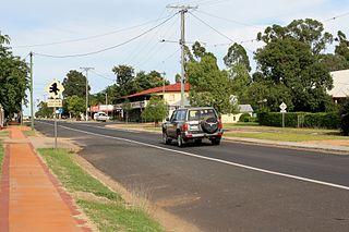
Tambo is a rural town and locality in the Blackall-Tambo Region, Queensland, Australia. In the 2016 census, Tambo had a population of 367 people. Cattle and tourism are the major industries of the town. A number of heritage buildings survive from the earliest days of settlement.

The Shire of Tambo was a local government area located in central Queensland south-east of the town of Blackall. It covered an area of 14,083.8 square kilometres (5,437.8 sq mi), and existed as a local government entity from 1881 until 2008, when it amalgamated with neighbouring Shire of Blackall to form the Blackall-Tambo Region.

West Woombye is a rural residential locality in the Sunshine Coast Region, Queensland, Australia. In the 2016 census, West Woombye had a population of 1,007 people.

The Blackall-Tambo Region is a local government area in Central West Queensland, Australia. Established in 2008, it was preceded by two previous local government areas dating from the 1870s.
Obi Obi is a rural locality in the Sunshine Coast Region, Queensland, Australia. In the 2016 census, Obi Obi had a population of 211 people.
Balmoral Ridge is a rural locality in the Sunshine Coast Region, Queensland, Australia. In the 2016 census, Balmoral Ridge had a population of 278 people.
Scrubby Creek is a rural locality in the Gympie Region, Queensland, Australia. In the 2016 census Scrubby Creek had a population of 55 people.
Yandarlo is a locality in the Blackall-Tambo Region, Queensland, Australia. In the 2016 census, Yandarlo had a population of 18 people.
Caldervale is a rural locality in the Blackall-Tambo Region, Queensland, Australia. In the 2016 census, Caldervale had a population of 11 people.
Home Creek is a former rural locality in the Barcaldine Region, Queensland, Australia. In the 2016 census, Home Creek had a population of 24 people.
Drummondslope is a former rural locality in the Barcaldine Region, Queensland, Australia. In the 2016 census, Drummondslope had a population of 43 people. On 22 November 2019 the Queensland Government decided to amalgamate the localities in the Barcaldine Region, resulting in five expanded localities based on the larger towns: Alpha, Aramac, Barcaldine, Jericho and Muttaburra. Drummondslope was incorporated into Alpha.
Bayrick is a rural locality in the Blackall-Tambo Region, Queensland, Australia. In the 2016 census, Bayrick had a population of 9 people.
Lumeah is a rural locality in the Blackall-Tambo Region, Queensland, Australia. In the 2016 census, Lumeah had a population of 3 people.
Lansdowne is a rural locality in the Blackall-Tambo Region, Queensland, Australia. In the 2016 census, Lansdowne had a population of 11 people.
Minnie Downs is a rural locality in the Blackall-Tambo Region, Queensland, Australia. In the 2016 census, Minnie Downs had a population of 13 people.
Macfarlane is a rural locality in the Blackall-Tambo Region, Queensland, Australia. In the 2016 census, Macfarlane had a population of 14 people.
Mount Enniskillen is a rural locality in the Blackall-Tambo Region, Queensland, Australia. In the 2016 census, Mount Enniskillen had a population of 13 people.
Windeyer is a rural locality in the Blackall-Tambo Region, Queensland, Australia. In the 2016 census, Windeyer had a population of 25 people.
