
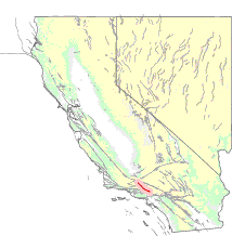
Southern California is a geographic and cultural region that generally comprises the southern portion of the U.S. state of California. It includes the Los Angeles metropolitan area, the second most populous urban agglomeration in the United States. The region generally contains ten of California's 58 counties: Imperial, Kern, Los Angeles, Orange, Riverside, San Bernardino, San Diego, Santa Barbara, San Luis Obispo and Ventura counties.

The San Andreas Fault is a continental transform fault that extends roughly 1,200 kilometers (750 mi) through California. It forms the tectonic boundary between the Pacific Plate and the North American Plate, and its motion is right-lateral strike-slip (horizontal). The fault divides into three segments, each with different characteristics and a different degree of earthquake risk. The slip rate along the fault ranges from 20 to 35 mm /yr. It was formed by a transform boundary.

In geology, a fault is a planar fracture or discontinuity in a volume of rock across which there has been significant displacement as a result of rock-mass movements. Large faults within Earth's crust result from the action of plate tectonic forces, with the largest forming the boundaries between the plates, such as the megathrust faults of subduction zones or transform faults. Energy release associated with rapid movement on active faults is the cause of most earthquakes. Faults may also displace slowly, by aseismic creep.

The Transverse Ranges are a group of mountain ranges of southern California, in the Pacific Coast Ranges physiographic region in North America. The Transverse Ranges begin at the southern end of the California Coast Ranges and lie within Santa Barbara, Ventura, Los Angeles, San Bernardino, Riverside and Kern counties. The Peninsular Ranges lie to the south. The name Transverse Ranges is due to their east–west orientation, making them transverse to the general northwest–southeast orientation of most of California's coastal mountains.

The Newport–Inglewood Fault is a right-lateral strike-slip fault in Southern California. The fault extends for 47 mi (76 km) from Culver City southeast through Inglewood and other coastal communities to Newport Beach at which point the fault extends east-southeast into the Pacific Ocean where it is known as the Rose Canyon Fault. The fault can be inferred on the Earth's surface as passing along and through a line of hills extending from Signal Hill to Culver City. The fault has a slip rate of approximately 0.6 mm (0.024 in)/year and is predicted to be capable of a 6.0–7.4 magnitude earthquake on the moment magnitude scale. A 2017 study concluded that, together, the Newport–Inglewood Fault and Rose Canyon Fault could produce an earthquake of 7.3 or 7.4 magnitude.

The Elsinore Fault Zone is a large right-lateral strike-slip geological fault structure in Southern California. The fault is part of the trilateral split of the San Andreas fault system and is one of the largest, though quietest faults in Southern California.

The Calaveras Fault is a major branch of the San Andreas Fault System that is located in northern California in the San Francisco Bay Area. Activity on the different segments of the fault includes moderate and large earthquakes as well as aseismic creep. The last large event was the 1984 Morgan Hill event and the last moderate earthquake was the 2007 Alum Rock event.
The San Gabriel Fault is a geological fault in Los Angeles County, California, running about 87 miles (140 km) southeastward from the Ridge Basin in the Sierra Pelona-San Emigdio Mountains juncture area to the western San Gabriel Mountains that forms their southwestern face near Sunland and the northeastern San Fernando Valley, and then on the south flank to the southeastern part of the San Gabriel range.

The San Jacinto Fault Zone (SJFZ) is a major strike-slip fault zone that runs through San Bernardino, Riverside, San Diego, and Imperial Counties in Southern California. The SJFZ is a component of the larger San Andreas transform system and is considered to be the most seismically active fault zone in the area. Together they relieve the majority of the stress between the Pacific and North American tectonic plates.

Crafton is an unincorporated community in San Bernardino County, California, United States, located east of Redlands, south of Mentone and west of Yucaipa, California.

The San Gregorio Fault is an active, 209 km (130 mi) long fault located off the coast of Northern California. The southern end of the fault is in southern Monterey Bay, and the northern end is about 20 km northwest of San Francisco, near Bolinas Bay, where the San Gregorio intersects the San Andreas Fault. Most of the San Gregorio fault trace is located offshore beneath the waters of Monterey Bay, Half Moon Bay, and the Pacific Ocean, though it cuts across land near Point Año Nuevo and Pillar Point. The San Gregorio Fault is part of a system of coastal faults which run roughly parallel to the San Andreas. The movement of the San Gregorio is right-lateral strike-slip, and the slip rate is estimated to be 4 to 10 mm/year. The most recent major earthquake along the fault occurred some time between 1270-1775 AD, with an estimated magnitude of 7 to 7.25.
The Hosgri Fault is an offshore fault zone located near the Central Coast of California in San Luis Obispo County. The main fault stretches for about 87 miles (140 km), and is located nearest to the coastal communities of Cambria, San Simeon, Morro Bay, Baywood Park-Los Osos and Avila Beach. The fault system is some 260 mi (420 km) long, and is a right-lateral strand of the San Andreas Fault system.

The Rose Canyon Fault is a right-lateral strike-slip fault running in a north-south direction through San Diego County, California.

The Imperial Fault Zone is a system of geological faults located in Imperial County in the Southern California region, and adjacent Baja California state in Mexico. It cuts across the border between the United States and Mexico.

The Mount Diablo Thrust Fault, also known as the Mount Diablo Blind Thrust, is a thrust fault in the vicinity of Mount Diablo in Contra Costa County, California. The fault lies between the Calaveras Fault, the Greenville Fault, and the Concord Fault, all right-lateral strike-slip faults, and appears to transfer movement from the Calaveras and Greenville Faults to the Concord Fault, while continuing to uplift Mount Diablo.
The 1812 San Juan Capistrano earthquake, also known simply as the Capistrano earthquake or the Wrightwood earthquake, occurred on December 8 at in Alta California. At the time, this was a colonial territory of the Spanish Empire. Damage occurred at several of the missions in the region of Pueblo de Los Ángeles, including Mission San Gabriel Arcángel and Mission San Juan Capistrano, where 40 parishioners were killed during the collapse of a church at an early morning service. Tree ring and paleoseismic evidence show that there is a strong likelihood that the earthquake originated along the Mojave segment of the San Andreas Fault near Wrightwood, but other faults have been suggested as the cause.

The El Tigre Fault is a 120 km long, roughly north-south trending, major strike-slip fault located in the Western Precordillera in Argentina. The Precordillera lies just to the east of the Andes mountain range in South America. The northern boundary of the fault is the Jáchal River and its southern boundary is the San Juan River. The fault is divided into three sections based on fault trace geometry, Northern extending between 41–46 km in length, Central extending between 48–53 km in length, and Southern extending 26 km in length. The fault displays a right-lateral (horizontal) motion and has formed in response to stresses from the Nazca Plate subducting under the South American Plate. It is a major fault with crustal significance. The Andes Mountain belt trends with respect to the Nazca Plate/South American Plate convergence zone, and deformation is divided between the Precordilleran thrust faults and the El Tigre strike-slip motion. The El Tigre Fault is currently seismically active.
The 1957 San Francisco earthquake occurred on March 22 at 11:44:22 local time with a moment magnitude of 5.7 and a maximum Mercalli Intensity of VII. It was located just off the San Francisco Peninsula near the San Andreas Fault and was felt in a limited portion of Northern and Central California. There was a non-destructive foreshock and aftershock sequence that lasted for several months. With financial losses of around US$1 million, damage was considered minimal, with one death and forty injuries.
The 1968 Borrego Mountain earthquake occurred on the evening of April 8, near the unincorporated community of Ocotillo Wells in San Diego County. The moment magnitude 6.6 earthquake was assigned a maximum intensity of VII on the Mercalli intensity scale, causing some damage in the Imperial Valley. Shaking from this earthquake was widely felt, even in Nevada, and Arizona. It was the largest earthquake in Southern California since the 1952 Kern County earthquake 16 years prior.

The San Felipe Fault Zone is an active Quaternary fault zone made up of continuous right-lateral fault strands]. It is a part of the San Andreas fault system and it is located in the western Salton Trough spanning three counties: Imperial, Riverside, and San Diego county, California. It is hypothesized to have originated during the early Pleistocene period.