Great Cumbrae is the larger of the two islands known as The Cumbraes in the lower Firth of Clyde in western Scotland. The island is sometimes called Millport, after its main town.

North Ayrshire is one of 32 council areas in Scotland. The council area borders Inverclyde to the north, Renfrewshire and East Renfrewshire to the northeast, and East Ayrshire and South Ayrshire to the east and south respectively. The local authority is North Ayrshire Council, formed in 1996 with the same boundaries as the district of Cunninghame which existed from 1975 to 1996.

Skelmorlie is a village in North Ayrshire in the southwest of Scotland. Although it is the northernmost settlement in the council area of North Ayrshire, it is contiguous with Wemyss Bay, which is in Inverclyde. The dividing line is the Kelly Burn, which flows into the Firth of Clyde just south of the Rothesay ferry terminal. Despite their proximity, the two villages have historically been divided, Skelmorlie in Ayrshire and Wemyss Bay in Renfrewshire.

Lamlash is a village on the Isle of Arran, in the Firth of Clyde, Scotland. It lies three miles south of the island's main settlement and ferry port Brodick, in a sheltered bay on the island's east coast, facing the Holy Isle. Lamlash is the seat of Arran's local government offices, and is also the location of the island's police station, secondary school and hospital. In common with the rest of the island, the village's main industry is tourism and the public sector is also an important employer. Lamlash has an RNLI Lifeboat station with a B class Atlantic 75 lifeboat, covering the inshore waters around the coast of Arran, and in summer, there is a regular ferry service from Lamlash harbour to Holy Isle. The village has several buildings of historical interest, including Hamilton Terrace, which consists of two rows of single storey-and-attic cottages on the Lamlash seafront, arranged in pairs.
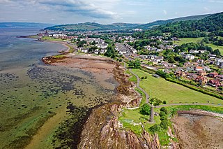
Largs is a town on the Firth of Clyde in North Ayrshire, Scotland, about 33 mi (53 km) from Glasgow. The original name means "the slopes" in Scottish Gaelic.

Peebles is a town in the Scottish Borders, Scotland. It was historically a royal burgh and the county town of Peeblesshire. According to the 2011 census, the population was 8,376 and the estimated population in June 2018 was 9,000.
Lochcarron is a village, community and civil parish in the Wester Ross area of Highland, Scotland. It has a population of 923.
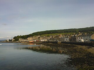
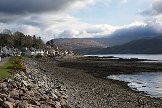
Port Bannatyne, is a coastal village on the Isle of Bute, Firth of Clyde, Scotland that is home to many steamers. Port Bannatyne developed into the 1900s as a quieter alternative to Rothesay. It is a popular harbour, with a small yacht marina and boatyard and an unusual 13-hole golf course rather than the standard 18.

Cruden Bay is a small village in Scotland, on the north coast of the Bay of Cruden in Aberdeenshire, 26 miles (42 km) north of Aberdeen.

Fairlie is a village in North Ayrshire, Scotland.

Silverknowes is a district of Edinburgh, Scotland. Silverknowes lies to the northwest of the city. The district contains over 2000 homes, ranging in size from bungalow to semi-detached housing, much of it built during the mid-twentieth century.

Ben Rhydding is a village in the City of Bradford, West Yorkshire, England. It is part of the Ilkley urban area and civil parish.

West Kilbride is a village and historic parish in North Ayrshire, Scotland, on the west coast by the Firth of Clyde, looking across the Firth of Clyde to Goat Fell and the Isle of Arran. West Kilbride and adjoining districts of Seamill and Portencross are generally considered to be a small town, having a combined population of 4,393 at the 2001 census.

The A78 is an A road in Scotland. It connects Greenock and Prestwick on a route which follows the northern section of the Ayrshire coast.

Portencross is a hamlet near Farland Head in North Ayrshire, Scotland. Situated about three kilometres west of Seamill and about two kilometres south of Hunterston B nuclear power station, it is noted for Portencross Castle.

Moffat is a burgh and parish in Dumfriesshire. Part of the Dumfries and Galloway local authority area in Scotland, it lies on the River Annan, with a population of around 2,500. It was a centre of the wool trade and a spa town.
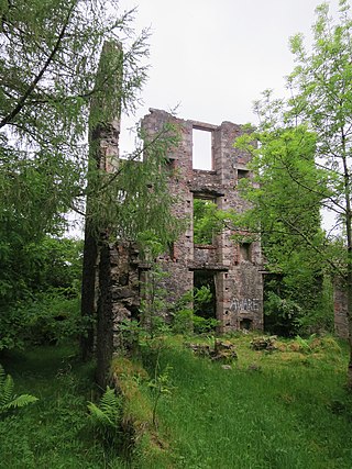
The Oban Hills Hydropathic Sanatorium was a proposed Hydropathic Hotel in Oban, Scotland. Construction of the hotel began in 1881 on a hill east of the downtown overlooking the town and the harbour. Had it been completed the hotel would have been a major landmark on the Oban skyline. The hotel was never completed due to financial difficulties and currently lies in ruins.

Peebles Hydro is an early 20th century hotel and spa resort in Peebles, in the historic county of Peebles-shire in the Scottish Borders. It is one of two hydropathic hotels left in Scotland, the other being Crieff Hydro in Perthshire.

Crieff Hydro is a hotel in Crieff, Perthshire, Scotland. The purpose-built hotel opened in 1868 as the Crieff Hydropathic Establishment, and is locally known as the Hydro. It was founded in 1868 by Dr Thomas Henry Meikle, who had received treatment at a centre in Gräfenberg, Austria, where Vincenz Priessnitz had built such an establishment. Preissnitz based his pharmacopeia on water, exercise, fresh mountain air, water treatments in the brooks and simple country food.
Ben Rhydding Hydro, opened as the Wharfedale Hydropathic Establishment and Ben Rhydding Hotel and later rebranded as the Ben Rhydding Golf Hotel was a hotel in Ben Rhydding near Ilkley, West Yorkshire, England, opened in 1844 and demolished in 1955.
