Girdle Toll

Last updated

Girdle Toll
  • The Gurdel
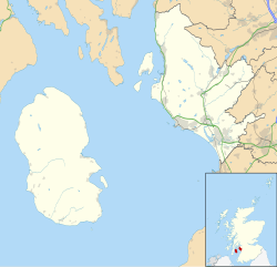
North Ayrshire UK location map.svg
Red pog.svg
Girdle Toll
Location within North Ayrshire
OS grid reference NS325395
Council area
Lieutenancy area
Country Scotland
Sovereign state United Kingdom
Post town IRVINE
Postcode district KA11, KA12
Dialling code 01294
Police Scotland
Fire Scottish
Ambulance Scottish
UK Parliament
Scottish Parliament
List of places
UK
Scotland
55°37′12″N4°39′41″W / 55.6201°N 04.6614°W / 55.6201; -04.6614 Coordinates: 55°37′12″N4°39′41″W / 55.6201°N 04.6614°W / 55.6201; -04.6614

Girdle Toll is an area of Irvine, North Ayrshire.
Geography

Girdle Toll is located east of the Stanecastle Roundabout located next to the Stanecastle Keep. This area of Irvine is 10 miles (16 kilometres) from Prestwick Airport and 23 miles (37 kilometres) from Glasgow. Nearby is Eglinton Country Park. The central part of Girdle Toll is located off of the Lochilbo Road and Girdle Toll; it previously formed part of the A736 route to Glasgow. The A736 now bypasses the area just to the west.

Contents

Schools

The Original Annick Primary School. The picture shows the old school, which subsequently was converted to a pub and then to a private house Annick Primary school.JPG
The Original Annick Primary School. The picture shows the old school, which subsequently was converted to a pub and then to a private house
Littlestane Farmhouse, now Girdle Toll Church manse. Littlestane Farmhouse.JPG
Littlestane Farmhouse, now Girdle Toll Church manse.

Annick Primary School and Stanecastle School are within the same grounds as each other, they are merely 100m apart from each other. The children from Annick Primary School occasionally visit Stanecastle School from time to do activities with the special needs children. Annick Primary and Stanecastle are situated in the fields between Bensley Rise and Burns Crescent. The schools were built in 1979.

Lawthorn Primary School is situated close to the Spar shop and pharmacy at the Littlestane roundabout at the top of the Girdle Toll Road, you pass it when you head along the old Glasgow Road. Lawthorn Primary School was built in 2000 to relieve the slightly overcrowded Annick Primary School. It now has over double the number of pupils than Annick Primary has.

Annick Water

The Annick Water at Bourtreehill Bourtreehillannick1.JPG
The Annick Water at Bourtreehill

The Annick Water passes through Girdle Toll which also flows through Bourtreehill and passes by the outskirts of Eglinton Country Park. The river is well known for having a healthy stock of trout and salmon during the fishing season. The river is known to be mostly pollution free.

Irvine New Town Trail

The Irvine New Town Trail passes through Girdle Toll, it forms part of the British National Cycle Network with routes 7 and 73 forming part of the route. The route forms a ring around the town and passes through Eglinton Country Park, Kilwinning, Bourtreehill, Dreghorn and passes through the town centre of Irvine. It connects to route 7 which is used by locals cycling/walking to nearby Troon and Ayr.

History

The old Girdle gate into the Eglinton Castle estate. The old gatehouse has been demolished. Girdlegate.JPG
The old Girdle gate into the Eglinton Castle estate. The old gatehouse has been demolished.
The Tollhouse Cottage(2007) Girdletoll.JPG
The Tollhouse Cottage(2007)

Before Girdle Toll was developed by Irvine Development Corporation (IDC), Girdle Toll was just a row of houses next to large areas of farmland. In the 1970s and 1980s IDC decided to develop the land into a large housing area with local amenities. Girdle Toll has been growing since, the most recent area to have houses built was in 2001 when a small development was built next to Bryce Knox court.

Littlestane Loch, now mostly drained, was once located nearby, drained by the Red Burn and fed by drainage, rainfall and natural springs. Littlestane Farm stood at the top of the loch.

Prehistory

John Smith in 1895 records that the GIRDLE stood 3 furlongs to the south-west of Lawthorn Mound and appears to have been so well constructed that it was the admiration of everyone who saw it. [1] A Mr.Rodger, manager of Fergushill Colliry, recollected that the mound was about 30 feet in diameter and 3 feet high; surrounded by a turf dyke and a thorn fence, outside of which were a number of trees, mostly beech. The Girdle Mound was completely levelled circa 1860. This mound gave the name to the toll and then the area. [1]

See also

Related Research Articles

<span class="mw-page-title-main">North Ayrshire</span> Council area of Scotland

North Ayrshire is one of 32 council areas in Scotland. The council area borders Inverclyde to the north, Renfrewshire and East Renfrewshire to the northeast, and East Ayrshire and South Ayrshire to the east and south respectively. The local authority is North Ayrshire Council, formed in 1996 with the same boundaries as the district of Cunninghame which existed from 1975 to 1996.

<span class="mw-page-title-main">Irvine, North Ayrshire</span> Administrative centre, new town and former royal burgh in Scotland

Irvine is a town on the coast of the Firth of Clyde in North Ayrshire, Scotland. The 2011 Census recorded the town's population at 33,698 inhabitants, making it the largest settlement in North Ayrshire.

<span class="mw-page-title-main">Kilwinning</span> Town and former civil parish in Scotland

Kilwinning is a town in North Ayrshire, Scotland. It is on the River Garnock, north of Irvine, about 21 miles (34 km) southwest of Glasgow. It is known as "The Crossroads of Ayrshire". Kilwinning was also a Civil Parish. The 2001 Census recorded the town as having a population of 15,908. The estimated population in 2016 was 16,460.

<span class="mw-page-title-main">Dreghorn</span> Human settlement in Scotland

Dreghorn is a village in North Ayrshire, Scotland, 3.5 kilometres east of Irvine town centre, on the old main road from Irvine to Kilmarnock. It is sited on a ridge between two rivers. As archaeological excavations near the village centre have found a significant neolithic settlement provisionally dated to around 3500 BC, as well as medieval structures, scholars have suggested that Dreghorn could be Britain's oldest continuously inhabited village. Both Irvine and Dreghorn have grown in size and they are now separated by the Annick Valley Park, which incorporates a footpath and National Cycle Route 73 on the route of the disused Irvine to Busby railway line. It had an estimated population of 3,450 in 2020.

<span class="mw-page-title-main">Bourtreehill</span>

Bourtreehill is a large housing estate built by the Irvine Development Corporation (IDC) in the late 1970s which forms part of the Irvine New Town in North Ayrshire, Scotland. The estate has two main parts, known as Bourtreehill North and Bourtreehill South. Along its southern border runs the Broomlands estate. The Bourtreehill South area has suffered from anti-social behaviour. However, with more frequent police and Community Warden Patrols, this has gone down, though the area still suffers from the lack of employment opportunities in North Ayrshire.

Perceton is a medieval settlement and old country estate in North Ayrshire, Scotland, near the town of Irvine. The ruined church in Perceton is one of the oldest buildings in the Irvine district. The earliest legible gravestone dates from 1698, though older stone coffins will certainly still rest deep within the small hillock on which the chapel and graveyard sit.

Broomlands is district of Irvine in North Ayrshire, Scotland. Situated on a series of bends in the River Annick, Broomlands and its original features are now almost lost within the south-Bourtreehill and Broomlands housing scheme.

<span class="mw-page-title-main">Stanecastle</span> Tower in Stanecastle, Irvine

Stanecastle was a medieval barony and estate in North Ayrshire, Scotland, first mentioned in 1363 and now part of the Irvine New Town project. Its nearest neighbours are Bourtreehill and Girdle Toll.

Cunninghamhead is a hamlet in North Ayrshire, Scotland. It was the centre of the lands of Cunninghamhead, Perceton and Annick Lodge in Cunninghame. This mainly rural area is noted for its milk and cheese production and the Ayrshire, Cunninghame or Dunlop breed of cattle.

Fullarton is a small area in Irvine, North Ayrshire. It is situated close to Irvine Bay and is next to several industrial estates, large supermarkets and retail stores and the town centre itself. Stagecoach Western buses operate the local bus services in the area. Fullarton is only 8 miles from Prestwick Airport and 25 miles from the city of Glasgow.

<span class="mw-page-title-main">Eglinton Castle</span> Gothic castellated mansion in Kilwinning, Scotland

Eglinton Castle was a large Gothic castellated mansion in Kilwinning, North Ayrshire, Scotland.

<span class="mw-page-title-main">Auchenharvie Castle</span>

Auchenharvie Castle is a ruined castle near Torranyard on the A 736 Glasgow to Irvine road. Burnhouse lies to the north and Irvine to the south. It lies in North Ayrshire, Scotland.

<span class="mw-page-title-main">A78 road</span>

The A78 is an A road in Scotland. It connects Greenock and Prestwick on a route which follows the northern section of the Ayrshire coast.

<span class="mw-page-title-main">A736 road</span>

The A736 road in Scotland runs between Renfrew and Irvine.

The Irvine New Town Trail is a recreational cycleway and footpath around Irvine, North Ayrshire, Scotland. The route is 19 kilometres (12 mi) long. The trail is used by many dog walkers and cyclists in the area.

<span class="mw-page-title-main">Eglinton Country Park</span>

Eglinton Country Park is located on the grounds of the old Eglinton Castle estate in Kilwinning, North Ayrshire, Scotland. Eglinton Park is situated in the parish of Kilwinning, part of the former district of Cunninghame, and covers an area of 400 ha ([98 acres ] of which are woodland. The central iconic feature of the country park is the ruined Eglinton Castle, once home to the Eglinton family and later the Montgomeries, Earls of Eglinton and chiefs of the Clan Montgomery. Eglinton Country Park is managed and maintained by North Ayrshire Council and its Ranger Service.

Benslie is a small village in North Ayrshire, in the parish of Kilwinning, Scotland. Map reference NS 336 429.

<span class="mw-page-title-main">Drukken Steps</span>

The Drukken, Drucken Steps or Drunken Steps were stepping stones across the Red Burn in Irvine, North Ayrshire, Scotland and are associated with Scotland's national poet, Robert Burns. Drukken is used on the commemorative cairn plaque, but Druken or Drucken may also be used.

<span class="mw-page-title-main">Littlestane Loch</span> Former lake in Irvine, Scotland

Littlestane Loch, was situated in the mid-Ayrshire clayland near Stanecastle, Irvine, North Ayrshire, Scotland. It is nowadays (2011) only visible as an area of permanent water in the Scottish Wildlife Trust Sourlie Nature Reserve. The loch was natural, sitting in a hollow created by glaciation. The loch waters outflow was via the Red Burn that flows into the River Garnock. The site of Littlestane Loch site is partly built over and much of the site is now public open space lying within the Parish of Girdle Toll.

<span class="mw-page-title-main">Lawthorn</span> Human settlement in Scotland

Lawthorn is a hamlet near Perceton in Strathannick, Irvine, North Ayrshire, Scotland. The settlement lies on the old Irvine to Stewarton toll road.

References

  1. 1 2 Smith, John (1895). Prehistoric Man in Ayrshire. Pub. Elliot Stock. P. 97.