
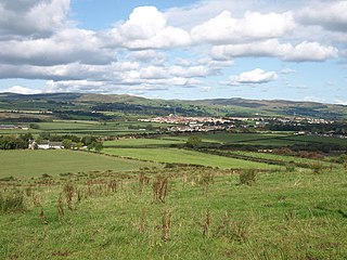
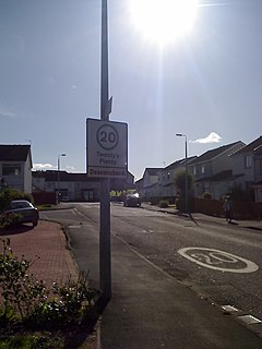
Longbar is a hamlet in North Ayrshire, Scotland, immediately to the east of Glengarnock.
Longbar is a hamlet in North Ayrshire, Scotland, immediately to the east of Glengarnock.
Longbar is now a housing estate situated on the low hillside above the Longbar Farm. Originally it was a string of single-storey terraced cottages (rows) that ran from the farm east towards the junction of the Auchengree Road with the B777 road. Both versions of the hamlet have provided housing for workers in the local heavy industries, primarily the Glengarnock Steel Works. [1]
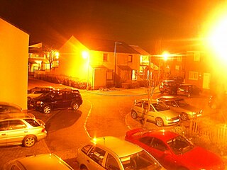
When the steel works closed in the early 1980s the inhabitants of the community found themselves largely unemployed and the housing estate became notorious for its social problems. Since then much of it has been purchased by its inhabitants.
The community shares a community hall with the neighbouring hamlet of Auchengree, or Meikle Auchengree.
Ayrshire is a historic county and registration county in south-west Scotland, located on the shores of the Firth of Clyde. Its principal towns include Ayr, Kilmarnock and Irvine and it borders the counties of Renfrewshire and Lanarkshire to the north-east, Dumfriesshire to the south-east, and Kirkcudbrightshire and Wigtownshire to the south. Like many other counties of Scotland it currently has no administrative function, instead being sub-divided into the council areas of North Ayrshire, South Ayrshire and East Ayrshire. It has a population of approximately 366,800.
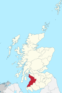
North Ayrshire is one of 32 council areas in Scotland.

Drongan is a former mining village in East Ayrshire, some 8 miles (13 km) east of Ayr and west of Cumnock. It had a population of 4686 in 2011.
Kilbirnie is a small town of 7,280 inhabitants situated in the Garnock Valley area of North Ayrshire, on the west coast of Scotland. It is around 20 miles (30 km) south-west of Glasgow and approximately 10 miles (16 km) from Paisley and 13 miles from Irvine respectively. Historically, the town's main industries were flax production and weaving before iron and steelmaking took over in the 19th and early 20th centuries. The suburb of Kilbirnie in the New Zealand capital of Wellington is named after the town.
Garnock Valley is an area in the northern part of North Ayrshire, Scotland, adjoining Renfrewshire.
Glengarnock is a small village in North Ayrshire that lies near the west coast of Scotland. It forms part of the Garnock Valley area and is about 18 miles from Glasgow, the nearest city. The Barony of Glengarnock is one of three baronies which together form the parish of Kilbirnie in the district of Cunningham which lies in north Ayrshire. The River Garnock flows through the village, but the name Glen Garnock applies more specifically to the ravine at Glengarnock Castle, some 4 kilometres north of the village.
Dalry is a small town in the Garnock Valley in Ayrshire, Scotland. Drakemyre is a northern suburb.

Meikle Auchengree is a hamlet near Kilbirnie and Longbar in North Ayrshire, Scotland.
Pilton is a residential area of northern Edinburgh, Scotland. It is to the north of Ferry Road, immediately east of Muirhouse, and to the west and south of Granton.

The River Garnock, the smallest of Ayrshire's six principal rivers, has its source on the southerly side of the Hill of Stake in the heart of the Clyde Muirshiel Regional Park. About a mile and a half south of this starting point the untested stream tumbles over the Spout of Garnock, the highest waterfall in Ayrshire, once thought to be the river's origin. The river then continues, for a total length of 20 miles (32 km) or so, through the towns of Kilbirnie, Glengarnock, Dalry and Kilwinning to its confluence with the River Irvine at Irvine Harbour.
Bourtreehill is a large housing estate built by the Irvine Development Corporation (IDC) in the late 1970s which forms part of the Irvine New Town in North Ayrshire, Scotland. The estate has two main parts, known as Bourtreehill North and Bourtreehill South. Along its southern border runs the Broomlands estate. The Bourtreehill South area has suffered from anti-social behaviour. However, with more frequent police and Community Warden Patrols, this has gone down, though the area still suffers from the lack of employment opportunities in North Ayrshire.
Deaconsbank is a neighbourhood in the Scottish city of Glasgow. It is situated south of the River Clyde. The main feature of the area, which falls into the Greater Pollok ward of Glasgow City Council and directly borders the East Renfrewshire council region, is an estate of around 639 private houses built in the late 1970s by Barratt Developments, prior to which the area was open farmland. Deaconsbank is bordered by the M77 motorway to the west and by Rouken Glen Park and golf course to the east. The northern parts of the suburban town of Newton Mearns are a short distance to the south, as is Patterton railway station.

Barrmill is a small village in North Ayrshire, Scotland about 1+1⁄2 miles east of Beith on the road to Burnhouse and Lugton. Locally it is known as the Barr.

Highfield is a small village or hamlet in North Ayrshire, Parish of Dalry, Scotland. It is situated between the settlements of Barkip and Dalry on the A737 at a junction with the B777. It lies in the lands of the old Barony of Kersland, the ruins of Kersland Castle and East Kersland Mill being situated nearby at East Kersland.

Houston and Killellan is a civil parish in the county and council area of Renfrewshire in the west central Lowlands of Scotland. It contains the villages of Houston and Crosslee, as well as a number of smaller settlements including Barochan and Killellan in its rural hinterland.

David Colville & Sons, a Scottish iron and steel company, was founded in 1871 and it opened its Dalzell Steel and Iron Works at Motherwell in 1872. By the first World War, it was the largest steel works in Scotland and it continued to expanded afterwards taking over a number of other steel works in Cambuslang and Glengarnock.
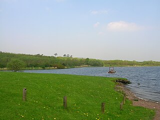
Kilbirnie Loch, is a freshwater Loch situated in the floodplain between Kilbirnie, Glengarnock and Beith, North Ayrshire, Scotland. It runs south-west to north-east for almost 2 km (1.2 mi), is about 0.5 km (0.31 mi) wide for the most part and has an area of roughly 3 km2. It has a general depth of around 5.2 metres (17 feet) to a maximum of around 11 metres (36 feet). The loch is fed mainly by the Maich Water, which rises in the Kilbirnie Hills near Misty Law, and is drained by the Dubbs Water that runs past the Barr Loch into Castle Semple Loch, followed by the Black Cart, the White Cart at Renfrew and finally the River Clyde. The boundary between East Renfrewshire and North Ayrshire, in the vicinity of the loch, runs down the course of the Maich Water along the northern loch shore to then run up beside the Dubbs Water.

Barkip, also known as The Den, is a hamlet in North Ayrshire, Scotland about three miles southwest of Beith on the A737 road to Dalry. The earliest recorded name is 'Blairkip'. In the Gaelic language, the name Barkip comes from bar ("top"), and kip. It is not clear when or why the name 'The Den' started to be used although it appears in the local press as both in 1898, however in Scots as in old English one meaning is 'A hollow between hills,' which is certainly an accurate description of the geography of the area that Barkip lies in. Following construction of a new road, Barkip no longer sits on the main Beith to Dalry road.

The remains of the old castle of Kersland lie about 1.5 miles to the north-east of the town of Dalry in North Ayrshire, Scotland, in the old Barony of Kersland. The River Garnock lies nearby.

Jerviston is a country estate on the north-eastern edge of the Scottish town of Motherwell in North Lanarkshire which is now occupied by Colville Park Country Club.
| Wikimedia Commons has media related to Longbar . |
Coordinates: 55°44′20″N4°39′53″W / 55.73885°N 4.66481°W
| | This North Ayrshire location article is a stub. You can help Wikipedia by expanding it. |