Serra de l'Espadella

Last updated
Serra de l'Espadella
Serra de l'Espadella92.JPG
Highest point
Peak Espadella
Elevation 968 m (3,176 ft)
Listing List of mountains in the Valencian Community
Coordinates 40°32′52″N0°5′23″E / 40.54778°N 0.08972°E / 40.54778; 0.08972 Coordinates: 40°32′52″N0°5′23″E / 40.54778°N 0.08972°E / 40.54778; 0.08972
Geography
Relief Map of Spain.png
Red triangle with thick white border.svg
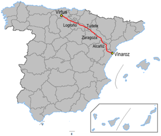
Serra de l'Espadella
Location in Spain
Location Baix Maestrat, Valencian Community
Parent range Iberian System, Eastern end
Geology
Orogeny Alpine orogeny
Type of rock Karstic
Climbing
First ascent Unknown
Easiest route From Vallivana or from Xert

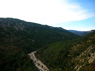
Serra de l'Espadella (Spanish : Sierra de la Espandela) [1] is an over 4 km (2 mi) long mountain range in the Baix Maestrat comarca, Valencian Community, Spain. Its highest point is Espadella (968 m). These mountains are frequently covered in snow in the winter.

Spanish language Romance language

Spanish or Castilian, is a Western Romance language that originated in the Castile region of Spain and today has hundreds of millions of native speakers in the Americas and Spain. It is a global language and the world's second-most spoken native language, after Mandarin Chinese.

Baix Maestrat Comarca in Valencian Community, Spain

Baix Maestrat is a coastal comarca located in the north of the province of Castellón, Valencian Community, Spain. The capital of the comarca is Vinaròs.

Valencian Community Autonomous community of Spain

The Valencian Community is an autonomous community of Spain. It is the fourth most populous autonomous community after Andalusia, Catalonia and Madrid with more than 4.9 million inhabitants. Its homonymous capital Valencia is the third largest city and metropolitan area in Spain. It is located along the Mediterranean coast on the east side of the Iberian peninsula. It borders with Catalonia to the north, Aragon and Castilla–La Mancha to the west, and Murcia to the south. The Valencian Community consists of three provinces which are Castellón, Valencia and Alicante.

Contents

Geography

This mountain chain rises south of the Serra del Turmell, between the almost abandoned village of Vallivana and the Moles de Xert, to the northeast of the Serra de Vallivana, on the other side of the valley through which the N-232 road passes. This sparsely populated mountain area has the most important forested zone of the region. [2]

Serra del Turmell mountain in Valencian Country

Serra del Turmell, also known as Serra del Mont Turmell, is an over 12 km (7 mi) long mountain range in the Baix Maestrat comarca, Valencian Community, Spain.

Vallivana human settlement in Spain

Vallivana is a small settlement belonging to Morella, Ports (comarca).

Moles de Xert mountain in Spain

Moles de Xert is a 4.2 km (3 mi) long mountain range in the Baix Maestrat comarca, Valencian Community, Spain. Its highest point is Mola Gran. The other main summits are Mola Murada, a breast-shaped hill, Moleta Redona and Mola Llarga. These mountains have very original shapes, topped by regular rocky outcrops resembling castles or fortifications. They are frequently covered in snow in the winter.

The main wild animals in these unpopulated mountains are the Spanish Ibex, Roe Deer and Wild Boar.

See also

Related Research Articles

N-232 road (Spain)

The N-232 is a highway in Spain. It broadly follows the Rio Ebro from Logroño to the coast. It starts south east of Logroño at the Autovía LO-20 and runs parallel to the Autopista AP-68. The road passes Calahorra before it junctions with the N-113, N-121 and Autovía A-15.

Espadella may refer to:

Xert Municipality in Valencian Community, Spain

Xert is a municipality in the comarca of Baix Maestrat in the Valencian Community, Spain.

Catí Municipality in Valencian Community, Spain

Catí is a municipality in the comarca of Alt Maestrat, Castellón, Valencia, Spain.

Tinença de Benifassà historical comarca of the Valencian Community, Spain

Tinença de Benifassà is a historical comarca of the Valencian Community, Spain. It is nowadays part of the Baix Maestrat, one of the present-day Comarques of the Valencian Community, even though commercial and human relationships have been stronger with Els Ports in the west, the Terres de l'Ebre in the northeast and the Matarranya in the northwest in historical times.

La Pobla de Benifassà Municipality in Valencian Community, Spain

La Pobla de Benifassà is a municipality in the comarca of Baix Maestrat in the Valencian Community, Spain.

Vallibona Municipality in Valencian Community, Spain

Vallibona is a small town and municipality located in the Ports comarca, province of Castelló, part of the autonomous community of Valencia, Spain. According to the 2009 census, it has a total population of 90 inhabitants. It is located in the upper valley of the Cérvol River, between the Serra del Turmell and the Ports de Beseit mountain ranges, in a very lonely area, relatively far from other towns. Vallibona is part of the Taula del Sénia free association of municipalities.

La Jana Municipality in Valencian Community, Spain

La Jana is a municipality in the comarca of Baix Maestrat in the Valencian Community, Spain. The Cervera Mountains rise just east of the town extending southwards.

Traiguera Municipality in Valencian Community, Spain

Traiguera is a town and municipality in the Baix Maestrat comarca, province of Castelló, Valencian Community, Spain. It is part of the Taula del Sénia free association of municipalities.

Cervera Mountains

The Cervera Mountains is an 18.8 km (12 mi) long mountain range in the Baix Maestrat comarca, Valencian Community, Spain. In some ancient texts these mountains are known as Serra d'en Menor. Its highest point is Revoltons, 635 m (2,083 ft). Other notable summits are Perdiguera, 516 m (1,693 ft) and Mola, 481 m (1,578 ft).

Santa Magdalena de Polpís Municipality in Valencian Community, Spain

Santa Magdalena de Polpís is a town and municipality in the Baix Maestrat comarca, province of Castelló, Valencian Community, Spain.

Canet lo Roig Municipality in Valencian Community, Spain

Canet lo Roig is a municipality in the comarca of Baix Maestrat in the Valencian Community, Spain.

Cervera del Maestre Municipality in Valencian Community, Spain

Cervera del Maestre is a municipality in the comarca of Baix Maestrat in the Valencian Community, Spain. It is located at the southern end of the Cervera Mountains, above the Rambla de Cervera seasonal river.

Serra de Sant Pere

Serra de Sant Pere or Serra del Solà is a 5.8 km (4 mi) long mountain range in the Baix Maestrat comarca, Valencian Community, Spain. Its highest point is Tossal de Sant Pere. The slopes are covered in low Mediterranean vegetation

Serra de Vallivana

Serra de Vallivana or Muntanyes de Vallivana is an over 14 km (9 mi) long mountain range straddling the Alt Maestrat and Baix Maestrat comarcas, Valencian Community, Spain.

Serra dEsparreguera

Serra de d'Esparreguera or Serra Esparreguera is an over 17 km (11 mi) long mountain range in the Alt Maestrat comarca, Valencian Community, Spain.

Serra de la Vall dàngel mountain in the Land of Valencia

Serra de la Valldàngel or Serra de la Vall d'Àngel,, is a mountain range in the Baix Maestrat comarca, Castellón Province, Valencian Community, Spain.

References

  1. Vicenç M. Rosselló i Verger, Toponímia, geografia i cartografia
  2. José Quereda Sala, Les Moles de Xert,; Análisis Geomorfológico (in Spanish)