Sexton, Iowa | |
|---|---|
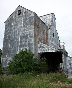 Sexton elevator | |
 Sexton  Sexton | |
| Coordinates: 43°04′30″N94°05′21″W / 43.07500°N 94.08917°W | |
| Country | USA |
| State | Iowa |
| County | Kossuth |
| Townships | Irvington, Prairie |
| Post office opened | August 20, 1888 |
| Area | |
• Total | 2.20 sq mi (5.70 km2) |
| • Land | 2.20 sq mi (5.70 km2) |
| • Water | 0.00 sq mi (0.00 km2) |
| Elevation | 1,207 ft (368 m) |
| Population (2020) | |
• Total | 46 |
| • Density | 20.89/sq mi (8.07/km2) |
| Time zone | UTC-6 (Central (CST)) |
| • Summer (DST) | UTC-5 (CDT) |
| ZIP Code | 50483 |
| Area code | 515 |
| GNIS feature ID | 2585487 [2] |
| FIPS code | 19-71715 |
Sexton is an unincorporated community and census-designated place in Irvington Township, Kossuth County, Iowa, United States. It is located at the intersection of U.S. Route 18 and Kossuth CR P60. As of the 2020 census it had a population of 46.