Shannon Cave

Last updated

Shannon Cave
Shannon Cave.jpg
The Vegetable Patch formations
Location Cuilcagh mountains,
County Fermanagh, Northern Ireland and
County Cavan, Republic of Ireland
Coordinates 54°14′26″N7°50′53″W / 54.24056°N 7.84806°W / 54.24056; -7.84806
Depth130 m (430 ft)
Length5.4 km (3.4 mi) [1]
Discovery1980
Geology Limestone
Entrances1
List of
entrances
Polltullyard
Pollahune (collapsed)
DifficultyHigh
HazardsVertical pitch; rock falls; boulder chokes
AccessWith experienced guide only
Associated cavesPolltullyard, Pigeon Pot, Shannon Pot

Shannon Cave is an active stream passage cave which straddles the border of County Fermanagh, Northern Ireland and County Cavan in the Republic of Ireland.

Contents

At 130 metres (430 ft) vertical depth, it stands joint sixth with Poulnagree in County Clare in the deepest caves on the island of Ireland. [2] [3] The cave is recorded at 5.4 kilometres (3.4 mi) in length (making it the sixth-longest on the island of Ireland), [4] [5] but exploration is ongoing and further passage is expected to be found. [1]

Description

The cave consists in the main of a large mainstream passage running to a terminal sump. The water flowing in the cave has been dye traced to Shannon Pot, two kilometres to the west of the terminal sump, which is the traditional source of the River Shannon. Inlets to the main passage are numerous. Some, such as the large "Mistake Passage" have been pushed only a short distance. Since the cave is undergoing active exploration, there remain many issues to be sorted out and the sinks for many of these inlets remains unclear. The stream passage itself is of considerable proportions in parts, but also contains many higher level fossil passages which have been deserted by the stream. The cave contains numerous calcite formations, with large amounts of helictites in places. Boulder chokes are frequent with several parts of the cave being quite unstable, especially the JCP passage. [6]

Location

While the location of the entrance to the cave is in County Fermanagh, the majority of the cave lies under County Cavan. The original entrance to the cave was in Cavan; however, this is now inaccessible. The current entrance of Polltullyard is located north of the Marlbank area of Fermanagh, high in the moors.

Exploration history

1980s: Discovery and initial exploration

The cave was discovered in August 1980 by members of the Reyfad Group, the cavers' collective responsible for exploring the Reyfad system. The entrance was made in a shakehole adjacent to the sink point of the Hune (pronounced "honey") stream, and close the border in County Cavan. This entrance became known as "Pollahune". The initial route was dug through a highly unstable area of glacial fill, making it extremely treacherous. Once in the cave the cavers encountered a "main" streamway into which the Hune flowed, with the upstream section leading to "JCP Passage" and the downstream section passing another significant inlet, "Mistake Passage". By the end of August, the team had progressed past several boulder chokes and explored cave passages some 1.6 kilometres (1 mi) in length. [7]

Downstream, the team reached a terminus at a prominent boulder choke, through which they attempted to dig. In October 1980 a section of the choke collapsed on Rev. George Pitt while he attempted to force a passage at river level. He became trapped for 10 hours, but was freed after a major rescue effort. [7] By 1990 the explorers had passed the newly named George's Choke. The end of the cave was reached, 400 metres (1,300 ft) downstream, [8] at the terminal sump (sump 3) [8] beneath another large boulder choke, and the extension to this point was named "The Mayfly Extension". [9]

While discoveries were being made in Shannon Cave in 1980, attention was also being paid to a large doline less than a kilometre away in County Fermanagh. Members of the Reyfad Group (including the aforementioned Rev. Pitt) and the Irish Caving Club worked together to dig their way into passage leading to a 30-metre (98 ft) underground shaft, with boulder chokes and crawls at its base. They named this cave Co-operation Pot in honour of their collaboration, but later the name Polltullyard, after the local townland, was adopted. [10]

1990s–2000s: Pollahune collapse and new entrance

The Pollahune entrance to Shannon was always dangerous, often dumping rocks on passing cavers [11] and finally in 1995 it collapsed, making the cave inaccessible. During subsequent years attention was turned to Polltullyard, the downstream end of which lay within 60 metres (200 ft) of upstream JCP Passage, according to the surveys. [8] Various groups of cavers attempted to dig through the terminal boulder choke, but none were successful in stabilising the passage. In 2004 cavers from the Shannon Group began in earnest to attempt to re-enter the system, and initiated a new dig in the direction of Shannon Cave. By 2005 Shannon Cave had been re-entered via a very tight section of passage named the "Rebirth Canal". [12] The cavers had regained JCP Passage, and access to the rest of the cave as far as George's Choke, which had collapsed again as reported by cavers on the last trip into Shannon Cave. [11] In 2007, after two years' work digging and stabilising, George's Choke was passed. The explorers reached the terminal sump, the first people to do so in twelve years.

2008: Saint Patrick's Extension

A new dig began on a balcony above the terminal sump, attempting to push a route through the boulder choke, but progress was slow and the choke proved unstable. In early 2008 a team of British cave divers were invited over to dive the sump, now named "Young, Free and Desperate". [13] After 40 metres (130 ft) the divers emerged at the far side of the choke and made a voice connection with the dry cavers on the other side. After exploring downstream for one kilometre they returned to help dig from the other side of the choke. A connection was made a week later, after a further dive. [14] 1,300 metres (4,300 ft) of cave was surveyed beyond the choke. This began with a short stretch of passage leading to sump 4, which was then bypassed from above, leading to 450 metres (1,480 ft) of unbroken canyon passage. The extension eventually terminated at a new terminal sump. The new section was named "St. Patrick's Extension", and the canyon passage named "Paddy's Parade". The sump, number 5 in the system, was named "Long Way From Home". [8]

"Downstream of sump 4 the streamway comprises c. 450 m of fine canyon passage. ... [It] is perhaps one of the grandest sections of canyon passage in Ireland but on a striking scale. The passage is about 1–2 metres wide and ranges from 8 to 14 metres in height. There is also evidence of old high-level passage with a few rift/high level passage leads." [1]

2009: Easter Extension

Methodical exploration of high-level leads in St. Patrick's Extension in 2009 led to the discovery of a tight cross-rift intercepting a section of "Paddy's Parade" at right-angles. [1] The dry, tightly meandering rift, the "Snake Escape", was followed for 30 metres (98 ft) to a 10-metre (33 ft) upward pitch, from the top of which led 70 metres (230 ft) of crawling passage to a number of deep pitch heads. The last of these pitches was found to take a small stream, which was followed at the base of the pitch to a sump. [1] Although it has not been traced, it is likely that this stream joins the main Shannon Cave watercourse further downstream of the Snake Escape. [1]

Upstream, beyond the pitches, a further 150 metres (490 ft) of active stream passage was followed upstream to a sump. The total surveyed length of all branches in the extension came to 635 metres (2,083 ft). [1]

In Media

A 12 minute VR documentary starring Pam and Tim Fogg based on a LiDAR point scan [15] of the descent into Poltullyard was premiered at IDFA 2023 [16] The experience is based on a series of still scenes rendered using proprietary point cloud technology on Unity and runs on the Quest 2. [17]

Related Research Articles

Krubera Cave is the second-deepest-known cave on Earth, after the Veryovkina Cave. It is located in the Arabika Massif of the Gagra Range of the Western Caucasus, in the Gagra District of Abkhazia, an occupied region of Georgia.

<span class="mw-page-title-main">Smoo Cave</span> Cave in Highland, Scotland

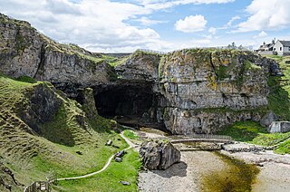
Smoo Cave is a large combined sea cave and freshwater cave in Durness in Sutherland, Highland, Scotland. The cave name is thought to originate from the Norse 'smjugg' or 'smuga', meaning a hole or hiding-place.

<span class="mw-page-title-main">Marble Arch Caves</span> Limestone caves in Northern Ireland

The Marble Arch Caves are a series of natural limestone caves located near the village of Florencecourt in County Fermanagh, Northern Ireland. The caves are named after the nearby Marble Arch, a natural limestone arch at the upstream end of Cladagh Glen under which the Cladagh River flows. The caves are formed from three rivers draining off the northern slopes of Cuilcagh mountain, which combine underground to form the Cladagh. On the surface, the river emerges from the largest karst resurgence in Ireland, and one of the largest in the United Kingdom. At 11.5 kilometres (7.1 mi) the Marble Arch Caves form the longest known cave system in Northern Ireland, and the karst is considered to be among the finest in the British Isles.

<span class="mw-page-title-main">Titan (cave)</span> Cave in Derbyshire, England

Titan is a natural cavern near Castleton in the Derbyshire Peak District, and is the deepest shaft of any known cave in Britain, at 141.5 metres (464 ft). The existence of Titan was revealed in November 2006, following its discovery on 1 January 1999 after cavers discovered connections from the James Hall Over Engine Mine to both Speedwell Cavern and Peak Cavern. Previously, the deepest known underground shaft in Britain had been Gaping Gill on the slopes of Ingleborough in the Yorkshire Dales.

<span class="mw-page-title-main">Crag Cave</span> Cave in County Kerry, Ireland

Crag Cave is a cave in Ireland, located just outside Castleisland, County Kerry.

<span class="mw-page-title-main">Rumbling Hole</span> Cave in Lancashire, England

Rumbling Hole is a cave on Leck Fell, in Lancashire, England. Its entrance is a 50-metre (160 ft) deep fenced shaft, and it rapidly descends a series of pitches to a low aqueous passage that has been connected to Lost Johns' Cave. It is part of the Three Counties System, an 87-kilometre (54 mi) cave system that spans the borders of Cumbria, Lancashire, and North Yorkshire.

<span class="mw-page-title-main">Langcliffe Pot</span> Cave system in North Yorkshire

Langcliffe Pot is a cave system on the slopes of Great Whernside in Upper Wharfedale, about 3 kilometres (1.9 mi) SSE of Kettlewell in North Yorkshire. It is part of the Black Keld Site of Special Scientific Interest where the "underground drainage system which feeds the stream resurgence at Black Keld is one of the largest and deepest in Britain, although only a small proportion of its cave passages are accessible at present." Mossdale Caverns is also part of the Black Keld SSSI. Although a considerable length of passage has been explored in Langcliffe Pot, the current end is over 170 metres (560 ft) above the resurgence, and over 4 kilometres (2.5 mi) in distance. A trip to the far end has been described as "one of the most serious undertakings in British caving".

<span class="mw-page-title-main">Noon's Hole</span> Cave in Northern Ireland

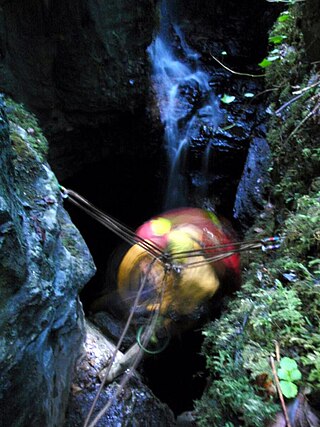
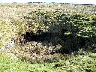
Noon's Hole lies about 5 km northwest of the centre of Boho, in the townland of Old Barr in the parish of Devenish, County Fermanagh, close to the border with Boho parish. The cave is under part of the escarpment on the east side of the Glenade Sandstone uplands. At 81 m (266 ft), this pothole was thought to have the deepest shaft in Ireland, but this honour was passed to the nearby Reyfad Pot, which contains an entrance shaft of 88 m (289 ft). The continuation of the cave system contains 3.7 km (2.3 mi) of passage, and it connects to the resurgence at Arch Cave through three cave dives, making this system the 8th deepest in Ireland, at 108 m (354 ft).

<span class="mw-page-title-main">Boho Caves</span>

The Boho Caves are a collection of caves centred on the village of Boho, County Fermanagh on the northern slopes of Belmore Mountain. They encompass the main Boho Cave and the smaller Waterfall Cave and Upper and Lower Ravine Caves. The Boho Cave system is the sixth-longest cave system in Northern Ireland, is designated an Area of Special Scientific Interest and is the only example of joint-controlled caves in Northern Ireland.

The Caves of the Tullybrack and Belmore hills are a collection of caves in southwest County Fermanagh, Northern Ireland. The region is also described as the West Fermanagh Scarplands by environmental agencies and shares many similar karst features with the nearby Marble Arch Caves Global Geopark.

<span class="mw-page-title-main">Pollnagollum</span>

Pollnagollum–Poulelva is an active stream passage cave situated in County Clare, Ireland.

<span class="mw-page-title-main">Aquamole Pot</span> Cave in North Yorkshire, England

Aquamole Pot is a limestone cave in West Kingsdale, North Yorkshire, England. It was originally discovered by cave divers who negotiated 168 metres (551 ft) of sump passage from Rowten Pot in 1974, to enter a high aven above the river passage. All subsequent major explorations were undertaken from below before an entrance was opened up from the surface. It is part of a 27-kilometre (17 mi) long cave system that drains both flanks of Kingsdale.

The Nidderdale Caves are a series of caves in Upper Nidderdale in North Yorkshire, England. There are two cave systems and most of the caves are in some way linked with one or the other. The smaller system is the Eglin cave system in the valley of How Stean Beck, a tributary of the River Nidd, associated with How Stean Gorge. The larger system is the Goyden cave system under the valley of the River Nidd, which flows east from Scar House Reservoir, then south, and shortly after disappears underground down several sink holes to reappear at the rising just beyond the village of Lofthouse. Cavers are able to access several sections of this system via the different entrances.

<span class="mw-page-title-main">Short Drop Cave - Gavel Pot System</span>

Short Drop Cave and Gavel Pot are different entrances into the same cave system on Leck Fell, in Lancashire, England. The main top entrance, Short Drop Cave, is a small hole in a fenced off shakehole near the main stream sink; Gavel Pot, a window into the system, is a large fenced shakehole some 40-metre (130 ft) deep requiring tackle to descend. There are two other smaller entrances into Short Drop Cave. At its base the system links via a sump with Lost Johns' Cave, and is part of the Three Counties System, an 87 kilometres (54 mi) cave system which spans the borders of Cumbria, Lancashire, and North Yorkshire.

<span class="mw-page-title-main">Disappointment Pot</span>

Disappointment Pot is one of the entrances to the Gaping Gill cave system, located in a steep grassy shakehole some 120 metres (130 yd) south-east of Gaping Gill Main Shaft. Its mainly narrow stream passage descends a number of small shafts to enter the main system as a major inlet of Hensler's Master Cave. It lies within the designated Ingleborough Site of Special Scientific Interest.

<span class="mw-page-title-main">Boulder choke</span> Collection of large rocks or rubble that obstructs the passage of a cave or mine

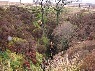
A boulder choke is a collection of large rocks or rubble that obstructs a shaft or passage in a cave or mine. In order to progress through passages cavers often need to negotiate or clear boulder chokes.

<span class="mw-page-title-main">Death's Head Hole</span> Cave in Lancashire, England

Death's Head Hole is a cave on Leck Fell, in Lancashire, England. Its entrance is a 64-metre (210 ft) deep shaft. It leads into Lost Johns' Cave and is part of the Three Counties System, an 87-kilometre (54 mi) cave system which spans the borders of Cumbria, Lancashire, and North Yorkshire.

<span class="mw-page-title-main">Long Kin East Cave - Rift Pot System</span> Cave system in North Yorkshire, England

The Long Kin East Cave - Rift Pot system is a limestone cave system on the southern flanks of Ingleborough, North Yorkshire in England lying within the designated Ingleborough Site of Special Scientific Interest. Long Kin East Cave starts as a long meandering stream passage but then plummets down a 58-metre (190 ft) deep shaft when it meets a shattered fault into which Rift Pot also descends. At the bottom, the stream flows through some low canals and sumps, to eventually emerge at Austwick Beck Head in Crummackdale.

<span class="mw-page-title-main">Réseau du Clot d'Aspres</span>

The Réseau du Clot d'Aspres is a cave system located mainly under the valley of Clot d'Aspres, which lies within the commune of Villard-de-Lans in the north of the Vercors Massif, in Isère, France. This extensive karst system contains 42 kilometres (26 mi) of passages over a height range of 1,066 meters. The highest point is upstream of the Oréade cave +74 metres (243 ft), and the lowest point is the siphon of the Nuits-Blanches scialet which has been dived to a depth of 34 metres (112 ft).

References

  1. 1 2 3 4 5 6 7 Macnamara, S. (October 2010). "Easter Extension, Shannon Cave". Irish Speleology. Speleological Union of Ireland. 19: 31–35. ISSN   0332-4907.
  2. "RO Ireland – Deepest caves" . Retrieved 16 December 2010.
  3. "N Ireland – Deepest caves" . Retrieved 16 December 2010.
  4. "RO Ireland – Longest caves" . Retrieved 16 December 2010.
  5. "N Ireland – Longest caves" . Retrieved 16 December 2010.
  6. Jones, Gareth Ll.; Burns, Gaby; Fogg, Tim; Kelly, John (1997). The Caves of Fermanagh and Cavan (2nd ed.). Lough Nilly Press. pp. 68–71. ISBN   0-9531602-0-3.
  7. 1 2 Burns, G., ed. (1985). "Shannon Cave". Irish Speleology. Speleological Union of Ireland. 3 (2): 32–33.
  8. 1 2 3 4 Brown, L.; Connor, A.; Furnell, T.; Macnamara, S.; McCullagh, S.; Read, S. (October 2009). "Shannon Cave Exploration 1980–2009". Irish Speleology. Speleological Union of Ireland. 18: 43–50. ISSN   0332-4907.
  9. Leonard, M. (May 1991). "Pollahune (Shannon) goes further (Mayfly Extension)". Irish Speleology. Speleological Union of Ireland. 14: 20–21.
  10. Burns, G., ed. (1985). "Polltullyard". Irish Speleology. Speleological Union of Ireland. 3 (2): 33.
  11. 1 2 Guilford, T. (19 April 1995). "Fermanagh '95". Depth Through Thought. Oxford University Caving Club. 5 (8). Retrieved 20 March 2010.
  12. Jewell, C. (28 November 2006). "Long Weekend in Fermanagh" . Retrieved 20 March 2010.
  13. Jewell, C. (20 May 2008). "Fermanagh at Easter" . Retrieved 18 October 2010.
  14. "Shannon Cave". Irish Technical Diving Wiki. Retrieved 20 March 2010.
  15. "Buried in the Rock". ScanLAB Projects. 11 November 2023. Retrieved 10 February 2024.
  16. "Buried in the Rock". International Documentary Film Festival Amsterdam. 11 November 2023. Retrieved 10 February 2024.
  17. Kent Bye (23 January 2024). "#1331: Recreating Spatial Presence in Caves with Point Clouds & Spatial Audio in "Buried in the Rock" Documentary". Voices of VR (Podcast). Event occurs at 11:19. Retrieved 10 February 2024.

Further reading