
Tayshet is a town and the administrative center of Tayshetsky District in Irkutsk Oblast, Russia, located 669 kilometers (416 mi) from Irkutsk, the administrative center of the oblast. Population: 35,485 (2010 Census); 38,535 (2002 Census); 42,391 (1989 Census).

Cheremkhovo is a town in Irkutsk Oblast, Russia, located on the Trans-Siberian Railway. Population: 52,647 (2010 Census); 60,107 (2002 Census); 73,636 (1989 Census).

Usolsky District is an administrative district, one of the thirty-three in Irkutsk Oblast, Russia. Municipally, it is incorporated as Usolsky Municipal District. It is located in the southern part of the oblast and borders Bokhansky District in the north, Angarsky, Shelekhovsky, and Slyudyansky Districts in the east, the Republic of Buryatia in the south, and Cheremkhovsky District in the west. The area of the district is 6,300 square kilometers (2,400 sq mi). Its administrative center is the urban locality of Belorechensky. As of the 2010 Census, the total population of the district was 50,334, with the population of Belorechensky accounting for 15.9% of that number.

Bratsky District is an administrative district, one of the thirty-three in Irkutsk Oblast, Russia. Municipally, it is incorporated as Bratsky Municipal District. It is located in the northwest of the oblast. The area of the district is 33,660 square kilometers (13,000 sq mi). Its administrative center is the city of Bratsk. Population: 56,878 (2010 Census); 65,240 ; 76,945 (1989 Census).
Cheremkhovsky District is an administrative district, one of the thirty-three in Irkutsk Oblast, Russia. Municipally, it is incorporated as Cheremkhovsky Municipal District. It is located in the southwest of the oblast. The area of the district is 9,887.42 square kilometers (3,817.55 sq mi). Its administrative center is the town of Cheremkhovo. As of the 2010 Census, the total population of the district was 30,114.

Kachugsky District is an administrative district, one of the thirty-three in Irkutsk Oblast, Russia. Municipally, it is incorporated as Kachugsky Municipal District. The area of the district is 32,000 square kilometers (12,000 sq mi). Its administrative center is the urban locality of Kachug. Population: 17,388 (2010 Census); 20,501 ; 23,026 (1989 Census). The population of Kachug accounts for 40.3% of the district's total population.

Katangsky District is an administrative district, one of the thirty-three in Irkutsk Oblast, Russia. Municipally, it is incorporated as Katangsky Municipal District. The area of the district is 139,043 square kilometers (53,685 sq mi). Its administrative center is the rural locality of Yerbogachen. Population: 3,779 (2010 Census); 4,579 ; 9,330 (1989 Census). The population of Yerbogachen accounts for 52.0% of the district's total population.
Mamsko-Chuysky District is an administrative district, one of the thirty-three in Irkutsk Oblast, Russia. Municipally, it is incorporated as Mamsko-Chuysky Municipal District. The area of the district is 43,396 square kilometers (16,755 sq mi). Its administrative center is the urban locality of Mama. Population: 5,501 (2010 Census); 7,990 ; 18,895 (1989 Census). The population of Mama accounts for 66.0% of the district's total population.

Nizhneudinsky District is an administrative district, one of the thirty-three in Irkutsk Oblast, Russia. Municipally, it is incorporated as Nizhneudinsky Municipal District. The area of the district is 50,000 square kilometers (19,000 sq mi). Its administrative center is the town of Nizhneudinsk. Population: 25,694 (2010 Census); 31,122 ; 37,293 (1989 Census).

Ust-Ilimsky District is an administrative district, one of the thirty-three in Irkutsk Oblast, Russia. Municipally, it is incorporated as Ust-Ilimsky Municipal District. It is located in the north of the oblast. The area of the district is 36,600 square kilometers (14,100 sq mi). Its administrative center is the town of Ust-Ilimsk. As of the 2010 Census, the total population of the district was 18,589.

Ust-Kutsky District is an administrative district, one of the thirty-three in Irkutsk Oblast, Russia. Municipally, it is incorporated as Ust-Kutsky Municipal District. It is located in the center of the oblast. The area of the district is 34,600 square kilometers (13,400 sq mi). Its administrative center is the town of Ust-Kut. As of the 2010 Census, the total population of the district was 8,416.
Ziminsky District is an administrative district, one of the thirty-three in Irkutsk Oblast, Russia. Municipally, it is incorporated as Ziminsky Municipal District. The area of the district is 7,000 square kilometers (2,700 sq mi). Its administrative center is the town of Zima. Population: 13,383 (2010 Census); 14,420 ; 15,833 (1989 Census).

Alarsky District is an administrative district of Ust-Orda Buryat Okrug of Irkutsk Oblast, Russia, one of the thirty-three in the oblast. Municipally, it is incorporated as Alarsky Municipal District. It is located in the south of the oblast. The area of the district is 2,700 square kilometers (1,000 sq mi). Its administrative center is the rural locality of Kutulik. As of the 2010 Census, the total population of the district was 21,479, with the population of Kutulik accounting for 22.7% of that number.

Ekhirit-Bulagatsky District is an administrative district of Ust-Orda Buryat Okrug of Irkutsk Oblast, Russia, one of the thirty-three in the oblast. Municipally, it is incorporated as Ekhirit-Bulagatsky Municipal District. It is located in the south of the oblast. The area of the district is 5,200 square kilometers (2,000 sq mi). Its administrative center is the rural locality of Ust-Ordynsky. As of the 2010 Census, the total population of the district was 30,597, with the population of Ust-Ordynsky accounting for 48.7% of that number.
Osinsky District is an administrative district of Ust-Orda Buryat Okrug of Irkutsk Oblast, Russia, one of the thirty-three in the oblast. Municipally, it is incorporated as Osinsky Municipal District. It is located in the south of the oblast. The area of the district is 4,400 square kilometers (1,700 sq mi). Its administrative center is the rural locality of Osa. Population: 20,431 (2010 Census); 20,962 ; 20,668 (1989 Census). The population of Osa accounts for 22.1% of the district's total population.

Artyomovsky is an urban locality in Bodaybinsky District of Irkutsk Oblast, Russia. Population: 1,539 (2010 Census); 2,186 (2002 Census); 3,773 (1989 Census).
Atagay is an urban locality in Nizhneudinsky District of Irkutsk Oblast, Russia. Population: 1,740 (2010 Census); 1,853 (2002 Census); 4,177 (1989 Census).
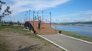
Yelantsy is a rural locality and the administrative center of Olkhonsky District of Irkutsk Oblast, Russia. Population: 4,009 (2010 Census); 3,762 (2002 Census); 3,362 (1989 Census).
Kazachinskoye is a rural locality and the administrative center of Kazachinsko-Lensky District of Irkutsk Oblast, Russia. Population: 2,624 (2010 Census); 2,650 (2002 Census); 2,792 (1989 Census).


