
Wiltshire is a historic county located in the South West England region. Wiltshire is landlocked and is in the east of the region.

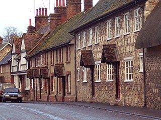
Codford is a civil parish south of Salisbury Plain in the Wylye Valley in Wiltshire, England. Its settlements are the adjacent villages of Codford St Peter and Codford St Mary, which lie some 7 miles (11 km) southeast of Warminster.
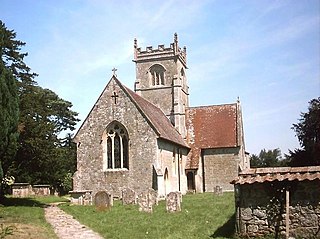
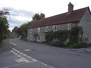
Berwick St James is a village and civil parish on the River Till in Wiltshire, England, about 7 miles (11 km) northwest of Salisbury, on the southern edge of Salisbury Plain. The parish includes the hamlet of Asserton. At the 2021 census the parish had a population of 137.
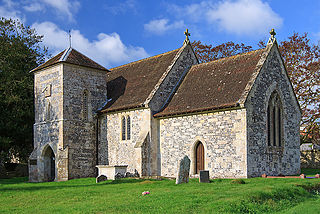
Berwick St John is a village and civil parish in southwest Wiltshire, England, about 5 miles (8 km) east of Shaftesbury in Dorset. The parish includes the Ashcombe Park estate, part of the Ferne Park estate, and most of Rushmore Park.
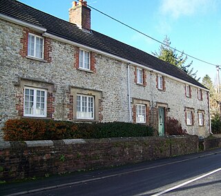
Berwick St Leonard is a small village and civil parish in Wiltshire, England, about 8 miles (13 km) southeast of Warminster and 14 miles (23 km) west of Salisbury.
Bishopstrow is a small village and civil parish in Wiltshire, England, on the southeastern edge of the town of Warminster. The village is about 1.5 miles (2.4 km) from the town centre, south of the old Warminster to Salisbury road, formerly the A36, now the B3414.

Boyton is a village and civil parish in Wiltshire, England. It lies in the Wylye Valley within Salisbury Plain, about 6 miles (10 km) south-east of Warminster and 13 miles (21 km) north-west of Salisbury. The parish includes the village of Corton.

The River Wylye, also known in its upper reaches as the River Deverill, is a chalk stream in Wiltshire, England, with clear water flowing over gravel. It is popular with fly fishermen. A half-mile stretch of the river and three lakes in Warminster are a local nature reserve.

Wylye is a village and civil parish on the River Wylye in Wiltshire, England. The village is about 9+1⁄2 miles (15 km) northwest of Salisbury and a similar distance southeast of Warminster.

Upton Lovell is a village and civil parish in Wiltshire, England. It lies on the A36, in the Wylye valley about 5 miles (8.0 km) southeast of Warminster. The parish is on the left (northeast) bank of the river, and stretches for over two miles northeast onto Salisbury Plain.

Norton Bavant is a small village and civil parish in Wiltshire, England, 2 miles (3.2 km) southeast of Warminster.

Stockton is a small village and civil parish in the Wylye Valley in Wiltshire, England, about 8 miles (13 km) southeast of Warminster. The parish includes the hamlet of Bapton.

Sutton Veny is a village and civil parish in the Wylye valley, to the southeast of the town of Warminster in Wiltshire, England; the village is about 3 miles (5 km) from Warminster town centre. 'Sutton' means 'south farmstead' in relation to Norton Bavant, one mile (1.6 km) to the north. 'Veny' may be a French family name or may describe the village's fenny situation.

Knook is a small village and civil parish in Wiltshire, England. The village lies to the north of the River Wylye at the edge of Salisbury Plain, about 4+1⁄2 miles (7 km) southeast of Warminster, close to the A36 road to Salisbury.

St Cosmas and St Damian Church is an Anglican church in the village of Keymer, in the Mid Sussex district of West Sussex, England. Rebuilt in 1866 in a style similar to the Saxon building it replaced, it is the parish church of Keymer and now lies within a combined parish serving three villages in Mid Sussex. The church bears a very rare dedication to the twin Saints Cosmas and Damian, Christian martyrs of the 4th century. It is a grade II listed building.

Great Wishford is a village and civil parish in the Wylye Valley in Wiltshire, England, about three miles (5 km) north of Wilton and five miles (8 km) northwest of Salisbury. The village lies west of a bend in the River Wylye and has a triangular street layout comprising South Street, West Street and Station Road.
Steeple Langford is a village and civil parish in the English county of Wiltshire, 6 miles (10 km) northwest of Wilton. It has also been called Great Langford or Langford Magna. The village lies on the north bank of the River Wylye, and is bypassed to the north by the A36 Warminster-Salisbury trunk road which follows the river valley.

South Newton is a village and civil parish about 4 miles (6.4 km) north-west of Salisbury in Wiltshire, England. Topologically it lies between chalk downs to the north-east, and downland with Grovely Wood to the south-west. The village straddles the A36 road and is on the left bank of the River Wylye, which defines much of the western boundary of the parish; the eastern boundary follows the A360 Salisbury-Devizes road.

Tytherington is a small village in Wiltshire, in the southwest of England. It lies on the south side of the Wylye valley, about 3+1⁄2 miles (6 km) southeast of the town of Warminster and 1 mile (1.6 km) southwest of the larger village of Heytesbury. Most of the village is now part of the civil parish of Heytesbury although a few houses in the west are within the parish of Sutton Veny.

St Denys' Church is the parish church of the town of Warminster, Wiltshire, England, and is the town's oldest church. Begun in the 11th century, rebuilt in the 14th and restored in the 19th, it is a Grade II* listed building.


