Related Research Articles

Mission San Gabriel Arcángel is a Californian mission and historic landmark in San Gabriel, California. It was founded by Spaniards of the Franciscan order on "The Feast of the Birth of Mary," September 8, 1771, as the fourth of what would become twenty-one Spanish missions in California. San Gabriel Arcángel was named after the Archangel Gabriel and often referred to as the "Godmother of the Pueblo of Los Angeles." The mission was built and run using what has been described as slave labor from nearby Tongva villages, such as Yaanga and was built on the site of the village of Toviscanga. When the nearby Pueblo de los Ángeles was built in 1781, the mission competed with the emerging pueblo for control of Indigenous labor.

The Tongva are an Indigenous people of California from the Los Angeles Basin and the Southern Channel Islands, an area covering approximately 4,000 square miles (10,000 km2). In the precolonial era, the people lived in as many as 100 villages and primarily identified by their village rather than by a pan-tribal name. During colonization, the Spanish referred to these people as Gabrieleño and Fernandeño, names derived from the Spanish missions built on their land: Mission San Gabriel Arcángel and Mission San Fernando Rey de España. Tongva is the most widely circulated endonym among the people, used by Narcisa Higuera in 1905 to refer to inhabitants in the vicinity of Mission San Gabriel. Some direct lineal descendants of the people advocate the use of their ancestral name Kizh as an endonym.

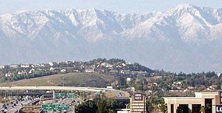
Claremont is a suburban city on the eastern edge of Los Angeles County, California, United States, 30 miles (48 km) east of downtown Los Angeles. It is in the Pomona Valley, at the foothills of the San Gabriel Mountains. As of the 2010 census it had a population of 34,926, and in 2019 the estimated population was 36,266.

Corona is a city in Riverside County, California, United States. At the 2020 census, the city had a population of 157,136, up from 152,374 at the 2010 census. The cities of Norco and Riverside lie to the north and northeast, Chino Hills and Yorba Linda to the northwest, Anaheim to the west, Cleveland National Forest and the Santa Ana Mountains to the southwest, and unincorporated Riverside County along the rest of the city's borders. Downtown Corona is approximately 48 miles southeast of Downtown Los Angeles and 95 miles (153 km) north-northwest of San Diego.

Puvunga is an ancient village and sacred site of the Tongva nation, the Indigenous people of the Los Angeles Basin, and the Acjachemen, the Indigenous people of Orange County now located at California State University, Long Beach and the surrounding area. The Tongva know Puvunga as the "place of emergence" and it is where they believed "their world and their lives began." The site remains an important ceremonial site and ending to an annual pilgrimage for the Tongva, Acjachemen, and Chumash.

The Tongva Sacred Springs are a group of springs located on the campus of University High School in Los Angeles, California.
Shevaanga or Sibagna is a former Tongva village located at the area of what would become San Gabriel, California. It was closely situated to the village of Toviscanga. It lay at an elevation of 430 feet. It was located near Mission San Gabriel Arcángel and the Whittier Narrows, in the San Gabriel Valley.

Hahamongna and Hahamog-na are historic Tongva villages located in the Verdugo Mountains of Southern California named after the local Tongva band's name Hahamog'na. The village sites are located in present-day Pasadena and Glendale in Los Angeles County, California. Hahamongna was one of the largest Tongva villages in the greater San Fernando Valley area, along with Cahuenga, Tujunga, and Siutcanga.
Kizh Kit’c are the Mission Indians of San Gabriel, according to Andrew Salas, Smithsonian Institution, Congress, the Catholic Church, the San Gabriel Mission, and other Indigenous communities. Most California tribes were known by their community and geographic names.

Puhú was a major residential village in the Santa Ana Mountains shared by the Tongva, Acjachemen, Payómkawichum, and Serrano near Santiago Peak. The village resided approximately 600m above sea level in the upper areas of the Black Star Canyon. The village was at its height from the years 1220-1770. The village retained its multi-seasonal occupancy and economic and political systems up until its destruction and a communal massacre in 1832.

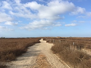
Genga, alternative spelling Gengaa and Kengaa, was a Tongva and Acjachemen village located on Newport Mesa overlooking the Santa Ana River in the Newport Beach and Costa Mesa, California area which included an open site now referred to as Banning Ranch. Archaeological evidence dates the village at over 9,000 years old. Villagers were recorded as Gebit in Spanish Mission records. The village may have been occupied as late as 1829 or 1830.

Moyongna, alternatively spelled Moyonga, was a coastal Tongva village or landmark site located near the entrance of Newport Bay in Newport Beach, California near Corona del Mar. As a coastal village, the usage of te'aats was likely important to the village's people. Nearby coastal villages included Genga, located on Newport Mesa, and Lupukngna, located near the mouth of the Santa Ana River.

Lupukngna was a coastal Tongva village that was at least 3,000 years old located on the bluffs along the Santa Ana River in Huntington Beach near the Newland House Museum. Other nearby coastal villages included Genga, located in West Newport Beach, and Moyongna, located down the coast near Corona del Mar. The village has also been referred to as Lukup and Lukupa. The village has been chronicled in the history of Costa Mesa, California.

Torojoatngna was a Tongva village located in what is now Claremont, California. The name of the village referred the place below Mount San Antonio as the place of snow. Archaeological investigations in the Claremont area have found evidence of village artifacts near the "Indian Hill" area of the city, located near the Rancho Santa Ana Botanic Gardens.
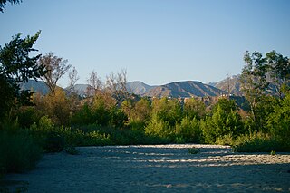
Wa'atsngna was a Tongva village located in the far eastern reaches of Tovaangar, or the Tongva world, in what is now the northwestern outskirts of the city of San Bernardino along Lytle Creek. The village was located close to Wa'aachnga, located in what is now Loma Linda, California.

Tovaangar refers to the Tongva world or homelands. It includes the greater area of the Los Angeles Basin, including the San Gabriel Valley, San Fernando Valley, northern Orange County, parts of San Bernardino County and Riverside County, and the southern Channel Islands, including San Nicholas, Santa Catalina, Santa Barbara, and San Clemente. The homelands of the Chumash are to the northwest, the Tataviam to the north, the Serrano and Cahuilla to the east, and the Acjachemen and Payómkawichum to the south.
The Tongva Taraxat Paxaavxa Conservancy is an Indigenous urban land trust that formed with the objective to return or rematriate land to the Tongva people in the greater Los Angeles County area. It was inspired by the work of the Sogorea Te’ Land Trust and has been associated with the Land Back movement. The conservancy is notable for its part in the return of Tongva land in Los Angeles County for the first time in nearly 200 years. The trust developed a kuuyam nahwá’a or "guest exchange" program for people who live and work in the tribe's traditional homelands to financially support the land trust's goals.

Geveronga was a Tongva village located at what is now Pico-Union, Los Angeles, California along the Los Angeles River. Part of the village area is also located on the campuses of the University of Southern California (USC) at its University Park Campus. The USC History Department provided a map of the general location of Geveronga in its land acknowledgement in 2021. People from the village were known as Geverovit.
Otsungna was a Tongva village located in what is now the El Sereno neighborhood of Los Angeles, California and California State University, Los Angeles. It was referenced as the "Otsungna Prehistoric Village Site" in the construction of State Route 710. The village has alternatively been referred to as Ochuunga, derived from the Tongva language word for "wild rose" and possibly translating to "Place of Roses."
References
- 1 2 Weinberger, Peter (2021-10-18). "OneDrumm brings Indigenous traditions to Claremont". The Claremont COURIER. Retrieved 2023-04-24.
- 1 2 "Man who died in custody honored at prayer vigil in Jurupa Valley". Press Enterprise. 2020-12-21. Retrieved 2023-04-24.
- ↑ Santa Ana River Main Stem and Santiago Creek: Environmental Impact Statement. 1978. p. 122.
- ↑ Loewe, Ronald (2016-09-15). Of Sacred Lands and Strip Malls: The Battle for Puvungna. Rowman & Littlefield. p. 27. ISBN 978-0-7591-2162-1.
- ↑ Uyeda, Ray Levy (2022-10-17). "Indigenous education in public schools remains inconsistent". Prism. Retrieved 2023-04-24.