Sini, Jharkhand

Last updated

Sini
Census Town
India Jharkhand location map.svg
Red pog.svg
Sini
Location in Jharkhand, India
India location map 3.png
Red pog.svg
Sini
Sini (India)
Coordinates: 22°48′08″N85°56′43″E / 22.8021°N 85.9453°E / 22.8021; 85.9453
CountryFlag of India.svg  India
State Jharkhand
District Seraikela Kharsawan
Government
  Type Federal democracy
Area
  Total2.02 km2 (0.78 sq mi)
Elevation
183 m (600 ft)
Population
 (2011)
  Total6,382
  Density3,200/km2 (8,200/sq mi)
Languages*
  Official Hindi, Urdu
Time zone UTC+5:30 (IST)
PIN
833219
Telephone code06597
Vehicle registration JH-22
Literacy84.52%
Lok Sabha constituency Singhbhum
Vidhan Sabha constituency Seraikella
Website seraikela.nic.in

Sini is a census town in the Seraikela CD block in the Seraikela Sadar subdivision of the Seraikella- Kharshwan district in the Indian state of Jharkhand.

Contents

Geography

Sini, Jharkhand
Cities, towns and locations in Seraikela Kharsawan district in Kolhan Division
M: municipality, R: rural/ urban centre, CT: census town, T: tourist centre
Owing to space constraints in the small map, the actual locations in a larger map may vary slightly

Location

Sini is located at 22°48′N85°58′E / 22.8°N 85.97°E / 22.8; 85.97 . [1] It has an average elevation of 183 metres (600 feet). The main source of livelihood for the common people is the Railway Workshop situated near the Sini Railway Station. There is also one Zonal Railway Training Institute (Z.R.T.I.) of Indian Railways situated at Sini. Sini is also blessed to have a very old cricket ground, popular as "Shershah Ground" (South Eastern Railway Sports Association or S.E.R.S.A.) where many inter division level competitions are held on a regular basis.

Area overview

The area shown in the map has been described as “part of the southern fringe of the Chotanagpur plateau and is a hilly upland tract”. 75.7% of the population lives in the rural areas and 24.3% lives in the urban areas. [2] [3]

Note: The map alongside presents some of the notable locations in the district. All places marked in the map are linked in the larger full screen map.

Demographics

According to the 2011 Census of India, Sini had a total population of 6,382, of which 3,340 (52%) were males and 3,042 (48%) were females. Population in the age range 0-6 years was 724. The total number of literate persons in Sini was 4,782 (84.52% of the population over 6 years). [4]

(*For language details see Seraikela block#Language and religion)

As of 2001 India census, [5] Sini had a population of 6,489. Males constitute 53% of the population and females 47%. Sini has an average literacy rate of 72%, higher than the national average of 59.5%: male literacy is 80%, and female literacy is 63%. In Sini, 12% of the population is under 6 years of age.

Infrastructure

According to the District Census Handbook 2011, Seraikela Kharsawan, Sini covered an area of 2.02 km2 (0.78 sq mi). It has an annual rainfall of 1,132.9 mm (44.60 in). Among the civic amenities, it had seven km (4.3 mi) of roads with both closed and open drains. The protected water supply involved tap water from treated sources, uncovered well, overhead tank. It had 1,292 domestic electric connections, 8 road lighting points. Among the medical facilities, it had 1 hospital, 2 dispensaries, 2 health centres, 1 family welfare centre, 5 maternity and child welfare centres, 6 maternity homes, 7 nursing homes, 10 veterinary hospitals, 2 medicine shops. Among the educational facilities it had 5 primary schools, 2 middle schools, 2 secondary schools, 1 senior secondary school, the nearest general degree college at Seraikela seven km (4.3 mi) away. Among social, cultural and recreational facilities, it had 1 auditorium/ community hall. An important commodity it produced was white stone. It had the branch offices of 1 nationalised bank, 1 co-operative banks. [6]

Transport

Sini is a station on the Tatanagar–Bilaspur section of Howrah-Nagpur-Mumbai line.

Education

Versini High School is a Hindi-medium coeducational institution established in 1958. It has facilities for teaching from class IX to class XII. The school has a playground and a library with 1,855 books. [7]

South Eastern Railway Inter College is a Hindi-medium coeducational institution. It has facilities for teaching in classes XI and XII. It has a playground, a library with 15,000 books, and has 5 computers for teaching and learning purposes. [8]

Culture

Noted filmmaker and writer Satyajit Ray has mentioned this place in his short story 'Ratan Babu ar Sei Lokta'.

Related Research Articles

Kharsawan garh is a town and a notified area in the Seraikela Sadar subdivision of the Seraikela Kharsawan district in the Indian state of Jharkhand.

Saraikela is the district headquarters and a nagar panchayat in the Seraikela Sadar subdivision of the Seraikela Kharsawan district in the Indian state of Jharkhand. It was formerly the capital of Saraikela State, a princely state. The town is a road junction, an agricultural trade centre and upcoming industrial centre. It is situated between Jamshedpur and Chaibasa.

Chandil is a census town in the Chandil CD block in the Chandil subdivision of Seraikela Kharsawan district in the state of Jharkhand, India.

Kandra is a census town in the Adityapur CD block in the Seraikela Sadar subdivision of the Saraikela Kharsawan district in the Indian state of Jharkhand.

<span class="mw-page-title-main">Ichagarh</span> Village in Jharkhand, India

Ichagarh is a village in the Ichagarh CD block in the Chandil subdivision of the Seraikela Kharsawan district in the Indian state of Jharkhand.

Kuchai block is a CD block that forms an administrative division in the Seraikela Sadar subdivision of Seraikela Kharsawan district, in the Indian state of Jharkhand.
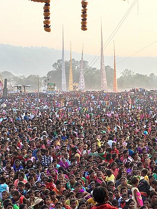
Kharsawan block is a CD block that forms an administrative division in the Seraikela Sadar subdivision of Seraikela Kharsawan district, in the Indian state of Jharkhand.

<span class="mw-page-title-main">Chandil block</span> Community development block in Jharkhand, India

Chandil block is a CD block that forms an administrative division in the Chandil subdivision of Seraikela Kharsawan district, in the Indian state of Jharkhand.

Ichagarh block is a CD block that forms an administrative division in the Chandil subdivision of Seraikela Kharsawan district, in the Indian state of Jharkhand.

Kukru block is a CD block that forms an administrative division in the Chandil subdivision of Seraikela Kharsawan district, in the Indian state of Jharkhand.

Nimdih block is a CD block that forms an administrative division in the Chandil subdivision of Seraikela Kharsawan district, in the Indian state of Jharkhand.

Adityapur block is a CD block that forms an administrative division in the Seraikela Sadar subdivision of Seraikela Kharsawan district, in the Indian state of Jharkhand.

<span class="mw-page-title-main">Seraikela block</span> Community development block in Jharkhand, India

Seraikela block is a CD block that forms an administrative division in the Seraikela Sadar subdivision of Seraikela Kharsawan district, in the Indian state of Jharkhand.

<span class="mw-page-title-main">Gobindpur block</span> Community development block in Jharkhand, India

Gobindpur block is a CD block that forms an administrative division in the Seraikela Sadar subdivision of Seraikela Kharsawan district, in the Indian state of Jharkhand.

Kuchai is a village in the Kuchai CD block in the Seraikela Sadar subdivision of the Seraikela Kharsawan district in the Indian state of Jharkhand.

Rajnagar is a village in the Gobindpur CD block in the Seraikela Sadar subdivision of the Seraikela Kharsawan district in the Indian state of Jharkhand.

Kukru is a village in the Kukru CD block in the Chandil subdivision of the Seraikela Kharsawan district in the Indian state of Jharkhand.

Nimdih is a village in the Nimdih CD block in the Chandil subdivision of the Seraikela Kharsawan district in the Indian state of Jharkhand.

Kopali is a census town in the Chandil CD block in the Chandil subdivision of the Seraikela Kharsawan district in the Indian state of Jharkhand.

Chandil subdivision is an administrative subdivision of the Seraikela Kharsawan district in the Kolhan division in the state of Jharkhand, India.

References

  1. Falling Rain Genomics, Inc - Sini
  2. "Bihar District Gazetteers - Singhbhum" (PDF). P.C. Roy Chaudhury. Secretariat Press, Bihar, Patna, 1958. Retrieved 2 December 2021.
  3. "District Census Handbook, Seraikella Kharsawan, Series 21, Part XII A" (PDF). Page 30: 2011 Census Findings–Population and its Distribution. Directorate of Census Operations Jharkhand. Retrieved 2 December 2021.
  4. "District Census Handbook, Seraikela Khasawan, Series 21, Part XII B" (PDF). Location Code: 379462, Pages 26-27: District primary census abstract, 2011 census. Directorate of Census Operations Jharkhand. Retrieved 2 December 2021.
  5. "Census of India 2001: Data from the 2001 Census, including cities, villages and towns (Provisional)". Census Commission of India. Archived from the original on 16 June 2004. Retrieved 1 November 2008.
  6. "District Census Handbook, Seraikella Kharsawan, Series 21, Part XII A" (PDF). Pages 632-637. Directorate of Census Operations Jharkhand. Retrieved 27 November 2021.
  7. "Versini +2 High School Sini". Schools.org. Retrieved 3 December 2021.
  8. "S.E. Rly. Inter College Sini". Schools.org. Retrieved 3 December 2021.