Small Ring, Brussels

Last updated
R20/N0

Brussels Small Ring

Length: 8 km
PetCeintureBruxelles.PNG
Intersections
AB-Vzw.svg (1)  Porte de Hal , Chaussée de Waterloo
Hallepoort , Waterloosesteenweg
AB-Vzw.svg (2)  Gare du Midi , Avenue Fonsny
Zuidstation , Fonsnylaan
AB-Vzw.svg (3)  Porte d'Anderlecht , Chaussée de Mons
Anderlechtsepoort , Bergensesteenweg
AB-Vzw.svg (4)  Porte de Ninove , Chaussée de Ninove
Ninoofsepoort , Ninoofsesteenweg
AB-Vzw.svg (5)  Porte de Flandre , Chaussée de Gand
Vlaanderenpoort , Gentsesteenweg
AB-Vzw.svg (6)  Place Sainctelette , Avenue du Port
Saincteletteplein , Havenlaan
AB-Vzw.svg (7)  Place de l'Yser , Quai de Willebroeck
IJzerplein , Willebroekkaai
AB-Vzw.svg (8)  Porte d'Anvers , Chaussée d'Anvers
Antwerpsepoort , Antwerpselaan
AB-Vzw.svg (9)  Place Rogier , Rue de Brabant
Rogierplein , Brabantstraat
AB-Vzw.svg (10)  Porte de Schaerbeek , Rue Royale
Schaarbeeksepoort , Koningsstraat
AB-Vzw.svg (11)  Place Madou , Chaussée de Louvain
Madouplein , Leuvensesteenweg
AB-Vzw.svg (12)  Rue de la Loi / Wetstraat
AB-Vzw.svg (13)  Rue Belliard / Belliardstraat
AB-Vzw.svg (14)  Place du Trône , Rue du Trône
Troonplein , Troonlaan
AB-Vzw.svg (15)  Porte de Namur , Chaussée de Wavre
Naamsepoort , Waversesteenweg
AB-Vzw.svg (16)  Place Louise , Avenue Louise
Louizaplein , Louizalaan
Signboard on the Small Ring. Senalizacion bilingue bruselas.jpg
Signboard on the Small Ring.
A map (in French) of the Pentagon and its neighbourhoods. Pentagone Bxl.01.jpg
A map (in French) of the Pentagon and its neighbourhoods.

The Small Ring (French : Petite Ceinture, Dutch : Kleine Ring) inner ring road, formally R20 and N0 is a series of roadways in central Brussels, Belgium, surrounding the historic city centre. The city centre is usually defined as the area within the Small Ring; this area is called the Pentagon due to its pentagonal shape. The pentagon forms the core of the City of Brussels municipality.

Contents

The road was built on the site of the 14th-century second walls of Brussels, after they had been torn down. During the second stage of the covering of the Senne in the 20th century, the river was diverted to underneath the western boulevards of the ring. This freed up the main tunnels that had contained the water to allow construction of the Brussels premetro with minimal disruption of the surface.

The Small Ring is about 8 km long. It is surrounded by the Greater Ring, which runs about 30 km and by the Ring (about 80 km). The road passes through tunnels allowing vehicles to avoid traffic lights that regulate the circulation at surface level. Thus, it is possible to travel from the Brussels-South railway station to the Place Sainctelette/Saincteletteplein (via Arts-Loi/Kunst-Wet), and even further to the Basilica, or the reverse route, through tunnels without having to stop at traffic lights. The section of the Small Ring between the Place Sainctelette and the south station via the Anderlecht gate is completely at surface-level and is subsequently slower to travel along.

History

In the 14th century, Brussels had a second set of defensive walls built to accommodate the expanding city. There were eight gates built along its length, many of which give their names to squares and intersections along the course of the road. The walls proved fairly useless in combat, not able to prevent either the French bombardment of Brussels in 1695, or French troops from seizing the city in 1746 as part of the War of the Austrian Succession. After the latter, the defensive works were in ruins. By that time, siege was no longer as important a part of warfare. Due to the growth of commerce and roads, it was found that the fortifications did little more than frustrate transit into and out of the city.

In 1782, Emperor Joseph II ordered the dismantling of most fortifications in the Low Countries, including those of Brussels. The dismantling work of the exterior defences began in the east of the city. In 1795, when Republican France invaded and annexed the Low Countries, the demolitions were stopped, not resuming until an order from Napoleon in 1804. Laeken Gate was destroyed in 1808. By an ordinance on May 19, 1810, the French Emperor ordered the second walls demolished and replaced by boulevards with a median in the centre. The fall of the First French Empire prevented the project's immediate execution.

With the return of stability, in 1818, authorities organized a contest for plans to demolish the ramparts and replace them with boulevards suited to the exigencies of contemporary life in the city. The proposal of Jean-Baptiste Vifquain was ultimately chosen. It involved construction of squares and boulevards, with spaces to walk and two to four rows of trees lining the route, a main road and parallel side roads. A barrier with a ditch running its length was still installed, however, and customs houses built at the entrances, to allow continued taxation of commercial goods entering the city. The work was to be financed by selling the land that was freed up, although this took over 20 years to do.

In the 1950s, with pressure from the automobile, new plans to improve traffic flow were implemented, partly due to the 1958 World's Fair. Later, tunnels were dug, and one of the main lines of the Brussels Metro now runs primarily underneath the Small Ring.

Road numbers

BE-N0.svg

The Small Ring has been a national road from the very beginning of road numbering in Belgium. As all radial highways connecting Brussels with the provincial capitals and the national borders received numbers running from 1 to 10 (later renumbered 1–9), it seemed logical to assign the number 0 to the Small Ring, especially since it forms the first and only complete connection between all these routes and, as a ring road, somewhat has the shape of a zero. The route N0 formally has its kilometer zero at the Porte de Hal/Hallepoort (in the middle of the tunnel) and then runs in a clockwise fashion back to where it began. The N0 follows the fastest option of the different roads available and therefore goes through the various tunnels, starting with the Rogier tunnel and ending with the Halle Gate tunnel.

Between the western exit of the Halle Gate tunnel and the Anderlecht Gate intersection the N0 designation follows Boulevard du Midi/Zuidlaan, while the counter-clockwise direction (following Boulevard Poincarélaan and Avenue de la Porte de Hal/Hallepoortlaan) has the designation N0a. While between Place de l'Yser/IJzerplein and the Antwerp Gate intersection the N0b designation exists for a short section of Boulevard d'Anvers/Antwerpselaan where the N0 has entered the Rogier tunnel. Finally, the designation N0c was given to a stretch of road connecting the Small Ring to Rue Belliardstraat at the Trône or Troon tunnel (counter-clockwise only). In a similar fashion the outer ring road, the motorway constructed between the 1950s and the late 1970s, received the road number R0 (ring zero).

During the 1980s a new numbering system for national roads was implemented. After the introduction of the R0 to R9 designation for motorway and expressway ring roads in the 1970s, the network of R-roads was expanded to include many Small Ring roads across the country, using the new provincially based numbering system. Within this system the numbers 20 to 29 were available for Brabant province. The Small Ring of Brussels then received a second road number, R20. This designation was originally conceived to include the surface-level sections of the ring where tunnels are available to carry through traffic, as well as the surface-level sections of the N23-West connecting at Sainctelette. R20a and R20b designations were subsequently introduced.

The intermediate ring road has the (partial) designation R21 and the second ring road is the R22, existing only between Verbrande Brug/Pont Brûlé industrial estate and La Cambre/Ter Kameren.

Roads that make up the Small Ring

The Small Ring is actually composed of a set of roads that form a pentagon, or ring.

Crossroads

The Small Ring also crosses a lot of main roads leading to other towns. Some of those crossroads are located next to former gates of the second walls of Brussels and are named after those gates, for instance Porte de Namur/Naamsepoort. On top of the 7 gates of the second walls, some of the gates were built later on to collect taxes at important crossroads, among which the Porte de Ninove/Ninoofsepoort and the Porte d'Anvers/Antwerpsepoort. The only gate to remain is the Porte de Hal/Hallepoort, while at Porte d'Anderlecht/Anderlechtsepoort and at Porte de Ninove/Ninoofsepoort some buildings from the former gate remain.

Starting from the north-east of the Small Ring, place Sainctelette, and going clockwise, the ring crosses successively:

Public transport

The Brussels metro's lines 2 and 6 run under or alongside the Small Ring from the South Station to Place Sainctelette via Arts-Loi/Kunst-Wet, while the section via the Anderlecht gate is serviced by tram routes 51 from Lemonnier to Petit Château/Kleinkasteel and 82 from Lemonnier to the Ninove gate. Bus 89 follows the Small Ring for one stop between the Ninove and Flanders gates. Between Rogier and Botanique/Kruidtuin, bus 61 also drives on the Small Ring, while buses 34, 64 and 80 drive between the Namur gate and Trône/Troon.

See also

50°51′25″N4°21′09″E / 50.85701°N 4.3525°E / 50.85701; 4.3525

Related Research Articles

<span class="mw-page-title-main">City of Brussels</span> Municipality of the Brussels-Capital Region and capital of Belgium

The City of Brussels is the largest municipality and historical centre of the Brussels-Capital Region, as well as the capital of the Flemish Region and Belgium. The City of Brussels is also the administrative centre of the European Union, as it hosts a number of principal EU institutions in its European Quarter.

<span class="mw-page-title-main">Hendrik Beyaert</span> Belgian architect

Hendrik Beyaert (Dutch) or Henri Beyaert (French) was a Belgian architect. He is considered one of the most important Belgian architects of the 19th century.

<span class="mw-page-title-main">Fortifications of Brussels</span> Former city walls in Brussels, Belgium

The Fortifications of Brussels refers to the medieval city walls that surrounded Brussels, Belgium, built primarily to defend the city but also for administrative reasons. There were two stages of fortifications of Brussels: the first walls, built in the early 13th century, and the second walls, built in the late 14th century and later upgraded. In the 19th century, the second walls were torn down and replaced with the Small Ring, a series of boulevards bounding the historical city centre. Nowadays, only a few sections of each walls remain, most notably the Halle Gate.

<span class="mw-page-title-main">Brussels-North railway station</span> Railway and premetro station in Brussels, Belgium

Brussels-North railway station is one of the three major railway stations in Brussels, Belgium; the other two are Brussels-Central and Brussels-South. Every regular domestic and international train passing there has a planned stop. The station has 200,000 passengers per week, mainly commuters, making it one of the busiest in Belgium.

<span class="mw-page-title-main">Halle Gate</span> Former city gate and current museum in Brussels, Belgium

The Halle Gate is a former medieval city gate and the last vestige of the second walls of Brussels, Belgium. Built between 1381 and 1383, it was heavily restored in the 19th century in its current neo-Gothic style by the architect Henri Beyaert. It is now a museum dedicated to the medieval City of Brussels, part of the Royal Museums of Art and History (RMAH).

<span class="mw-page-title-main">Porte de Hal metro station</span> Metro station in Brussels, Belgium

Porte de Hal or Hallepoort (Dutch) is a rapid transit station in Brussels, Belgium, consisting of both a metro station and a premetro station. The metro station opened on 2 October 1988 and the premetro station opened on 3 December 1993.

<span class="mw-page-title-main">Porte de Namur metro station</span> Metro station in Brussels, Belgium

Porte de Namur or Naamsepoort (Dutch) is a Brussels Metro station on the southern segment of lines 2 and 6. It is located under the Small Ring and next to the Chaussée d'Ixelles/Elsense Steenweg, in the municipality of Ixelles, south of the City of Brussels, Belgium.

<span class="mw-page-title-main">City gates of Paris</span>

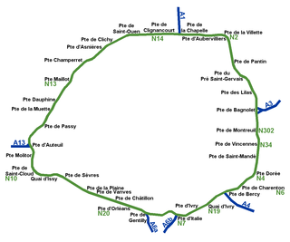
While Paris is encircled by the Boulevard Périphérique, the city gates of Paris are the access points to the city for pedestrians and other road users. As Paris has had successive ring roads through the centuries, city gates are found inside the modern-day Paris.

<span class="mw-page-title-main">Northern Quarter, Brussels</span> Central business district in Brussels, Belgium

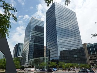
The Northern Quarter is the central business district of Brussels, Belgium. Like La Défense in Paris, the Docklands in London or the Zuidas in Amsterdam, the Northern Quarter consists of a concentrated collection of high-rise buildings where many Belgian and multinational companies have their headquarters.

The N1 is a national route that connects Brussels with Antwerp and the Dutch border near Wuustwezel.

The Greater Ring or Intermediate Ring in Brussels, Belgium is a set of roads in the shape of a ring, intermediate between the Small Ring and the main Brussels Ring motorway. The greater part of this set of roads is numbered R21 and is about 30 km long, compared to 8 km for the Small Ring and 80 km for the main Ring.

<span class="mw-page-title-main">Brussels tram route 51</span> Tram route in Brussels, Belgium

The tram route 51 in Brussels, Belgium, is a tram route operated by STIB/MIVB, which connects Heysel/Heizel metro station in the City of Brussels to the Van Haelen stop in the municipality of Uccle. The route runs north–south, crossing the City of Brussels, Jette, Molenbeek-Saint-Jean, the City of Brussels again, Saint-Gilles, Forest and Uccle. Currently, service is interrupted between Brussels-South railway station and Altitude Cent/Hoogte Honderd due to construction work at Albert premetro station.

<span class="mw-page-title-main">Brussels tram route 82</span> Tram route in Brussels, Belgium

The tram route 82 in Brussels, Belgium, is a tram route operated by STIB/MIVB, which connects Berchem-Sainte-Agathe railway station in Berchem-Sainte-Agathe to Drogenbos Castle in the Flemish municipality of Drogenbos. After 8 p.m., the route terminates at Brussels-South railway station, with connections to Drogenbos provided by tram route 32.

<span class="mw-page-title-main">Brussels Metro line 2</span> Metro line in Brussels, Belgium

Line 2 on the Brussels Metro is a rapid transit line in Brussels, Belgium operated by STIB/MIVB. It exists in its current form since April 4, 2009, when the section between Delacroix metro station and Gare de l'Ouest/Weststation was opened, which allowed to close the loop from and to Simonis/Elisabeth. The configuration of the Simonis/Elisabeth metro station though does not allow trains on the line 2 to be able to perform the loop several consecutive times in the same direction, i.e. a train running clockwise from Elisabeth will have to run counterclockwise from Simonis. The two termini of line 2 have thus received different names: originally Simonis (Elisabeth) and Simonis , changed in November 2013 to Elisabeth and Simonis. Between the Yser/IJzer metro station and the Porte de Hal/Hallepoort station, the line runs under the small ring road of Brussels, which is itself built on the former Second walls of Brussels.

The North–South Axis is a tram tunnel in Brussels, Belgium, which crosses the city centre from North to South between Brussels-North railway station and Albert premetro station.

<span class="mw-page-title-main">Chaussée de Wavre</span> Thoroughfare in Brussels, Belgium

The Chaussée de Wavre or Waversesteenweg (Dutch) is a major street in Brussels, Belgium, running through the municipalities of Ixelles, Etterbeek and Auderghem. It starts at a crossroad with the Chaussée d'Ixelles/Elsensesteenweg near the Namur Gate in Ixelles, goes down to the Place Jourdan/Jourdanplein in Etterbeek, then goes up to the La Chasse crossroad, continues to the Arsenal crossroad with the Greater Ring. After this crossroad, the street enters Auderghem, crosses the Boulevard du Souverain/Vorstlaan, then merges with the European route E411 where it runs along the Red Cloister and then the Sonian Forest. At its end, the road crosses the Brussels Ring. This street is part of the N4 road, which connects Brussels to Arlon. It is named after the city of Wavre (Wallonia).

<span class="mw-page-title-main">Namur Gate</span> Former city gate and current neighbourdhood in Brussels, Belgium

The Namur Gate was one of the medieval city gates of the second walls of Brussels, Belgium. Built in the 14th century, it was demolished in 1784 during the construction of the Small Ring.

The N23 is a short national highway in the Brussels Capital Region, Belgium. It is one of the busiest roads within the capital with daily gridlock during the rush hours.