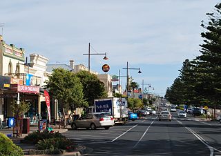
Portland is a city in Victoria, Australia, and is the oldest European settlement in the state. It is also the main urban centre in the Shire of Glenelg and is located on Portland Bay. As of the 2021 census the population was 10,016, increasing from a population of 9,712 taken at the 2016 census.

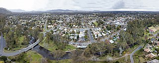
Stawell, is an Australian town in the Wimmera region of Victoria 237 kilometres (147 mi) west-north-west of the state capital, Melbourne. Located within the Shire of Northern Grampians local government area, it is a seat of local government for the shire and its main administrative centre. At the 2021 census, Stawell had a population of 6,220.
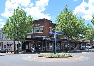
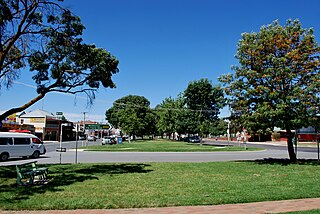
Euroa is a town in the Shire of Strathbogie in the north-east of Victoria, Australia. At the 2021 census, Euroa's population was 3,116.
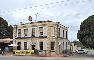
Hamilton is a large town in south-western Victoria, Australia, at the intersection of the Glenelg Highway and the Henty Highway. The Hamilton Highway connects it to Geelong.

Kyneton is a town in the Macedon Ranges region of West Central Victoria, Australia. The Calder Freeway bypasses Kyneton to the north and east. Kyneton is on Dja Dja Wurrung, Taungurung and Wurundjeri Woi Wurrung country.
Fyansford is a township on the western edge of Geelong, Victoria, Australia, named after Captain Foster Fyans who came to Geelong as a Police magistrate in October, 1837. It is located at the junction of the Barwon and Moorabool rivers. At the 2016 census, Fyansford had a population of 196.

Winchelsea is a town in Victoria, Australia. The town is located in the Surf Coast Shire local government area, the suburb or locality of Winchelsea is predominantly within Surf Coast Shire with a small section within the Colac Otway Shire. Winchelsea is located on the Barwon River 115 km south-west of Melbourne and close to Geelong.
Yea is a town in Victoria, Australia 112 kilometres (70 mi) north-east of the state capital Melbourne at the junction of the Goulburn Valley Highway and the Melba Highway, in the Shire of Murrindindi local government area. In an area originally inhabited by the Taungurung people, it was first visited by Europeans of the Hume and Hovell expedition in 1824, and within 15 years most of the land in the area had been taken up by graziers. Surveyed in 1855, the township grew as a service centre for grazing, gold-mining and timber-getting in the area.

Maldon is a town in Victoria, Australia, in the Shire of Mount Alexander local government area. It has been designated "Australia's first notable town" and is notable for its 19th-century appearance, maintained since gold-rush days. At the 2016 census, Maldon had a population of 1,513.
Bacchus Marsh is an urban centre and suburban locality in Victoria, Australia located approximately 50 kilometres (30 mi) north west of the state capital Melbourne and 14 kilometres (9 mi) west of Melton at a near equidistance to the major cities of Melbourne, Ballarat and Geelong. The population of the Bacchus Marsh urban area was 22,223 at June 2018. Bacchus Marsh is the largest urban area in the local government area of Shire of Moorabool.

Meredith is a town in Victoria, Australia, located on the Midland Highway between Ballarat and Geelong, in the local government area of the City of Greater Geelong. At the 2016 census, Meredith had a population of 788.

Omeo is a town in Victoria, Australia on the Great Alpine Road, east of Mount Hotham, in the Shire of East Gippsland. At the 2016 census, Omeo had a population of 406. The name is derived from an Aboriginal word for 'mountains' or 'hills'. Omeo is affectionately known as the City of the Alps with many historic buildings remaining in the town. The town is still the commercial hub for the Omeo Region and is a service centre for outlying communities such as Benambra, Cobungra, Cassilis, Swifts Creek, and Ensay.
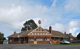
Cape Clear is a small town located in Victoria, Australia. Cape Clear has a hotel and a general store. The town is close to the Woady Yaloak River. The area was once vibrant during the gold rush in the 19th century with the area swamping to 25,000 people during the height of the gold rush with the local population being lower than 1,000. Cape Clear Post Office opened on 17 April 1865. and still ran and owned by the same family. It is now largely dependent on farming.
Lillias Margaret Skene, was an Australian women's rights activist.

Blackwood is a rural village in Victoria, Australia. The township is located on the Lerderderg River, 89 kilometres north-west of the state capital, Melbourne, within the Wombat State Forest. Blackwood is in the Shire of Moorabool local government area and had a population of 387 at the 2021 census.

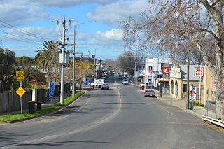
Harrow is a town in the Wimmera region of western Victoria, Australia. The town is located in the Shire of West Wimmera local government area, 391 kilometres north west of the state capital Melbourne, overlooking the Glenelg River valley. At the 2016 census, Harrow and the surrounding area had a population of 200.
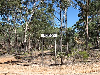
Irishtown is a locality near Castlemaine, Victoria, Australia. It is noted for heritage sites associated with the Victorian Gold Rush, near or within the Castlemaine Diggings National Heritage Park. These include the Red Hill hydraulic gold sluicing site and the Burying Flat Cemetery, also known as Deadmans Gully Burial Ground.

The Shire of Grenville was a local government area southwest of the regional city of Ballarat, Victoria, Australia. The shire covered an area of 845 square kilometres (326.3 sq mi), and existed from 1861 until 1994.
The Convincing Ground Massacre was a massacre of the Indigenous Gunditjmara people Kilcarer gundidj clan by British settler whalers based at Portland Bay in South-Eastern Australia. It was part of the wider Eumeralla Wars between the British colonisers and Gunditjmara. Tensions between the two groups had been building since the establishment of the town as a whaling station some five years previously, however, around 1833 or 1834, a dispute over a beached whale caused events to escalate.

Shelford is a rural locality in Victoria, Australia. The locality is in the Golden Plains Shire near the regional city of Geelong and 106 kilometres (66 mi) west of the state capital, Melbourne.


