The City of Ballarat is a local government area in the west of the state of Victoria, Australia. It covers an area of 739 square kilometres (285 sq mi) and, in June 2018, had a population of 107,325. It is primarily urban with the vast majority of its population living in the Greater Ballarat urban area, while other significant settlements within the LGA include Buninyong, Waubra, Learmonth and Addington. It was formed in 1994 from the amalgamation of the City of Ballarat, Shire of Ballarat, Borough of Sebastopol and parts of the Shire of Bungaree, Shire of Buninyong, Shire of Grenville and Shire of Ripon.
Viewbank is a suburb of Melbourne, Victoria, Australia, 14 km north-east of Melbourne's Central Business District. The area now known as Viewbank is on the traditional lands of the Wurundjeri people. Its local government area is the City of Banyule. At the 2016 census, Viewbank had a population of 6,923.

Terang is a town in the Western District of Victoria, Australia. The town is in the Shire of Corangamite and on the Princes Highway 212 kilometres (132 mi) south west of the state's capital, Melbourne. At the 2006 census, Terang had a population of 1,824. At the 2001 census, Terang had a population of 1,859. The population of Terang has since risen according to the 2011 Census; the population is now 2,348, of which 1,155 are male and 1,193 are female, with the median age being 44.
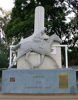
Goondiwindi is a rural town and locality in the Goondiwindi Region, Queensland, Australia. It is on the border of Queensland and New South Wales. In the 2016 census, Goondiwindi had a population of 6,355 people.

Normanton is an outback town and coastal locality in the Shire of Carpentaria, Queensland, Australia. In the 2016 census the locality of Normanton had a population of 1,257 people, of whom 750 (60%) identified as Aboriginal and/or Torres Strait Islander people, while the town of Normanton had a population of 1,210 people, of whom 743 (62%) identified as Aboriginal and/or Torres Strait Islander people.

Robe is a town and fishing port located in the Limestone Coast of South Australia. The town's distinctive combination of historical buildings, ocean, fishing fleets, lakes and dense bush is widely appreciated. Robe lies on the southern shore of Guichen Bay, just off the Princes Highway. At the 2016 census, Robe had a population of 998. Robe is the main town in the District Council of Robe local government area. It is in the state electorate of MacKillop and the federal Division of Barker.

Cattai is an historic suburb of Sydney, in the state of New South Wales, Australia. It is located 44 kilometres north-west of the Sydney central business district and 30 kilometres north-west of Parramatta. It is in the local government areas of The Hills Shire and City of Hawkesbury. Cattai's state electoral district is Hawkesbury, and its federal electoral divisions are Berowra and Macquarie.

Bothwell, Tasmania is a small town with a population at the 2016 census of 485. Situated in central Tasmania on the River Clyde in a broad valley, it is notable for hunting and being a lake district. It is part of the municipality of Central Highlands Council and will celebrate the bicentenary of its founding in 2022. Nearby locations include Hollow Tree, Hamilton, Ouse and Kempton.

Barham is a town in the western Riverina district of New South Wales, Australia. The town is located 823 kilometres south west of the state capital, Sydney and 303 kilometres north west of Melbourne. Situated on the banks of the Murray River across from Koondrook in the neighbouring state of Victoria, Barham had a population of 1,159 at the 2016 census. The town is in the Murray River Council local government area.

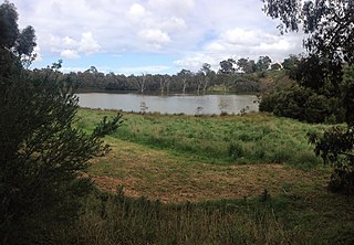
Learmonth is a picturesque township, located in Central Victoria, Australia, 136 kilometres (85 mi) west of the state capital Melbourne, and 23 kilometres north west of the regional city centre of Ballarat. Learmonth is located on the Sunraysia Highway, on the road to Avoca, St Arnaud and the Pyrenees wine region, and is surrounded by an agricultural, pastoral and dairy region. At the 2016 census, Learmonth had a population of 438.

Eynesbury is a locality of Victoria, Australia, 44 km west of Melbourne's Central Business District, located within the Cities of Melton and Wyndham local government areas. Eynesbury recorded a population of 2,577 at the 2016 census.
Booborowie is a locality in South Australia. It is located 200 km (124 mi) north of Adelaide. At the 2016 census, the Booborowie district had a population of 218.

Thomas Livingstone Learmonth of Parkhill was an early settler of Australia, of Scots descent, who established himself as a squatter on land around Ballarat, Victoria, in the 1830s.

Buderim is the central suburb of the town of Buderim in the Sunshine Coast Region, Queensland, Australia. In the 2016 census, the suburb of Buderim had a population of 29,355 people.
Rowsley is a rural locality in Victoria, Australia. The locality is approximately 50 kilometres (31 mi) west of Melbourne in the Shire of Moorabool local government area.
Ombersley is a rural locality in Victoria, Australia. Most of the locality is in Colac Otway Shire, with a portion being in adjacent Surf Coast Shire. In the 2016 census, Ombersley had a population of 97.
Hesse is a rural locality in the Golden Plains Shire, Victoria, Australia. In the 2016 census, Hesse had a population of 19 people.
Wonna is a rural locality in the Mid North region of South Australia, situated in the Regional Council of Goyder. The modern locality was established in August 2000 when boundaries were formalised for the long established local name.
Oakden, Addison and Kemp was an Australian architectural firm in Melbourne, Victoria. While it was short lived, existing from only 1887 to 1892, they designed a number of outstanding projects, and all three members designed many more notable projects in earlier and later partnerships.
