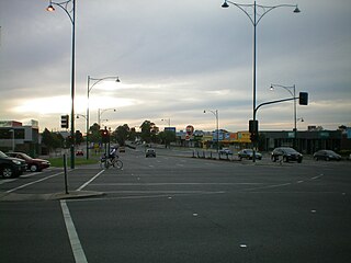
Nunawading is a suburb of Melbourne, Victoria, Australia, 18 km east of Melbourne's Central Business District, located within the City of Whitehorse and City of Manningham local government areas. Nunawading recorded a population of 12,413 at the 2021 census.

Ryde is a suburb of Sydney, New South Wales, Australia. Ryde is located 13 km north-west of the Sydney central business district and 8 km east of Parramatta. Ryde is the administrative centre of the local government area of the City of Ryde and part of the Northern Sydney region. It lies on the north bank of the Parramatta River. People from Ryde are colloquially known as Ryders, Rydiens or Rydemen.

Balnarring is a town in the south-eastern extremity of the Mornington Peninsula in Melbourne, Victoria, Australia, approximately 63 km (39 mi) south-east of Melbourne's Central Business District, located within the Shire of Mornington Peninsula local government area. Balnarring recorded a population of 2,371 at the 2021 census.

Mickleham is a suburb of Melbourne, Victoria, Australia, 29 km (18 mi) north of Melbourne's central business district, located within the City of Hume local government area and beyond the Urban Growth Boundary. Mickleham recorded a population of 17,452 at the 2021 census, compared to 3,142 at the 2016 census. In 2018, it was covered by the Australian Broadcasting Corporation as Australia's fastest-growing suburb.

Essendon is an Inner suburb in Melbourne, Victoria, Australia, 8 km (5.0 mi) north-west of Melbourne's central business district, located within the City of Moonee Valley local government area. Essendon recorded a population of 21,240 at the 2021 census.

Mount Gambier is the second most populated city in South Australia, with an estimated urban population of 26,878 as of 2021. The city is located on the slopes of Mount Gambier, a volcano in the south east of the state, about 450 kilometres (280 mi) south-east of the capital Adelaide and just 17 kilometres (11 mi) from the Victorian border. The traditional owners of the area are the Bungandidj people. Mount Gambier is the most important settlement in the Limestone Coast region and the seat of government for both the City of Mount Gambier and the District Council of Grant.

Riddells Creek is a town in Victoria, Australia, located in Wurundjeri Country and the Shire of Macedon Ranges. It is located in between the cities of Bendigo and Melbourne. Riddells Creek is also the name of the main watercourse which flows through the township, and which is a tributary of Jacksons Creek to the south. The town is served by Riddells Creek railway station on the Bendigo line. At the 2021 census, Riddells Creek had a population of 3574.
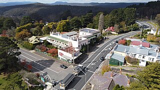
Mount Victoria is a village in the Blue Mountains of New South Wales, Australia. Geographically, Mount Victoria is the westernmost village and suburb of Greater Sydney on the Great Western Highway in the City of Blue Mountains, located about 120 kilometres (75 mi) west-northwest by road from the Sydney central business district and at an altitude of about 1,052 metres (3,451 ft) AHD. At the 2021 Census, the settlement had a population of 945.

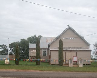
Erica is a town in Victoria, Australia, on Rawson Road, in the Shire of Baw Baw.

Manangatang is a town in north-western Victoria, Australia. At the 2021 census, Manangatang had a population of 274. It is sometimes noted for its unusual name, from an Aboriginal term "manang" meaning land and "kaaiti" meaning water.
Buckrabanyule is a locality in the north-central area of the state of Victoria in Australia. It is 237 kilometres (147 mi) from Melbourne, Victoria's capital city.

Mount Perry is a rural town and locality in the North Burnett Region, Queensland, Australia. In the 2021 census, the locality of Mount Perry had a population of 487 people.

Mount Molloy is a rural town and locality in the Shire of Mareeba, Queensland, Australia. It is a historic mining and timber town, 55 kilometres (34 mi) north of Cairns. The dominant industry in the area is cattle grazing; the town itself consists of a few shops and an old hotel. In the 2021 census, the locality of Mount Molloy had a population of 266 people.

Gordon is a town in Victoria, Australia, named after settler George Gordon. The town is located on the Old Melbourne Road in the Shire of Moorabool local government area, 95 kilometres (59 mi) west of the state capital, Melbourne. At the 2021 census, Gordon had a population of 1,393.

Trawalla is a town in central Western Victoria, Australia, located on the Western Highway, 41 kilometres (25 mi) west of Ballarat and 154 kilometres (96 mi) west of Melbourne, in the Shire of Pyrenees. At the 2006 census, Trawalla and the surrounding agricultural area had a population of 224.
Irvinebank is a rural town and locality in the Shire of Mareeba, Queensland, Australia. In the 2021 census, the locality of Irvinebank had a population of 113 people.
Buckley is a rural locality in the Surf Coast Shire, Victoria, Australia. It was formerly known as Laketown. In the 2021 census, Buckley had a population of 227.
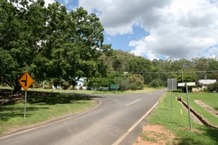
Mount Moriac is a rural locality in the Surf Coast Shire, Victoria, Australia. In the 2016 census, Mount Moriac had a population of 240 people.
Rossbridge is a town in the north west region of Victoria, Australia. It is approximately 229 kilometres (142 mi) west of the state's capital, Melbourne. Rossbridge has a population of 27, as of the 2021 Census.

Eungella is a rural town and locality in the Mackay Region, Queensland, Australia. In the 2021 census, the locality of Eungella had a population of 190 people.


