Black Hill, Victoria

Last updated

Black Hill
Ballarat,  Victoria
Cnr napier nicholson street black hill victoria.jpg
Corner of Napier and Peel Street. The Post Office is on the left and the Black Hill Hotel on the right.
Australia Victoria Ballarat City location map.svg
Red pog.svg
Black Hill
Coordinates 37°33′36″S143°52′21″E / 37.5600°S 143.8726°E / -37.5600; 143.8726 Coordinates: 37°33′36″S143°52′21″E / 37.5600°S 143.8726°E / -37.5600; 143.8726
Population2,124 (2021 census) [1]
 • Density1,221/km2 (3,162/sq mi)
Postcode(s) 3350
Area1.74 km2 (0.7 sq mi)
Location2 km (1 mi) from Ballarat Central
LGA(s) City of Ballarat
State electorate(s) Wendouree
Federal division(s) Ballarat
Suburbs around Black Hill:
Ballarat North Ballarat North Nerrina
Ballarat North Black Hill Nerrina
Soldiers Hill Ballarat East Ballarat East

Black Hill is a suburb of Ballarat, Victoria, Australia in the northeast of the city. It is named after the major landmark, Black Hill, on which there was extensive and highly profitable open-cut gold mining from the early 1850s during the Victoria gold rush. The hill was originally given its indigenous name, Bowdun, by surveyor William Urquhart. [2]

Contents

This is a suburb that many locals claim to be the ‘Fitzroy of Ballarat’, due to its high house price, large blocks of land and distance to the CBD.

The population at the 2021 census was 2,124. [1]

Topography

The suburb, at is highest, is some 520m above sea level. The suburb is bordered to the south and east by the Yarrowee River and to the north by Howitt Street, Walker Street and Boronia/Haimes Road and Reid Street to the west by Havelock and Rowe Streets. The Yarrowee River, Ballarat's major linear corridor, adjoins the reserve to the south. Urban areas of residential development adjoin the Reserve to the north, east and west.

History

Looking toward Black Hill from Ballarat in 1862 Black hill ballarat 1862.jpg
Looking toward Black Hill from Ballarat in 1862

According to Federation University's Ballarat and District Industrial Heritage Project, Black Hill was known by the local Watha Warrung as 'Bowdun', which was the original name given by the surveyor William Urquart in 1851. [3] The subtitle 'Black Hill' was given by Urquart in reference to the dense canopy of trees. [4] [5] [6] However, extensive mining over the 1850s saw the hill stripped of trees and significantly reduced in height, as well as the creation of a valley. [7] It became a focal point for quartz causing operations at this time, with the erection of a crushing battery at the base of the hill, probably the first in Australia. [3] As late as 1856 this is evidence that Indigenous peoples lived amongst miners at Black Hill, with some oral history accounts of child minding during the Eureka Rebellion. [8]

By the mid-1860s the hill became known as the "White Cliffs of Ballarat" due to the open cut mining operations which exposed cliffs of sandstone. [5] The various buildings associated with the mine would have been located at the base of the hill across from the Newman Street footbridge that exists today. [3] On the southern side of the Yarrowee River were the Black Hill Flats, which were mined extensively for gold which was located at the surface and in deep leads far below. [9] The flats are now located in the suburb of Ballarat East. By 1907 mining operations had almost ended and the hill was turned into a reserve. Local community groups, including the girl guides, planted Montarey pine ( pinus radiata ), many of which still exist today. [3]

Black Hill Post Office opened on 7 June 1864. [10]

Education

The local primary school is Black Hill Primary School, located on Chisholm Street, which was started in 1878, although the initial request to government was made earlier in 1862. It is government owned and has a kindergarten. The school has students from prep to year 6. It has 526 students enrolled as of 2019. [11]

Parks and reserves

One reserve in the area is the Black Hill Reserve and is approximately 21 hectares and is located about 1.7 km northeast of the Ballarat CBD. The hill is a dominant landmark within the urban landscape of Ballarat and the lookout area at the top of the hill provides a carpark lookout over Ballarat, encompassing the East around to the airport. The reserve's terrain is steep and undulating with significant areas of exposed soils. The landscape has since been heavily forested with mature pine trees in plantations and more recent plantings of native trees. There is extensive observable evidence of its mining history, including only tunnels. [8] The hill has many downhill mountain bike riding trails, varying in difficulty.

Black Hill also has a public swimming pool, with a solar heated 25m outdoor pool, toddlers pool, BBQ and picnic facilities, which is open from November to the end of March. Although it is generally closed if the temperature is below 23 degrees.

There is another reserve, Chisholm Street Reserve, which is a large grassland. Both of these reserves are leash free areas, meaning that you take your dog off the lead.

Ballarat CBD panorama from Black Hill lookout Ballarat panorama from black hill.jpg
Ballarat CBD panorama from Black Hill lookout

Transport

Black Hill has 2 bus routes, operated by CDC Ballarat. Route 13 goes from the Ballarat CBD to Invermay Park via Peel Street, Macarthur St and Lydiard St. Route 14 goes from the Ballarat CBD to part of Brown Hill and Chisholm Street, up Peel St and Havelock St and loops around Walker and Norman Sts. Black Hill's main north–south road is Peel Street. The east–west main road is Chisholm Street.

Related Research Articles

<span class="mw-page-title-main">Ballarat</span> Town in Victoria, Australia

Ballarat is a city in the Central Highlands of Victoria, Australia. At the 2021 Census, Ballarat had a population of 116,201, making it the third largest city in Victoria.

<span class="mw-page-title-main">Eureka Rebellion</span> 1854 miners revolt in Victoria, Australia

The Eureka Rebellion was a series of events involving gold miners who revolted against the British administration of the colony of Victoria, Australia during the Victorian gold rush. It culminated in the Battle of the Eureka Stockade, which took place on 3 December 1854 at Ballarat between the rebels and the colonial forces of Australia. The fighting resulted in an official total of 27 deaths and many injuries, the majority of casualties being rebels. There was a preceding period beginning in 1851 of peaceful demonstrations and civil disobedience on the Victorian goldfields. The miners had various grievances, chiefly the cost of mining permits and the officious way the system was enforced.

<span class="mw-page-title-main">Warrandyte, Victoria</span> Suburb of Melbourne, Victoria, Australia

Warrandyte is a suburb of Melbourne, Victoria, Australia, 24 km north-east of Melbourne's Central Business District, located within the City of Manningham local government area. Warrandyte recorded a population of 5,541 at the 2021 census.

<span class="mw-page-title-main">Braybrook, Victoria</span> Suburb of Melbourne, Victoria, Australia

Braybrook is a suburb in Melbourne, Victoria, Australia, 10 km (6.2 mi) west of Melbourne's Central Business District, located within the City of Maribyrnong local government area. Braybrook recorded a population of 9,682 at the 2021 census.

<span class="mw-page-title-main">Mount Keira</span> Suburb of Wollongong, New South Wales, Australia

Mount Keira is a suburb and mountain in the Illawarra region of New South Wales, Australia.

John Basson Humffray was a leading advocate in the movement of miner reform process in the British colony of Victoria, and later a member of parliament.

<span class="mw-page-title-main">Ballarat East, Victoria</span> Suburb of Ballarat, Victoria, Australia

Ballarat East is a suburb of Ballarat in Victoria, Australia. From 1857 until 1921 the suburb had its own council. The suburb covers a large area east of the city centre. It is the oldest urban area in Ballarat and was the site of many goldmines, as well as of the Eureka Rebellion.

<span class="mw-page-title-main">Lake Gardens, Victoria</span> Suburb of Ballarat, Victoria, Australia

Lake Gardens is a relatively new suburb on the western rural-urban fringe of Ballarat, Victoria Australia located near Lake Wendouree and directly behind the Ballarat Botanical Gardens from which the suburb draws its name. The suburb is bounded by Gillies Street to the east, O'Donnell's Road to the west and Gregory Street West to the north. The population at the 2021 census was 1,801.

<span class="mw-page-title-main">Redan, Victoria</span> Suburb of Ballarat, Victoria, Australia

Redan is an inner suburb of Ballarat, Victoria, Australia immediately south of Ballarat Central. The population at the 2021 census was 3,000.

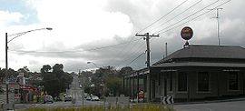
Wendouree is a large suburb on the north western rural-urban fringe of the city of Ballarat, in Victoria, Australia. It is the second most populated suburb in the City of Ballarat with a total of 10,376 inhabitants at the 2021 census.

<span class="mw-page-title-main">Gordon, Victoria</span> Town in Victoria, Australia

Gordon is a small town in Victoria, Australia, named after settler George Gordon. The town is located on the Old Melbourne Road in the Shire of Moorabool local government area, 95 kilometres (59 mi) west of the state capital, Melbourne. At the 2021 census, Gordon had a population of 1,393.

<span class="mw-page-title-main">Soldiers Hill, Victoria</span> Suburb of Ballarat, Victoria, Australia

Soldiers Hill is a suburb of Ballarat, Victoria, Australia located directly north of the Central Business District. At the 2021 census, Soldiers Hill had a population of 2,813.

<span class="mw-page-title-main">Ballarat Central</span> Suburb of Ballarat, Victoria, Australia

Ballarat Central is the central locality of Greater Ballarat in Victoria, Australia. The population of Ballarat Central at the 2021 census was 5,378, making it the sixth most populous in the urban area. It is the administrative headquarters for the City of Ballarat as well as the Ballarat Base Hospital and health services and home to the city's major religious institutions and a major retail, commercial and inner city residential area.

<span class="mw-page-title-main">Bakery Hill, Victoria</span> Suburb of Ballarat, Victoria, Australia

Bakery Hill is an inner city suburb of Ballarat in Victoria, Australia. It is the smallest suburb in the city of Ballarat in terms of both area and population, which at the 2021 census was just 180 people. The area is a mix of residential and commercial, as it has been since it came into existence at the beginning of the gold rush. In the present time it is mainly known for its restaurants and pubs, as well as fast food. The suburb boundaries are that of Mair, East, Barkly, Steinfield and Peel Streets.

<span class="mw-page-title-main">Golden Point, Victoria</span> Suburb of Ballarat, Victoria, Australia

Golden Point is a suburb of Ballarat, Victoria, Australia located south-east of the CBD. It is the oldest settlement in Greater Ballarat. Gold was discovered at Poverty Point on 21 August 1851 by John Dunlop and James Regan, sparking the Ballarat gold rush. Golden Point was the site of what was known as the Ballarat diggings, and for at least a decade the focal point of the original Ballarat township was Main Street. At the 2021 census, Golden Point had a population of 2,217.

<span class="mw-page-title-main">Mount Pleasant, Victoria</span> Suburb of Ballarat, Victoria, Australia

Mount Pleasant is the oldest residential suburb of Ballarat, Victoria, Australia. It is located on the southern extremity of the city between the Yarrowee Creek and the White Horse Range. Physically it is largely cut off from the rest of Ballarat which contributes to a sense of a suburb apart. The traditional Wathaurung country was first settled in 1836 when the Yuille brothers established a sheep run that included the sheltered corner under the escarpment later named Mount Pleasant. In those days, before there was a town at Ballarat, Buninyong was the nearest township. When the gold rush of 1851 brought thousands of diggers to nearby Golden Point, Mount Pleasant was left alone as no gold was initially found there. Its peacefulness made it attractive to a number of Cornish miners and their families who had come to Australia to settle permanently. These Wesleyans were the founders of the community. As devout and sober church people they sought a place to live away from the drunken mayhem of the diggings around Main Road.

<span class="mw-page-title-main">Eureka, Victoria</span> Suburb of Ballarat, Victoria, Australia

Eureka is a small eastern suburb of Ballarat, Victoria, Australia – (AU). It was originally part of Ballarat East but became its own suburb in 1946 in recognition of the area's significance to Australian history. Eureka is bordered by Specimen Creek to the north, Canadian Creek to the south, Queen and Joseph streets to the west and Kline and Stawell Street to the east. The suburb takes its name from the Eureka Lead – a lead is an ancient river bed that contains gold – of the Eureka Mining Company and is most notable as the site of the historic event of the Eureka Rebellion. This was the site where the rebel miners flew the Eureka Flag for the first time; a flag that has since become a symbol of the working class and trade union movement and, at times, Australian republicanism.

The Ballarat Star was a newspaper in Ballarat, Victoria, Australia, first published on 22 September 1855. Its publication ended on 13 September 1924 when it was merged with its competitor, the Ballarat Courier.

<span class="mw-page-title-main">Yarrowee River</span> Perennial river in Victoria, Australia

The Yarrowee River is a perennial river of the Corangamite catchment, located in the Central Highlands region of the Australian state of Victoria.

<span class="mw-page-title-main">Electoral district of Wendouree</span> State electoral district of Victoria, Australia

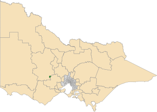
The electoral district of Wendouree is an electoral district of the Victorian Legislative Assembly in Australia. It was created in the redistribution of electoral boundaries in 2013, and came into effect at the 2014 state election.

References

  1. 1 2 Australian Bureau of Statistics (28 June 2022). "Black Hill (Vic) (State Suburb)". 2021 Census QuickStats. Retrieved 3 November 2022. OOjs UI icon edit-ltr-progressive.svg
  2. Weston Bate, Lucky City: The first generation at Ballarat: 1851-1901 (1978), p.25-26.
  3. 1 2 3 4 City of Ballarat, Ballarat Heritage Precincts Statements Of Significance 2006
  4. Lucky City: The First Generation at Ballarat 1851-1901. Melbourne: Melbourne University Press.
  5. 1 2 Cooper, B. 'Black Hill - the White Cliffs of Ballarat', Ballarat Historian, v4 n7 (1990)
  6. Clark, Ian D., Another Side of Eureka – the Aboriginal presence on the Ballarat goldfields in 1854 – Were Aboriginal people involved in the Eureka rebellion?
  7. Guide to Ballarat, F.W. Niven & Co, Ballarat, 1890, p.49
  8. 1 2 "Black Hill - Ballarat and District Industrial Heritage Project". Archived from the original on 22 March 2016.
  9. "Black Hill Flat - Ballarat and District Industrial Heritage Project". Archived from the original on 22 March 2016.
  10. Premier Postal History, Post Office List , retrieved 11 April 2008
  11. "My School provides information that helps parents and the community in understanding the performance of schools over time".