
Ballarat is a city in the Central Highlands of Victoria, Australia. In 2018, Ballarat had a population of 105,471, making it the third-largest city in both Victoria and inland Australia.

Melton is an urban area within metropolitan Melbourne, Australia located 35 km west from the capital's central business district. It is the administrative centre of the City of Melton local government area and its most populous centre. At June 2019 Melton had an urban population of 72,177, and has grown steadily with an average annual rate of 5.01% year-on-year for the five years to 2019. It is considered part of the Greater Melbourne metropolitan area and is included in the capital's population statistical division.
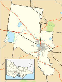
The City of Ballarat is a local government area in the west of the state of Victoria, Australia. It covers an area of 739 square kilometres (285 sq mi) and, in June 2018, had a population of 107,325. It is primarily urban with the vast majority of its population living in the Greater Ballarat urban area, while other significant settlements within the LGA include Buninyong, Waubra, Learmonth and Addington. It was formed in 1994 from the amalgamation of the City of Ballarat, Shire of Ballarat, Borough of Sebastopol and parts of the Shire of Bungaree, Shire of Buninyong, Shire of Grenville and Shire of Ripon.
Burwood is a suburb of Melbourne, Victoria, Australia, 14 km east of Melbourne's Central Business District. Its local government areas are the Cities of Monash and Whitehorse. At the 2016 Census, Burwood had a population of 15,019.

Melton South is a suburb of Melbourne, Victoria, Australia, 37 km west of Melbourne's Central Business District, located within the City of Melton local government area. Melton South recorded a population of 11,517 at the 2016 Census.

Deer Park is a suburb of Melbourne, Victoria, Australia, 17 km west of Melbourne's Central Business District, located within the City of Brimbank local government area. Deer Park recorded a population of 18,126 at the 2016 Census.

Mount Waverley is a suburb in Melbourne, Victoria, Australia, south-east of Melbourne's central business district. It is 16 km from Melbourne at its closest point. Mount Waverley railway station, located in the main shopping precinct, is located 17.8 km from Flinders Street railway station. Its local government area is the City of Monash. At the 2016 Census, Mount Waverley had a population of 33,611.

Geelong North is a suburb of Geelong in the Australian state of Victoria. The suburb was bypassed by traffic from Melbourne coming from the Princes Freeway by the creation of the Geelong Ring Road, which was complete in 2009. At the 2016 census, Geelong North had a population of 2,966. It is often referred to as North Geelong

Buninyong is a town 11 km from Ballarat in Victoria, Australia. The town is on the Midland Highway, south of Ballarat on the road to Geelong.

Alfredton is a suburb of Ballarat, Victoria, Australia, west of the CBD. The population at the 2016 census was 9,220 making it the third most populated in the Ballarat urban area.

Ballarat East is a suburb of Ballarat in Victoria, Australia. From 1857 until 1921 the suburb was its own town with its own council, the East Ballarat Town Council. The suburb covers a large area east of the City of Ballarat. It is the oldest area in Ballarat and was the site of many goldmines, as well as the Eureka Rebellion.
Ballarat East was an electoral district of the Legislative Assembly in the Australian state of Victoria. Prior to its abolition, it was a 3,323 km² part-urban and part-rural electorate covering areas to the east of the regional centre of Ballarat. It included the Ballarat suburbs of Ballarat East, Bakery Hill, Golden Point, Eureka, Canadian, Mount Pleasant, Mount Clear, Mount Helen and Warrenheip, and the rural towns of Ballan, Buninyong, Bungaree, Creswick, Daylesford, Dunnstown, Hepburn Springs, Kyneton, Lal Lal, Malmsbury, Meredith and Steiglitz. The electorate had a population of 54,127 as of the 2006 census, with 40,578 enrolled electors at the 2010 state election.
Lake Gardens is a relatively new suburb on the western rural-urban fringe of Ballarat, Victoria Australia located near Lake Wendouree and directly behind the Ballarat Botanical Gardens from which the suburb draws its name. The suburb is bounded by Gillies Street to the east, O'Donnell's Road to the west and Gregory Street West to the north. The population at the 2016 census was 1,695.

Gordon is a small town in Victoria, Australia, named after settler George Gordon. The town is located on the Old Melbourne Road in the Shire of Moorabool local government area, 95 kilometres (59 mi) west of the state capital, Melbourne. At the 2011 census, Gordon had a population of 1,151.
Ballarat Road is a major urban arterial road in the western suburbs of Melbourne, Victoria, Australia.
The Buninyong Line was a Victorian Railways (Australia) branch line running south from Ballarat to the town of Buninyong. The line branched from the main Melbourne – Ballarat railway at Ballarat East station and was 11 km long. The line was opened on 11 September 1889, with traffic commencing the following day, 12 September 1889 and finally closed on 1 December 1986. The section from Eureka to Buninyong closed much earlier on 2 February 1947. The line had previously closed to passenger services in 1930.
Soldiers Hill is a suburb of Ballarat, Victoria, Australia located directly north of the Central Business District. At the 2016 census, Soldiers Hill had a population of 2,803.

Mount Pleasant is the oldest residential suburb of Ballarat, Victoria, Australia. It is located on the southern extremity of the city between the Yarrowee Creek and the White Horse Range. Physically it is largely cut off from the rest of Ballarat which contributes to a sense of a suburb apart. The traditional Wathaurung country was first settled in 1836 when the Yuille brothers established a sheep run that included the sheltered corner under the escarpment later named Mount Pleasant. In those days, before there was a town at Ballarat, Buninyong was the nearest township. When the gold rush of 1851 brought thousands of diggers to nearby Golden Point, Mount Pleasant was left alone as no gold was initially found there. Its peacefulness made it attractive to a number of Cornish miners and their families who had come to Australia to settle permanently. These Wesleyans were the founders of the community. As devout and sober church people they sought a place to live away from the drunken mayhem of the diggings around Main Road.
Eureka is a small eastern suburb of Ballarat, Victoria, Australia – (AU). It was originally part of Ballarat East but became its own suburb in 1946 in recognition of the area's significance to Australian history. Eureka is bordered by Specimen Creek to the north, Canadian Creek to the south, Queen and Joseph streets to the west and Kline and Stawell Street to the east. The suburb takes its name from the Eureka Lead – a lead is an ancient river bed that contains gold – of the Eureka Mining Company and is most notable as the site of the historic event of the Eureka Rebellion. This was the site where the rebel miners flew the Eureka Flag for the first time; a flag that has since become a symbol of the working class and trade union movement and, at times, Australian republicanism.
Mount Clear is a semi-rural suburb of Ballarat, Victoria, Australia south of the CBD in the Canadian Creek Valley. At the 2016 census, Mount Clear had a population of 3,390.
