James Henry Scullin was an Australian politician and trade unionist who served as the ninth prime minister of Australia from 1929 to 1932. He held office as the leader of the Australian Labor Party (ALP), having briefly served as treasurer of Australia during his time in office from 1930 to 1931. His time in office was primarily categorised by the Wall Street Crash of 1929 which transpired just two days after his swearing in, thus heralding the beginning of the Great Depression in Australia. Scullin remained a leading figure in the Labor movement throughout his lifetime, and was an éminence grise in various capacities for the party until his retirement from federal parliament in 1949. He was the first Catholic, as well as the first Irish-Australian, to serve as prime minister.
Hamilton is a city in south-western Victoria, Australia, at the intersection of the Glenelg Highway and the Henty Highway. The Hamilton Highway connects it to Geelong.
HM Prison Langi Kal Kal is an Australian prison located in Trawalla, near Beaufort, Victoria, Australia. The prison is a minimum security prison farm and all inmates are required to work if they are physical able and under 65. It is a minimum security pathway for protection prisoners from Hopkins Correctional Centre.
The Western District comprises western regions of the Australian state of Victoria. It is said to be an ill–defined district, sometimes incorrectly referred to as an economic region,. The district is located within parts of the Barwon South West and the Grampians regions; extending from the south-west corner of the state to Ballarat in the east and as far north as Ararat. The district is bounded by the Wimmera district in the north, by the Goldfields district in the east, by Bass Strait and the Southern Ocean in the south, and by the South Australian border in the west. The district is well known for the production of wool. The most populated city in the Western District is the Ballarat region, with 96,940 inhabitants.

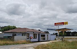
Beaufort is a town in Victoria, Australia. It is located on the Western Highway midway between Ararat and Ballarat, in the Pyrenees Shire local government area. It is 387 metres (1,270 ft) above sea level. At the 2016 census, Beaufort had a population of 1,539. The town takes its name either from Rear-Admiral Francis Beaufort or a Welsh village in Monmouthshire.

Coranderrk was an Aboriginal reserve run by the Victorian government between 1863 and 1924, located around 50 kilometres (31 mi) north-east of Melbourne. The residents were mainly of the Woiwurrung, Bunurong and Taungurung peoples, and the first inhabitants chose the site of the reserve.
The murnong or yam daisy is any of the plants Microseris walteri, Microseris lanceolata and Microseris scapigera, which are an important food source for many Aboriginal peoples in southern parts of Australia. Murnong is a Woiwurrung word for the plant, used by the Wurundjeri people and possibly other clans of the Kulin nation. They are called by a variety of names in the many different Aboriginal Australian languages, and occur in many oral traditions as part of Dreamtime stories.
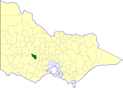
The Shire of Lexton was a local government area about 150 kilometres (93 mi) northwest of Melbourne, the state capital of Victoria, Australia. The shire covered an area of 821.03 square kilometres (317.0 sq mi), and existed from 1860 until 1994.
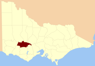
The County of Ripon is one of the 37 counties of Victoria which are part of the cadastral divisions of Australia, used for land titles. The county includes the plains of the Western District from Ballarat in the east to the Grampians in the west. Larger towns include Beaufort. The county was proclaimed in 1849.
Cape Conran is a locality in far-eastern Victoria, Australia. It lies within the Cape Conran Coastal Park located between Marlo and Bemm River about 400 km from Melbourne. The area actually includes two capes: East Cape Conran and West Cape Conran. Both are popular recreational destinations for visitors from nearby towns such as Orbost, as well as further afield, especially in the warmer months.

The Mount Emu Creek, a perennial creek of the Glenelg Hopkins catchment, is located in the Western District of Victoria, Australia.

Snake Valley is a town in central Western Victoria, Australia, on Linton-Carngham Road, 27 kilometres (17 mi) west of Ballarat and 153 kilometres (95 mi) west of Melbourne, in the Shire of Pyrenees. A post office was opened on 1 March 1859. At the 2016 Census, Snake Valley had a population of 743, up from 329 in 2006.
The Boonwurrung language, also anglicised as Bunurong, Bun wurrung, and other variant spellings, is an Aboriginal Australian language traditionally spoken by the Boonwurrung people of the Kulin nation of central Victoria prior to European settlement in the colony of Victoria. The last remaining traditional native speakers died in the early 20th century.

Tommy McRae (c.1835–1901) was an Aboriginal artist who lived in the Upper Murray district of Australia.

The Warkawarka, also called Weki Weki, were an Australian Aboriginal group whose traditional lands are located in Victoria, Australia. Controversy exists as to whether they were an independent 'tribe' or rather consisted of a subgroup of the Wergaia, the latter view being shared by both Robert M. W. Dixon and Luise Hercus.
The Kwatkwat were an indigenous Australian tribe of the State of Victoria, though some scholars consider them part of the broader Yorta Yorta/Pangerang macrogroup.
The Wotjobaluk are an Aboriginal Australian people of the state of Victoria. They are closely related to the Wergaia people.
The Baradha people, also spelt Barada and Thar ar ra burra, and also known as Toolginburra, were an Aboriginal Australian people of Central Queensland not far inland from the east coast.
The Pallanganmiddang, otherwise known as the Waywurru, were an Indigenous Australian people of North-eastern Victoria, in the state of Victoria, Australia. Recent scholarship has suggested that In Norman Tindale's classic study his references to a Djilamatang tribe and their language arguably refer in good part to the Pallanganmiddang
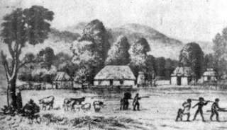
Katherine Kirkland was an Australian colonist, squatter and memoirist who was born in Glasgow. She is known for the accounts she wrote of her few years in Australia when she was the first European woman at Trawalla near Beaufort, Victoria.