The East Deccan dry evergreen forests is an ecoregion of southeastern India. The ecoregion includes the coastal region behind the Coromandel Coast on the Bay of Bengal, between the Eastern Ghats and the sea. It covers eastern Tamil Nadu, part of Puducherry and south eastern Andhra Pradesh.

The Aravalli West Thorn Scrub Forests, formerly known as Northwestern thorn scrub forests, is a xeric shrubland ecoregion of Pakistan and Northern India, stretching along the border lowlands and hills between the two countries. Once covered in deciduous forest, this ecoregion has been degraded through agriculture and the extraction of timber so that it currently has a scanty covering of thorny scrub dominated by such trees as Acacia senegal, Acacia leucophloea and Prosopis cineraria. Where the soils are particularly saline, there are patches of semi-desert. A number of mammals are found in this habitat, including about four hundred species of bird. Some small areas are protected but the collection of firewood and the conversion of the land to subsistence farming continues.

The Upper Gangetic Plains moist deciduous forests is a tropical and subtropical moist broadleaf forests ecoregion of northern India.

The Eastern Highlands moist deciduous forests, presently known as East Deccan moist deciduous forests, is a tropical and subtropical moist broadleaf forests ecoregion in east-central India. The ecoregion covers an area of 341,100 square kilometers (131,700 sq mi), extending across portions of Andhra Pradesh, Chhattisgarh, Jharkhand, Madhya Pradesh, Maharashtra, Odisha, and Telangana states.

The Northern dry deciduous forests, presently known as the North Deccan dry deciduous forests, is a tropical dry broadleaf forest ecoregion of east-central India.

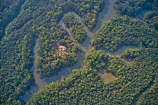
The Lower Gangetic Plains moist deciduous forests is a tropical and subtropical moist broadleaf forests ecoregion of Bangladesh and India. The ecoregion covers an area of 254,100 square kilometres (98,100 sq mi), comprising most of Bangladesh and the Indian states of West Bengal, Bihar and Tripura, and extending into adjacent states of Odisha, Uttar Pradesh and a tiny part of Assam, as well as adjacent western Myanmar.

The Narmada Valley dry deciduous forests are a tropical dry forest ecoregion of central India. The ecoregion lies mostly in Madhya Pradesh state, but extends into portions of Chhattisgarh, Maharashtra, Karnataka and Uttar Pradesh states.

The Deccan thorn scrub forests are a xeric shrubland ecoregion of south India and northern Sri Lanka. Historically this area was covered by tropical dry deciduous forest, but this only remains in isolated fragments. The vegetation now consists of mainly of southern tropical thorn scrub type forests. These consist of open woodland with thorny trees with short trunks and low, branching crowns; spiny and xerophytic shrubs; and dry grassland. This is the habitat of the great Indian bustard and blackbuck, though these and other animals are declining in numbers; this area was at one time home to large numbers of elephants and tigers. Almost 350 species of bird have been recorded here. The remaining natural habitat is threatened by overgrazing and invasive weeds, but there are a number of small protected areas which provide a haven for the wildlife. Trees in these forests have adapted to not require much water.

The Eastern Mediterranean conifer-sclerophyllous-forests, also known as the Eastern Mediterranean conifer-forests, is an ecoregion in the eastern Mediterranean Basin. It covers portions of Turkey, Syria, Iraq, Lebanon, Israel, Palestinian territories, Jordan, and Saudi Arabia.

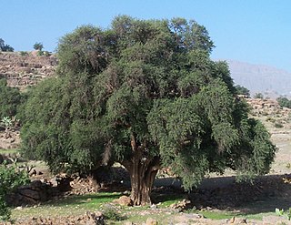
The Mediterranean Acacia–Argania dry woodlands and succulent thickets is a Mediterranean forests, woodlands, and scrub ecoregion in North Africa centered mainly on Morocco but also including northwestern Western Sahara and the eastern Canary Islands.

The Mediterranean dry woodlands and steppe is a Mediterranean forests, woodlands, and scrub ecoregion of North Africa. It occupies interior plateaus and mountain ranges of the Maghreb region, lying generally between the coastal Mediterranean woodlands and forests to the north and the Sahara to the south.

The Illyrian deciduous forests is a terrestrial ecoregion in southern Europe, which extends along the eastern coast of the Adriatic Sea. It belongs to the Mediterranean forests, woodlands, and scrub biome, and is in the Palearctic realm.

The Arabian Peninsula coastal fog desert, also known as the Southwestern Arabian coastal xeric scrub, is a desert ecoregion on the southern coasts of the Arabian Peninsula, which experiences thick fogs where visibility may be reduced to 10 metres (33 ft). It is classed as an Afrotropical fog desert

The Tyrrhenian-Adriatic sclerophyllous and mixed forests is an ecoregion in southern Italy, Sicily, Sardinia, Corsica, the Dalmatian Islands of Croatia, and Malta.

The Somali Acacia–Commiphora bushlands and thickets is a semi-arid tropical grasslands, savannas, and shrublands ecoregion in the Horn of Africa. It is home to diverse communities of plants and animals, including several endemic species.

The South Arabian fog woodlands, shrublands, and dune is an ecoregion in Oman and Yemen. The fog woodlands lie on mountainsides which slope southeastwards towards the Arabian Sea. The mountains intercept moisture-bearing winds from the Arabian Sea, creating orographic precipitation and frequent fogs that sustain unique woodlands and shrublands in a desert region.

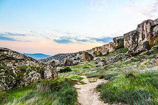
The Azerbaijan shrub desert and steppe is a deserts and xeric shrublands ecoregion in western Asia. It lies in the lowlands west of the Caspian Sea, and covers portions of Azerbaijan, Georgia, and Iran.

The Central Afghan Mountains xeric woodlands ecoregion covers the xeric (dry) eastern and southern slopes of the central mountain range of Afghanistan, between the sandy desert to the south and the alpine meadows in the higher, wetter region to the north. Despite the 'woodlands' in the ecoregion name, very little of the territory is forested – less than 1% – but is instead sparse vegetation or herbaceous cover.

The Paropamisus xeric woodlands ecoregion covers the portion of northeastern Afghanistan north of the central mountain range and the Hindu Kush Mountains. The name is derived from the Old Persian name for the region, Parupraesanna. While there are low canopy woodlands in the northeast of the ecorgegion, most of the territory is desert or xeric (dry) scrubland.

The Baluchistan xeric woodlands ecoregion covers the middle elevations of a series of mountain ranges of western Pakistan and northeastern Afghanistan, reaching 1,200 kilometres (750 mi) from the Arabian Sea in the south to the Hindu Kush Mountains and the Himalayas in the north. The characteristic vegetation is xeric (dry) woodlands of shrubs and herbaceous cover. The region has rich biodiversity but relatively few endemic species.


