A census-designated place (CDP) is a concentration of population defined by the United States Census Bureau for statistical purposes only.

The Baton Rouge metropolitan statistical area, as defined by the United States Office of Management and Budget, or simply the Baton Rouge metropolitan area or Greater Baton Rouge, is a sprawling metropolitan statistical area surrounding the city of Baton Rouge. Its principal city Baton Rouge is unusual because it has no major incorporated satellite cities, a rarity for a metropolitan area of its size. Including the western edge of the Florida Parishes regions, it is known as "Plantation Country", the "Capital Region", and "The 225". At the 2010 U.S. census, the metropolitan area had a population of 802,484, up from 705,973 in 2000. At the 2020 census, its population increased to 870,569, up from 2020 estimates at 858,571.
Hopeland is a small unincorporated hamlet and census-designated place (CDP) in Lancaster County in the south of the U.S. state of Pennsylvania. The hamlet's ZIP code is 17533. As of the 2010 census the population was 738.
Lakeville is a hamlet and census-designated place (CDP) in the town of Livonia, Livingston County, New York, United States. Its population was 756 as of the 2010 census.
Farmersville is a rural Mennonite settlement and a census-designated place (CDP) in West Earl Township, Lancaster County, Pennsylvania, United States. As of the 2010 census the population was 991.

The Charleston Metropolitan Statistical Area, as defined by the United States Census Bureau, is an area consisting of three counties in West Virginia, anchored by the city of Charleston. It is the largest metropolitan area entirely within the state of West Virginia. While the Huntington Metro Area is more populous, it spans three states, and the core county of the Charleston area, Kanawha County, is more populous than the West Virginia portion of the Huntington area.

Komatke is a census-designated place in Maricopa County, Arizona, United States. The area currently comprising the census-designated place had a population of 1,013 at the 2020 census, up from 821 at the 2010 census. It is located within the Gila River Indian Community. Its name refers to the Sierra Estrella mountain range, which rises just to the southwest of Komatke.

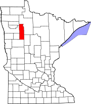
Conway is an unincorporated community and census-designated place (CDP) in Emmet County in the U.S. state of Michigan. As of the 2010 census, the CDP had a population of 204.
Harbor Island is a small residential island located 14 miles (22 km) east of Beaufort, South Carolina. It is one of the Carolina Sea Islands. The swing drawbridge has been replaced by a fixed high level bridge. , Harbor River Bridge, that connects the island to Saint Helena Island towards the west. A small causeway crossing Johnson Creek connects Harbor Island with Hunting Island towards the south.
Mohrsville is a census-designated place in Centre Township, Berks County, Pennsylvania, United States. It is located approximately three miles south of the borough of Shoemakersville, along the Schuylkill River. As of the 2010 census, the population was 383 residents.

Naples is a census-designated place (CDP) in the town of Naples in Cumberland County, Maine, United States. The population of the CDP was 428 at the 2010 census.
Grazierville is a census-designated place in Snyder Township, Blair County, Pennsylvania, United States. It is located near I-99 and is approximately one mile to the south of the borough of Tyrone. As of the 2010 census, the population was 665 residents.
Bear Rocks is an unincorporated community and census-designated place in Bullskin Township, Fayette County, Pennsylvania, United States. It is located along the south side of Pennsylvania Route 31 in northern Fayette County, on the western slope of Chestnut Ridge. The elevation ranges from 1,150 feet (350 m) above sea level at the northwestern end of the community, in the valley of Jacobs Creek, to 2,196 feet (669 m) near the southeastern corner of the community, at the intersection of Kreinbrook Hill Road and Sky Top Road. As of the 2010 census, the population of the CDP was 1,048.
Blucksberg Mountain is an unincorporated community and census-designated place in Meade County, South Dakota, United States. Its population was 467 as of the 2020 census. Interstate 90 passes through the community.
Parsippany is a census-designated place (CDP) and the central community in the township of Parsippany-Troy Hills, Morris County, in the U.S. state of New Jersey. It includes development around Lake Parsippany, as well as neighborhoods in the eastern part of the township, between Troy Hills to the south and Lake Hiawatha to the north. The southern end of Boonton Reservoir is also in the CDP.
The Hills is a planned community and census-designated place (CDP) in Bedminster and Bernards townships, Somerset County, in the U.S. state of New Jersey. It was first listed as a CDP prior to the 2020 census.
McGaffey is an unincorporated community and census-designated place (CDP) in McKinley County, New Mexico, United States. It was first listed as a CDP prior to the 2020 census.
Point View is an unincorporated community and census-designated place (CDP) in Blair County, Pennsylvania, United States. It was first listed as a CDP prior to the 2020 census.