Special routes of U.S. Route 79

Last updated

US 79.svg
U.S. Route 79
Location
Country United States
Highway system

A total of twelve special routes of U.S. Route 79 exist, divided between the states of Arkansas, Louisiana, Tennessee and Texas. Currently, they are all business routes, except for one bypass of Humboldt, Tennessee, and one bypass of Homer, Louisiana.

Contents

Former Taylor business route

Business plate.svg

US 79.svg

Business U.S. Highway 79-B

Location Taylor, Texas
Length3.246 mi [1]  (5.224 km)
Existed1990–2018

Business U.S. Highway 79-B began at the intersection of mainline US 79 and SH 95 in southern Taylor. The business route travelled northward along Main Street, concurrent with SH 95, and intersected FM 112. It then turned to the east along 4th Street to rejoin mainline US 79 at the city limits. [1] [2] [3]

Texas Loop 427.svg

The business route through Taylor was originally designated on January 20, 1966 as Loop 427; on March 1, 1972, the western terminus extended north to Lake Drive. On October 6, 1972, the route had been designated to serve as a full loop around the city. [4] What is now currently mainline US 79 in southern Taylor was originally part of the loop route, and the designations would be switched on January 20, 1977. In addition, the old route of US 79 was marked as Business US 79. On April 26, 1978, the section north of Taylor was cancelled. The section from SH 95 east and south to US 79 was cancelled, as it was never built, while the section from US 79 north and east to SH 95 was given the new designation of FM 397. The designation was changed from Loop 427 on June 21, 1990, and the western segment along 2nd St, 4th St, Main St, and Porter St was cancelled, and was replaced with the segment concurrent with SH 95 on April 25, 2002. On June 24, 2010, the section along Second Street from US 79 east to SH 95 was given to the city of Taylor, and Business US 79-B was rerouted south along SH 95 to US 79. Business US 79-B was cancelled on September 27, 2018. the section along Fourth Street was given to the city of Taylor, and the portion concurrent with SH 95 became SH 95 only. [1] [5]

Henderson business route

Business plate.svg

US 79.svg

Business U.S. Highway 79-F

Location Henderson, Texas
Length2.583 mi [6]  (4.157 km)

Business U.S. Highway 79-F begins at US 79 in southeastern Henderson and travels northward along Jacksonville Drive and South Main Street. It turns eastward at its intersection with FM 13, briefly running concurrently with Bus. SH 64 along East Main Street. The route ends at US 79 / US 259 near Willow Lake; East Main Street continues past this intersection as FM 840. [7]

Sections of roadway that are now Bus. US 79-F and Bus. SH 64-E were originally designated in 1944 as both Loop 153 and Loop 154. [8] [9] These designations were changed to the current business routes on June 21, 1990. [6] [10]

Texas Loop 153.svg Loop 153 was designated on May 18, 1944 from SH 64 and SH 323 southeast to downtown Henderson and then east to US 79. On December 19, 1955, the section from US 79 & FM 840 to US 79 was removed from the state highway system. On June 21, 1990, Loop 153 was cancelled, as it was transferred to Bus. SH 64-E and Bus. US 79-F.

Texas Loop 154.svg Loop 154 was designated on May 18, 1944 from SH 64 southward through Henderson to US 79. On June 21, 1990, Loop 154 was cancelled, as it was transferred to Bus. SH 64-E and Bus. US 79-F.

Carthage business route

Business plate.svg

US 79.svg

Business U.S. Highway 79-G

Location Carthage, Texas
Length2.92 mi [11]  (4.70 km)

Business U.S. Highway 79-G travels through Carthage while mainline US 79 loops around the city to the north. The route begins at US 79 / SH 149 in eastern Carthage. The route travels eastward along Panola Street, passing Panola College and a junction with SH 315, before intersecting Bus. US 59 at a traffic circle. After leaving the traffic circle along Sabine Street, Bus. US 79-G continues eastward until it ends at a diamond interchange with US 79 / US 59. [12]

Bus. US 79-G was designated in 1981 as Loop 334; it was the second route to bear that designation. [13] The mileage was transferred to Bus. US 79-G in 1991. [11]

Homer bypass route

By-pass plate.svg

US 79.svg

Bypass U.S. Highway 79

Location Homer, Louisiana

In Homer, the U.S. Highway 79 Bypass begins at an intersection with US 79 and LA 9 south of the town. The bypass runs west of the town and overlaps LA 2 for about the last 1 1/2 miles before ending at US 79 north of town.

Junction list

The entire highway is in Claiborne Parish.

LocationmikmDestinationsNotes
US 79.svgLouisiana 9 (2008).svg US 79  / LA 9  Minden, Homer, Arcadia, Junction City Southern terminus
Homer Louisiana 3062 (2008).svg LA 3062  Homer
Louisiana 2 (2008).svg LA 2 west Shongaloo South end of LA 2 overlap
Homer US 79.svgLouisiana 2 (2008).svg US 79  / LA 2 east Haynesville, Homer, Bernice Northern terminus; north end of LA 2 overlap
1.000 mi = 1.609 km; 1.000 km = 0.621 mi

Magnolia business route

US 79B.svg

Jackson Street

Location Magnolia, Arkansas
Length1.77 mi [14]  (2.85 km)
Existedc. 1967–present

U.S. Route 79 Business (US 79B and Hwy. 79B) is a 1.77-mile (2.85 km) business route of U.S. Route 79 in Columbia County, Arkansas. [15]

Route description

The route's southern terminus is at US 79 at the southern city limits of Magnolia. The route runs north as Jackson Street through residential areas until meeting Highway 19. The two routes begin a concurrency northbound towards downtown Magnolia where US 79B/AR 19 both terminate at US 82B (E Main Street). This junction also serves as the southern terminus of Highway 355. [15]

Major intersections

The entire route is in Magnolia, Columbia County.

mi [15] kmDestinationsNotes
0.000.00US 79 (AR).svg US 79 Southern terminus
1.021.64Arkansas 19.svg AR 19 south (Legion Dr)Begin AR 19 concurrency north
1.772.85US 82B (AR).svgArkansas 355.svg US 82B (E Main St) / AR 355 northNorthern terminus, AR 19 northern terminus, AR 355 southern terminus
1.000 mi = 1.609 km; 1.000 km = 0.621 mi

Camden business route

US 79B.svg

U.S. Highway 79B

Location Camden, Arkansas
Length5.41 mi [14]  (8.71 km)

Bearden business route

Highway 79B in downtown Bearden Highway 79B in Bearden, Arkansas 002.jpg
Highway 79B in downtown Bearden

US 79B.svg

1st Street

Location Bearden, Arkansas
Length3.57 mi [14]  (5.75 km)

Thornton business route

US 79B.svg

2nd Street

Location Thornton, Arkansas
Length2.14 mi [14]  (3.44 km)

Fordyce business route

US 79B.svg

U.S. Highway 79B

Location Fordyce, Arkansas
Length3.30 mi [14]  (5.31 km)

Pine Bluff/Altheimer business route

US 79B.svg

Blake Street/Martha Mitchell Expressway

Location Pine Bluff, Arkansas
Altheimer, Arkansas
Length15.44 mi [14]  (24.85 km)

U.S. Route 79-B in Pine Bluff begins at I-530/US 65/US 79, southwest of Downtown. The highway runs east of the city center and north toward Altheimer. The highway meets its parent route before running through town and terminates north of town.

Junction list

The entire route is in Jefferson County.

LocationmikmDestinationsNotes
Pine Bluff I-530.svgUS 65 (AR).svgUS 79 (AR).svg I-530  / US 65  / US 79 south Little Rock, Dumas, Rison Southern terminus
Arkansas 190.svg AR 190 (West 6th Avenue) Cross Roads, Pine Bluff
US 65B (AR).svgArkansas 365.svg US 65B north (Martha Mitchell Expressway) / AR 365 north (Blake Street) Little Rock, White Hall South end of US 65B overlap
US 65B (AR).svg US 65B south (Martha Mitchell Expressway) Dumas North end of US 65B overlap
Arkansas 31.svg AR 31 north Lonoke
Altheimer Arkansas 15.svg AR 15 north England
US 63 (AR).svgUS 79 (AR).svg US 63  / US 79  Stuttgart, Pine Bluff
Arkansas 88.svg AR 88 east Gillett
US 63 (AR).svgUS 79 (AR).svg US 63  / US 79  Pine Bluff, Stuttgart Northern terminus
1.000 mi = 1.609 km; 1.000 km = 0.621 mi

Stuttgart business route

US 79B.svg

22nd Street

Location Stuttgart, Arkansas
Length2.10 mi [14]  (3.38 km)

Clarendon business route

US 79B.svg

U.S. Highway 79B

Location Clarendon, Arkansas
Length1.00 mi [14]  (1.61 km)
US 79B terminates at its parent route in Clarendon US 79B terminates in Clarendon, AR.jpg
US 79B terminates at its parent route in Clarendon

Former McNeil city route

US 79C.svg

U.S. Highway 79C

Location McNeil, Arkansas
Length0.94 mi [14]  (1,510 m)

US Highway 79C was a city route in McNeil, Arkansas. The route was redesignated as Highway 98B in 1970. [16]

Humboldt bypass route

By-pass plate.svg

US 79.svg

U.S. Route 79 Bypass

Location Humboldt, Tennessee
Length3.9 mi (6.3 km)

U.S. Route 79 Bypass (also known as US 79 Bypass or US 79 Byp.) is a bypass route of U.S. Route 79 in Humboldt, Tennessee. It is concurrent with US 70A Bypass and unsigned State Route 366 (SR 366) for its entire length.

The highway begins as a two-lane highway at an interchange with US 70A/US 79 (W Main Street/SR 76 at the southwestern edge of town. It heads north through some industrial areas, where it has an intersection with SR 152. The highway then curves to the east through more industrial areas to cross a railroad overpass and enter a business district and come to an intersection with US 45W and US 45W Business (N Central Avenue/SR 5), where it widens to a four-lane highway and US 45W joins the highway. They then pass through some neighborhoods, where they cross over another railroad overpass, before US 70A Bypass/US 79 Bypass come to an end at an intersection with US 70A/US 79 (Eastend Drive/SR 76), with the Humboldt Bypass, and unsigned SR 366, continuing south along US 45W.

The entire route is in Humboldt, Gibson County.

mikmDestinationsNotes
0.00.0US 70A.svgUS 79.svg US 70A  / US 79 (W Main Street/SR 76) McKenzie, Gadsden, DowntownInterchange; southern terminus; western terminus of US 70A Bypass/SR 366; southern end of US 70A Bypass/SR 366 concurrency
1.11.8Secondary Tennessee 152.svg SR 152 (McLin Street) Maury City, Downtown
2.84.5US 45W.svgBusiness plate.svg
US 45W.svg
US 45W north / US 45W Bus. south (N Central Avenue/SR 5) Trenton, Downtown
Southern end of wrong-way US 45W concurrency; northern terminus of US 45W Business
3.96.3US 70A.svgUS 79.svg US 70A  / US 79 (Eastend Drive/SR 76) – Downtown, Gibson, Milan
US 45W.svg US 45W south (SR 366 east) Three Way, Jackson
Eastern terminus of US 70A Bypass; northern terminus of US 79 Bypass
1.000 mi = 1.609 km; 1.000 km = 0.621 mi

Related Research Articles

U.S. Highway 181 is a south–north U.S. Highway located entirely in the state of Texas. Both termini are at Interstate 37, the road that it mainly parallels to the east. US 181 begins in Corpus Christi, Texas at mile marker 0 to the south, through south-central Texas to just south of San Antonio to the north, for a total length of 137 miles (220 km).

U.S. Route 80 or U.S. Highway 80 (US 80) is a major east-west United States Numbered Highway in the Southern United States, much of which was once part of the early auto trail known as the Dixie Overland Highway. As the "0" in the route number indicates, it was originally a cross-country route, from the Pacific Ocean to the Atlantic Ocean. Its original western terminus was at Historic US 101 in San Diego, California. However, the entire segment west of Dallas, Texas, has been decommissioned in favor of various Interstate Highways and state highways. Currently, the highway's western terminus is at an interchange with Interstate 30 (I-30) on the Dallas–Mesquite, Texas city line. Its eastern terminus is in Tybee Island, Georgia near the Atlantic Ocean. Between Jonesville, Texas and Kewanee, Mississippi, US 80 runs parallel to or concurrently with Interstate 20. It also currently runs through Dallas, Texas; Shreveport, Louisiana; Jackson, Mississippi; Montgomery, Alabama; Columbus, Georgia; Macon, Georgia; and Savannah, Georgia.

U.S. Route 290 is an east–west U.S. Highway located entirely within the state of Texas. Its western terminus is at Interstate 10 southeast of Segovia, and its eastern terminus is at Interstate 610 in northwest Houston. It is the main highway between Houston and Austin and is a cutoff for travelers wanting to bypass San Antonio on Interstate 10. Throughout its length west of Austin, US 290 cuts across mountainous hills comprising the Texas Hill Country and the Edwards Plateau; between Austin and Houston, the highway then travels through gradually hilly grasslands and pine forests comprising the Gulf Coastal Plains.

State Highway 6 runs from the Red River, the Texas–Oklahoma boundary, to northwest of Galveston, where it is known as the Old Galveston Highway. In Sugar Land and Missouri City, it is known as Alvin-Sugarland Road and runs perpendicular to I-69/US-59. In the Houston area, it runs north to FM 1960, then northwest along U.S. Route 290 to Hempstead, and south to Westheimer Road and Addicks, and is known as Addicks Satsuma Road. In the Bryan–College Station area, it is known as the Earl Rudder Freeway. In Hearne, it is known as Market Street. In Calvert, it is known as Main Street. For most of its length, SH 6 is not a limited-access road. In 1997, the Texas Legislature designated SH 6 as the Texas Korean War Veterans Memorial Highway.

Texas State Highway 64 State highway in Texas

State Highway 64 is a Texas state highway that runs from Wills Point via Tyler to Henderson.

Texas State Highway 70 State highway in Texas

State Highway 70 is a state highway in Texas. The route runs approximately 315 miles (507 km) from US 277 near Blackwell to US 83 south of Perryton.

Texas State Highway 72 State highway in Texas

State Highway 72 is a Texas state highway that runs approximately 111 miles (179 km) from near Fowlerton to Cuero in South Texas.

Farm to Market Road 973 is a paved rural road that connects agricultural areas to market towns in Travis and Williamson counties, Texas.

Farm to Market Road 400 Highway in Texas

Farm to Market Road 400 is a farm to market road located in Lynn, Lubbock, Hale, and Swisher counties in the Llano Estacado of Texas.

A total of seven special routes of U.S. Route 90 exist.

There are fourteen business routes of Interstate 35 (I-35): nine are in Texas, two are in Iowa, and three are in Minnesota.

Interstate business routes are roads connecting a central or commercial district of a city or town with an Interstate bypass. These roads typically follow along local streets often along a former US route or state highway that had been replaced by an Interstate. Interstate business route reassurance markers are signed as either loops or spurs using a green shield shaped and numbered like the shield of the parent Interstate highway.

Numerous special routes of U.S. Route 67, all business routes, exist. One other route, formerly an alternate route in western Illinois, has since been downgraded to state Route 267.

All of the business loops within Texas are maintained by the Texas Department of Transportation (TxDOT). Interstate 20 (I-20) has fifteen business loops in the state, all located in western Texas. Along I-20, TxDOT identifies each business route as Business Interstate 20 followed by an alphabetic suffix. Along Texas Interstates, the alphabetic suffixes on business route names ascend eastward and northward. There are gaps in the alphabetic values to allow for future system expansion. The alphabetic naming suffixes are included as small letters on the bottom of route shields.

U.S. Route 77 Alternate

Alternate U.S. Highway 77 is a north–south auxiliary route of US 77, located entirely within the state of Texas. The route was commissioned in 1953, when US 77 was rerouted in southeast Texas.
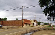
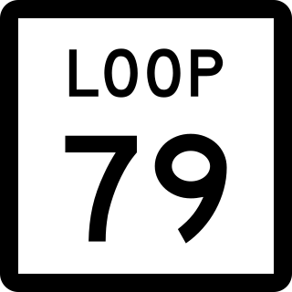
Farm to Market Road 1053 (FM 1053) is a Farm to Market Road in the U.S. state of Texas maintained by the Texas Department of Transportation (TxDOT). The road, located in Pecos, Crane, and Ector counties, begins along the concurrent routes of Business Interstate 10-G, U.S. Route 285 (US 285), and U.S. Route 385 (US 385) in the city of Fort Stockton and continues to the north ending at Interstate 20 (I-20) near Penwell. The road passes through the towns of Imperial, where it intersects FM 11, and Tubbs Corner, where it crosses State Highway 329 (SH 329). The road also has major intersections with I-10 / US 67 in Fort Stockton as well as FM 1450 and FM 1233.

There are currently four business routes of U.S. Route 175 that are designated and maintained by the Texas Department of Transportation (TxDOT). The business routes in the US state of Texas are traditionally short spurs or loops that connect the main route, in this case, U.S. Route 175 (US 175), to the center or commercial district of a city. The routes commonly follow the course of an decommissioned state highway, or the old course of the main route. Business routes are signed with the traditional US 175 highway shield, and with a small "business plate" placed above the marker. TxDOT regards business routes as official highways, and is responsible for the maintenance of the route.

References

  1. 1 2 3 Transportation Planning and Programming Division (n.d.). "Business U.S. Highway No. 79-B". Highway Designation Files. Texas Department of Transportation . Retrieved August 30, 2013.
  2. Transportation Planning and Programming Division (2018). Texas County Mapbook (PDF) (Map) (2018 ed.). 1:72,224. Texas Department of Transportation. p. 1489. Retrieved July 15, 2021.
  3. Transportation Planning and Programming Division (2018). Texas County Mapbook (PDF) (Map) (2018 ed.). 1:72,224. Texas Department of Transportation. p. 1490. Retrieved July 15, 2021.
  4. Transportation Planning and Programming Division (n.d.). "State Highway Loop No. 427". Highway Designation Files. Texas Department of Transportation . Retrieved August 30, 2013.
  5. "Minute Order 115344" (PDF). TxDOT. September 27, 2018.
  6. 1 2 Transportation Planning and Programming Division (n.d.). "Business U.S. Highway No. 79-F". Highway Designation Files. Texas Department of Transportation . Retrieved August 30, 2013.
  7. Transportation Planning and Programming Division (2018). Texas County Mapbook (PDF) (Map) (2018 ed.). 1:72,224. Texas Department of Transportation. p. 884. Retrieved July 15, 2021.
  8. Transportation Planning and Programming Division (n.d.). "State Highway Loop No. 153". Highway Designation Files. Texas Department of Transportation . Retrieved August 30, 2013.
  9. Transportation Planning and Programming Division (n.d.). "State Highway Loop No. 154". Highway Designation Files. Texas Department of Transportation . Retrieved August 30, 2013.
  10. Transportation Planning and Programming Division (n.d.). "Business State Highway No. 64-E". Highway Designation Files. Texas Department of Transportation . Retrieved August 30, 2013.
  11. 1 2 Transportation Planning and Programming Division (n.d.). "Business U.S. Highway No. 79-G". Highway Designation Files. Texas Department of Transportation . Retrieved August 30, 2013.
  12. Transportation Planning and Programming Division (2018). Texas County Mapbook (PDF) (Map) (2018 ed.). 1:72,224. Texas Department of Transportation. p. 886. Retrieved July 15, 2021.
  13. Transportation Planning and Programming Division (n.d.). "State Highway Loop No. 334". Highway Designation Files. Texas Department of Transportation . Retrieved August 30, 2013.
  14. 1 2 3 4 5 6 7 8 9 Planning and Research Division (2010). "Arkansas Road Log Database". Arkansas State Highway and Transportation Department. Archived from the original (Database) on June 23, 2011. Retrieved June 9, 2011.
  15. 1 2 3 General Highway Map, Columbia County, Arkansas (PDF) (Map). 1:62500. Cartography by Planning and Research Division. Arkansas State Highway and Transportation Department. February 14, 2008. Retrieved December 12, 2012.
  16. "Minutes of the Meeting" (PDF). Arkansas State Highway Commission. May 27, 1970. p. 1619. Retrieved January 28, 2013.