St. Clair Township, Michigan

Last updated
St. Clair Township, Michigan
St. Clair Township, MI location.png
Location within St. Clair County
USA Michigan location map.svg
Red pog.svg
St. Clair Township
Location within the state of Michigan
Coordinates: 42°52′03″N82°32′26″W / 42.86750°N 82.54056°W / 42.86750; -82.54056 Coordinates: 42°52′03″N82°32′26″W / 42.86750°N 82.54056°W / 42.86750; -82.54056
Country United States
State Michigan
County St. Clair
Government
  SupervisorMike Boulier
Area
  Total39.6 sq mi (102.5 km2)
  Land39.0 sq mi (100.9 km2)
  Water0.6 sq mi (1.7 km2)
Elevation
623 ft (190 m)
Population
 (2010)
  Total6,817
  Density174.8/sq mi (67.6/km2)
Time zone UTC-5 (Eastern (EST))
  Summer (DST) UTC-4 (EDT)
ZIP code(s)
48040, 48079
Area code 810
FIPS code 26-70700 [1]
GNIS feature ID1627025 [2]
Website Official website

St. Clair Township is a civil township of St. Clair County in the U.S. state of Michigan. The population was 6,817 at the 2010 Census. The city of St. Clair is located near the southeast corner of the township.

Contents

Communities

Naming

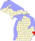
Being situated on the western banks of the St. Clair River, the city's name is taken from the river, which in turn was named for Lake Saint Clair. An expedition led by the French explorer René Robert Cavelier, Sieur de La Salle named it Lac Sainte-Claire, because they entered the lake on August 12, 1679, the feast day of Saint Clare of Assisi. [4] The lake is named on English maps as early as 1710 as Saint Clare. But as early as the Mitchell Map in 1755, the spelling is presented with the current spelling as St. Clair. [5] The name is sometimes attributed as honoring the American Revolutionary War General and Governor of the Northwest Territory Arthur St. Clair, but the name was in use with the current spelling long before St. Clair was a notable figure. However it is possible that earlier name of the lake was conflated with that of the general in naming some of the political entities near the lake and the river, such as St. Clair County, St. Clair Township, and the cities of St. Clair and St. Clair Shores.

The origin of the name has also been confused with that Patrick Sinclair, a British officer who purchased land on the St. Clair River at the outlet of the Pine River. There, in 1764, he built Fort Sinclair, which was in use for nearly twenty years before being abandoned. [6]

Geography

According to the United States Census Bureau, the township has a total area of 39.6 square miles (103 km2), of which 39.0 square miles (101 km2) is land and 0.6 square miles (1.6 km2) (1.62%) is water. [7]

Demographics

As of the census [1] of 2000, there were 6,423 people, 2,266 households, and 1,828 families residing in the township. The population density was 164.9 inhabitants per square mile (63.7/km2). There were 2,394 housing units at an average density of 61.5 per square mile (23.7/km2). The racial makeup of the township was 98.18% White, 0.26% African American, 0.23% Native American, 0.30% Asian, 0.26% from other races, and 0.76% from two or more races. Hispanic or Latino of any race were 1.04% of the population.

There were 2,266 households, out of which 38.0% had children under the age of 18 living with them, 72.1% were married couples living together, 5.5% had a female householder with no husband present, and 19.3% were non-families. 16.1% of all households were made up of individuals, and 6.6% had someone living alone who was 65 years of age or older. The average household size was 2.83 and the average family size was 3.17.

In the township the population was spread out, with 27.7% under the age of 18, 7.3% from 18 to 24, 29.1% from 25 to 44, 25.1% from 45 to 64, and 10.8% who were 65 years of age or older. The median age was 38 years. For every 100 females, there were 101.5 males. For every 100 females age 18 and over, there were 100.0 males.

The median income for a household in the township was $58,711, and the median income for a family was $65,924. Males had a median income of $52,045 versus $27,106 for females. The per capita income for the township was $24,705. About 2.5% of families and 3.2% of the population were below the poverty line, including 2.3% of those under age 18 and 1.3% of those age 65 or over.

Related Research Articles

<span class="mw-page-title-main">St. Clair County, Michigan</span> County in Michigan, United States

St. Clair County is a county located in the U.S. state of Michigan and bordering the west bank of the St. Clair River. As of the 2020 Census, the population was 160,383. It is the 13th-most populous county in the state. The county seat is Port Huron, located at the north end of the St. Clair River at Lake Huron. The county was created September 10, 1820, and its government was organized in 1821. It is located northeast of Detroit. Geographically, it lies in the Thumb area of eastern Michigan.

Leighton Township is a civil township of Allegan County in the U.S. state of Michigan. The population was 7,001 at the 2020 census, up from 4,934 at the 2010 census.

<span class="mw-page-title-main">Oronoko Charter Township, Michigan</span> Charter township in Michigan, United States

Oronoko Charter Township is a charter township of Berrien County in the U.S. state of Michigan. The population was 9,193 at the 2010 census.

<span class="mw-page-title-main">St. Joseph Charter Township, Michigan</span> Charter township in Michigan, United States

St. Joseph Charter Township is a charter township of Berrien County in the U.S. state of Michigan. The population was 10,028 at the 2010 census. The township is on the shores of Lake Michigan in the west central portion of the county, south of and adjacent to the city of St. Joseph. The village of Shoreham, on Lake Michigan south of St. Joseph city, is the only incorporated community within the boundaries of the township. Both the village and township are bedroom communities for the city of St. Joseph.

<span class="mw-page-title-main">Detour Township, Michigan</span> Civil township in Michigan, United States

DeTour Township is a civil township of Chippewa County in the U.S. state of Michigan. The population was 807 at the 2010 census. The township is at the extreme eastern tip of the Upper Peninsula.

<span class="mw-page-title-main">Harrison Township, Michigan</span> Charter township in Michigan, United States

Harrison Charter Township is a charter township of Macomb County in the U.S. state of Michigan. The population was 24,314 at the 2020 census.

<span class="mw-page-title-main">Algonac, Michigan</span> City in Michigan, United States

Algonac is a city in St. Clair County of the U.S. state of Michigan. The population was 4,110 at the 2010 census.

<span class="mw-page-title-main">Berlin Township, St. Clair County, Michigan</span> Civil township in Michigan, United States

Berlin Township is a civil township of St. Clair County in the U.S. state of Michigan. At the 2010 Census, the township population was 3,285.

<span class="mw-page-title-main">Casco Township, St. Clair County, Michigan</span> Civil township in Michigan, United States

Casco Township is a civil township of St. Clair County in the U.S. state of Michigan. As of the 2020 Census, the township population was 3,990.

<span class="mw-page-title-main">Clay Township, Michigan</span> Civil township in Michigan, United States

Clay Township is a civil township of St. Clair County in the U.S. state of Michigan. The population was 9,066 at the 2010 Census.

<span class="mw-page-title-main">Clyde Township, St. Clair County, Michigan</span> Civil township in Michigan, United States

Clyde Township is a civil township of St. Clair County in the U.S. state of Michigan. The population was 5,579 at the 2010 Census.

<span class="mw-page-title-main">Columbus Township, St. Clair County, Michigan</span> Civil township in Michigan, United States

Columbus Township is a civil township of St. Clair County in the U.S. state of Michigan. The population was 4,070 at the 2010 Census.

<span class="mw-page-title-main">Cottrellville Township, Michigan</span> Civil township in Michigan, United States

Cottrellville Township is a civil township of St. Clair County in the U.S. state of Michigan. The population was 3,559 at the 2010 Census.

<span class="mw-page-title-main">East China Township, Michigan</span> Charter township in Michigan, United States

East China Township is a charter township of St. Clair County in the U.S. state of Michigan. The population was 3,788 at the 2010 Census.

<span class="mw-page-title-main">Kimball Township, Michigan</span> Civil township in Michigan, United States

Kimball Township is a civil township of St. Clair County in the U.S. state of Michigan. As of the 2010 census, the township population was 9,358.

<span class="mw-page-title-main">Riley Township, St. Clair County, Michigan</span> Civil township in Michigan, United States

Riley Township is a civil township of St. Clair County in the U.S. state of Michigan. The population was 3,353 at the 2010 Census.

<span class="mw-page-title-main">St. Clair, Michigan</span> City in Michigan, United States

St. Clair is a city in St. Clair County in the eastern "Thumb" of the U.S. state of Michigan. The population was 5,485 at the 2010 census. The city is located on the St. Clair River near the southeast corner of St. Clair Township.

<span class="mw-page-title-main">Ira Township, Michigan</span> Civil township in Michigan, United States

Ira Township is a civil township of St. Clair County in the U.S. state of Michigan. The population was 5,178 at the 2010 Census.

<span class="mw-page-title-main">Kenockee Township, Michigan</span> Civil township in Michigan, United States

Kenockee Township is a civil township of St. Clair County in the U.S. state of Michigan. The population was 2,470 at the 2010 Census.

<span class="mw-page-title-main">Genesee Township, Potter County, Pennsylvania</span> Township in Pennsylvania, United States

Genesee Township is a township in Potter County, Pennsylvania, United States and lies near the source of the Genesee River. The population was 729 at the 2020 census. The name Genesee derives from Indian term for "beautiful valley".

References

  1. 1 2 "U.S. Census website". United States Census Bureau . Retrieved 2008-01-31.
  2. U.S. Geological Survey Geographic Names Information System: St. Clair Township, Michigan
  3. U.S. Geological Survey Geographic Names Information System: Adair, Michigan & GNIS in Google Map
  4. Jenks, p. 22
  5. Jenks, pp. 23-24
  6. Fuller, pp. 21-22
  7. "St. Clair County" (PDF). County Maps. Michigan Department of Technology, Management, and Budget. Archived (PDF) from the original on 2006-05-10. Retrieved 1 February 2012.