Clay Township, Michigan

Last updated

Clay Township, Michigan
Clay Township, MI offices.jpg
Clay Township Municipal Offices
Clay Township, MI location2.png
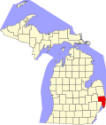
Location within St. Clair County (red) and the administered CDP of Pearl Beach (pink)
USA Michigan location map.svg
Red pog.svg
Clay Township
Location within the state of Michigan
Usa edcp location map.svg
Red pog.svg
Clay Township
Location within the United States
Coordinates: 42°36′38″N82°35′31″W / 42.61056°N 82.59194°W / 42.61056; -82.59194
CountryUnited States
State Michigan
County St. Clair
Settled1805
Established1826 (Plainfield Township)
1828 (Clay Township)
Government
[1]
  SupervisorArtie Bryson
   Clerk Cindy Valentine
Area
  Total82.47 sq mi (213.60 km2)
  Land35.32 sq mi (91.48 km2)
  Water47.15 sq mi (122.12 km2)
Elevation
577 ft (176 m)
Population
 (2020) [2]
  Total8,446
  Density102.4/sq mi (39.5/km2)
Time zone UTC-5 (Eastern (EST))
  Summer (DST) UTC-4 (EDT)
ZIP code(s)
48001 (Algonac)
48028 (Harsens Island)
Area code 810
FIPS code 26-16180 [3]
GNIS feature ID1626090 [4]
Website Official website

Clay Township is a civil township of St. Clair County in the U.S. state of Michigan. The population was 8,446 at the 2020 census. [2]

Contents

The township is located along the mouth of the St. Clair River at Lake St. Clair. The river delta includes numerous islands, in which Harsens Island is the largest. The township mostly surrounds the city of Algonac, but the two are administered autonomously since Algonac incorporated as a city in 1967. Most of Algonac State Park is located within Clay Township.

Communities

History

The area was first settled by John Martin in 1805, and the area was originally referred to as Pointe du Chene (Oak Point). In 1826, the area was organized as Plainfield Township, which was named by early settler John K. Smith after his hometown of Plainfield, Vermont. A post office named Plainfield began operating here on April 5, 1826 with Smith serving as the first postmaster. In 1828, the township was reorganized and renamed after attorney and statesman Henry Clay, and the post office was later renamed Clay on December 23, 1835; Smith continued serving as postmaster. The post office was renamed Algonac on August 17, 1843. Algonac incorporated as a village within Clay Township in 1867. The village gained autonomy from the township when it incorporated as a city in 1967. [25]

Historic sites

Geography

Looking north on M-29 along the St. Clair River at Algonac State Park Algonac State Park 3.jpg
Looking north on M-29 along the St. Clair River at Algonac State Park

According to the U.S. Census Bureau, the township has a total area of 82.47 square miles (213.60 km2), of which 35.32 square miles (91.48 km2) is land and 47.15 square miles (122.12 km2) (57.17%) is water. [30]

The township contains a large portion of water that includes areas along the St. Clair River mouth in the northern Anchor Bay area of Lake St. Clair, which contains numerous channels and canals. Directly across the river is the Walpole Island First Nation in Ontario, which is accessible via the Walpole–Algonac Ferry in downtown Algonac.

The St. Clair Flats State Wildlife Area and the majority of the St. John's Marsh State Wildlife Area are located within Clay Township. [31] [32] Most of Algonac State Park is located within Clay Township with a small portion extending north into Cottrellville Township.

Islands

Transportation

Ferry service to and from Harsens Island Harsens Island Ferry (August 2022).jpg
Ferry service to and from Harsens Island

Airport

Ferries

Major highways

Demographics

As of the census [3] of 2000, there were 9,822 people, 3,934 households, and 2,844 families residing in the township. The population density was 277.0 inhabitants per square mile (107.0/km2). There were 5,325 housing units at an average density of 150.2 per square mile (58.0/km2). The racial makeup of the township was 97.92% White, 0.20% African American, 0.68% Native American, 0.11% Asian, 0.21% from other races, and 0.87% from two or more races. Hispanic or Latino of any race were 0.85% of the population.

There were 3,934 households, out of which 27.9% had children under the age of 18 living with them, 61.3% were married couples living together, 7.0% had a female householder with no husband present, and 27.7% were non-families. 22.9% of all households were made up of individuals, and 9.2% had someone living alone who was 65 years of age or older. The average household size was 2.50 and the average family size was 2.94.

In the township the population was spread out, with 22.6% under the age of 18, 6.5% from 18 to 24, 28.2% from 25 to 44, 28.8% from 45 to 64, and 13.9% who were 65 years of age or older. The median age was 41 years. For every 100 females, there were 103.6 males. For every 100 females age 18 and over, there were 103.2 males.

The median income for a household in the township was $55,059, and the median income for a family was $63,182. Males had a median income of $48,053 versus $31,923 for females. The per capita income for the township was $27,169. About 2.3% of families and 4.7% of the population were below the poverty line, including 6.7% of those under age 18 and 3.6% of those age 65 or over.

Related Research Articles

<span class="mw-page-title-main">Eagle Harbor Township, Michigan</span> Civil township in Michigan, United States

Eagle Harbor Township is a civil township of Keweenaw County in the U.S. state of Michigan. The population was 217 at the 2020 census. The township is located on the Keweenaw Peninsula and also includes the southwestern portion of Isle Royale National Park.

<span class="mw-page-title-main">Hudson Township, Mackinac County, Michigan</span> Civil township in Michigan, United States

Hudson Township is a civil township of Mackinac County in the U.S. state of Michigan. As of the 2020 census, its population was 193.

<span class="mw-page-title-main">Moran Township, Michigan</span> Civil township in Michigan, United States

Moran Township is a civil township of Mackinac County in the U.S. state of Michigan. The population was 1,029 at the 2020 census.

<span class="mw-page-title-main">Chesterfield Township, Michigan</span> Charter township in Michigan, United States

Chesterfield Charter Township is a charter township of Macomb County in the U.S. state of Michigan. As of the 2020 census the population was 45,376.

<span class="mw-page-title-main">Harrison Township, Michigan</span> Charter township in Michigan, United States

Harrison Charter Township is a charter township of Macomb County in the U.S. state of Michigan. The population was 24,314 at the 2020 census.

<span class="mw-page-title-main">Algonac, Michigan</span> City in Michigan, United States

Algonac is a city in St. Clair County of the U.S. state of Michigan. The population was 4,196 at the 2020 census.

<span class="mw-page-title-main">Berlin Township, St. Clair County, Michigan</span> Civil township in Michigan, United States

Berlin Township is a civil township of St. Clair County in the U.S. state of Michigan. At the 2010 census, the township population was 3,285.

<span class="mw-page-title-main">Casco Township, St. Clair County, Michigan</span> Civil township in Michigan, United States

Casco Township is a civil township of St. Clair County in the U.S. state of Michigan. As of the 2020 Census, the township population was 3,990.

<span class="mw-page-title-main">Cottrellville Township, Michigan</span> Civil township in Michigan, United States

Cottrellville Township is a civil township of St. Clair County in the U.S. state of Michigan. The population was 3,559 at the 2010 Census.

<span class="mw-page-title-main">Fort Gratiot Township, Michigan</span> Charter township in Michigan, United States

Fort Gratiot Township is a charter township of St. Clair County in the U.S. state of Michigan. The population was 11,108 at the 2010 Census. It is named for Fort Gratiot, an American fort located there off and on between 1814 and 1879.

<span class="mw-page-title-main">Kimball Township, Michigan</span> Civil township in Michigan, United States

Kimball Township is a civil township of St. Clair County in the U.S. state of Michigan. As of the 2010 census, the township population was 9,358.

<span class="mw-page-title-main">Pearl Beach, St. Clair County, Michigan</span> Census-designated place & unincorporated community in Michigan, United States

Pearl Beach is an unincorporated community and census-designated place (CDP) in St. Clair County in the U.S. state of Michigan. The population of the CDP was 4,698 at the 2020 census. The community is located within Clay Township.

<span class="mw-page-title-main">Wales Township, Michigan</span> Civil township in Michigan, United States

Wales Township is a civil township of St. Clair County in the U.S. state of Michigan. The population was 3,248 at the 2010 Census.

<span class="mw-page-title-main">Augusta Charter Township, Michigan</span> Charter township in Michigan, United States

Augusta Charter Township is a charter township of Washtenaw County in the U.S. state of Michigan. The population was 6,745 at the 2010 census.

<span class="mw-page-title-main">Van Buren Township, Michigan</span> American township in Michigan

Van Buren Township is a charter township in Wayne County in the U.S. state of Michigan. A western suburb of Detroit, Van Buren Township is located roughly 28 miles (45.1 km) southwest of downtown Detroit, and 17 miles (27.4 km) southeast of Ann Arbor. As of the 2020 census, the township had a population of 30,375. It surrounds, but is independent of, the city of Belleville.

<span class="mw-page-title-main">South Branch Township, Wexford County, Michigan</span> Civil township in Michigan, United States

South Branch Township is a civil township of Wexford County of the U.S. state of Michigan. The population was 348 at the 2020 census.

<span class="mw-page-title-main">Ira Township, Michigan</span> Civil township in Michigan, United States

Ira Township is a civil township of St. Clair County in the U.S. state of Michigan. The population was 5,178 at the 2010 Census.

<span class="mw-page-title-main">Russell Island (Michigan)</span>

Russell Island is a small private island in the St. Clair River in the U.S. state of Michigan between Algonac and Walpole Island, Ontario, Canada. It is immediately upriver from Sand Island which is itself immediately upriver from Harsens Island; it includes two smaller islands, Anderson Island on the northwest, and "The Gold Coast" on the southwest. The island, which is accessible only via passenger ferry or by private watercraft, contains about 150 cottages. There are no cars on the island; the only motorized vehicles are golf carts.

<span class="mw-page-title-main">Sans Souci, Michigan</span> Unincorporated community in Michigan, United States

Sans Souci is an unincorporated community in St. Clair County in the U.S. state of Michigan. The community is located within Clay Township.

<span class="mw-page-title-main">McMillan Township, Luce County, Michigan</span> Civil township in Michigan, United States

McMillan Township is a civil township of Luce County in the U.S. state of Michigan. The population was 2,471 at the 2020 census. At 588.78 square miles (1,524.9 km2) of total land area, McMillan Township is the largest municipality by area in the state of Michigan.

References

  1. Michigan Townships Association (2022). "Clay Twp., St. Clair Co" . Retrieved August 11, 2023.
  2. 1 2 United States Census Bureau (August 12, 2023). "Clay township, St. Clair County, Michigan".
  3. 1 2 "U.S. Census website". United States Census Bureau . Retrieved January 31, 2008.
  4. U.S. Geological Survey Geographic Names Information System: Clay Township, Michigan
  5. U.S. Geological Survey Geographic Names Information System: Bedore, Michigan
  6. U.S. Geological Survey Geographic Names Information System: Clays Landing, Michigan
  7. U.S. Geological Survey Geographic Names Information System: Forster, Michigan
  8. U.S. Geological Survey Geographic Names Information System: Grand Pointe, Michigan
  9. Romig 1986, p. 233.
  10. Romig 1986, p. 255.
  11. Romig 1986, p. 500.
  12. Google (July 24, 2022). "48028 ZIP Code map" (Map). Google Maps . Google. Retrieved July 24, 2022.
  13. UnitedStatesZipCodes.org (2022). "ZIP Code 48028: Harsens Island" . Retrieved July 24, 2022.
  14. U.S. Geological Survey Geographic Names Information System: Maple Leaf, Michigan
  15. U.S. Geological Survey Geographic Names Information System: Miller, Michigan
  16. U.S. Geological Survey Geographic Names Information System: Muirs, Michigan
  17. U.S. Geological Survey Geographic Names Information System: Pearl Beach, Michigan
  18. U.S. Geological Survey Geographic Names Information System: Perch Point, Michigan
  19. U.S. Geological Survey Geographic Names Information System: Pointe aux Tremble, Michigan
  20. Romig 1986, p. 449.
  21. U.S. Geological Survey Geographic Names Information System: Riverside, Michigan
  22. U.S. Geological Survey Geographic Names Information System: Roberts Landing, Michigan
  23. Romig 1986, p. 479.
  24. U.S. Geological Survey Geographic Names Information System: Sans Souci, Michigan
  25. Romig 1986, p. 17.
  26. St. Clair County MPC. "Blueway of St. Clair: Harsen House" . Retrieved August 10, 2023.
  27. Michigan Department of Natural Resources. "Historical Marker - L1488B - North Channel Shooting Club (Marker ID#:L1488B)" (PDF). Retrieved August 11, 2023.
  28. MichMarkers.com (2023). "St. Clair River: Registered Site S0124" . Retrieved August 11, 2023.
  29. MichMarkers.com (2023). "Stewart Farm / Memoir of Aura Stewart: Registered Site L2128" . Retrieved August 11, 2023.
  30. "Michigan: 2010 Population and Housing Unit Counts 2010 Census of Population and Housing" (PDF). 2010 United States census . United States Census Bureau. September 2012. p. 40 Michigan. Archived (PDF) from the original on October 19, 2012. Retrieved August 11, 2023.
  31. Michigan Department of Natural Resources (May 2006). "St. Clair Flats State Wildlife Area" (PDF). Retrieved August 11, 2023.
  32. Michigan Department of Natural Resources (May 2006). "St. John's Marsh State Wildlife Area" (PDF). Retrieved August 11, 2023.
  33. U.S. Geological Survey Geographic Names Information System: Brucker Island
  34. U.S. Geological Survey Geographic Names Information System: Club Island
  35. U.S. Geological Survey Geographic Names Information System: Dickinson Island
  36. U.S. Geological Survey Geographic Names Information System: Green Island
  37. U.S. Geological Survey Geographic Names Information System: Gull Island
  38. U.S. Geological Survey Geographic Names Information System: Harsens Island
  39. U.S. Geological Survey Geographic Names Information System: McDonald Island
  40. U.S. Geological Survey Geographic Names Information System: Middle Island
  41. U.S. Geological Survey Geographic Names Information System: Muscamoot Ridge
  42. U.S. Geological Survey Geographic Names Information System: North Island
  43. U.S. Geological Survey Geographic Names Information System: Russell Island
  44. U.S. Geological Survey Geographic Names Information System: Sand Island
  45. U.S. Geological Survey Geographic Names Information System: Strawberry Island
  46. AirNav, LLC. (2023). "Harsens Island Airport" . Retrieved August 10, 2023.
  47. Champion's Auto Ferry (2023). "Welcome to Champion's Auto Ferry" . Retrieved August 11, 2023.
  48. Bowling Green State University. "Historical Collections of the Great Lakes: Pride of Lake Huron" . Retrieved August 10, 2023.
  49. Bridge to Bay Trail (2023). "Bridge to Bay Trail: Trail Map" . Retrieved August 10, 2023.

Sources