A green belt is a policy and land-use zone designation used in land-use planning to retain areas of largely undeveloped, wild, or agricultural land surrounding or neighboring urban areas. Similar concepts are greenways or green wedges, which have a linear character and may run through an urban area instead of around it. In essence, a green belt is an invisible line designating a border around a certain area, preventing development of the area and allowing wildlife to return and be established.
Green belt or greenbelt is an area of protected open space around an urban area.

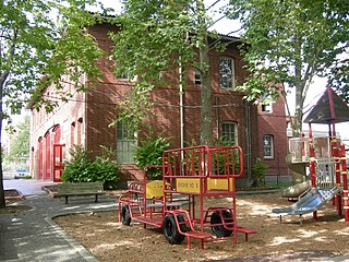
Greenbelt station is a Washington Metro and MARC station in Prince George's County, Maryland. The station is the northeastern terminus of the Green Line of the Washington Metro. MARC commuter rail trains on the Camden Line also stop at Greenbelt on a set of tracks parallel to the Metro tracks.
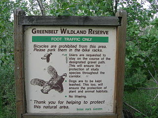
The Boise River Greenbelt is a recreational and alternate transportation trail along the banks of the Boise River through Boise, Idaho, United States. The Boise Greenbelt is more of a greenway than a green belt since its character is linear. It extends more than 20 miles (32 km) beginning at Lucky Peak Dam in the east to a short distance beyond Eagle Road in the west in Eagle, Idaho. Taking into account both sides of the river and other parallel trails and spurs, the total Greenbelt trail system measures more than 30 miles (48 km).

Lake Artemesia is a man-made lake in Prince George's County, Maryland, located within the Lake Artemesia Natural Area in College Park and Berwyn Heights. The lake covers an area of 38 acres (150,000 m2), and the surrounding natural area is administered by Maryland-National Capital Park and Planning Commission and includes aquatic gardens, fishing piers, and hiker-biker trails.

St. Mark's Episcopal Cathedral in Seattle, Washington, is the seat of the bishop of the Episcopal Diocese of Olympia. St. Mark's was founded as a mission church of Trinity Parish Church.
The Bay Area Ridge Trail is a planned 550-mile (890 km) multi-use trail along the hill and mountain ridgelines ringing the San Francisco Bay Area, in Northern California. Currently, 400 miles (640 km) have been established. When complete, the trail will connect over seventy-five parks and open spaces. The trail is being designed to provide access for hikers, runners, mountain bicyclists, and equestrians. It will be accessible through trailheads near major population centers, but the trail will extend into more remote areas. The first trail section was dedicated on May 13, 1989.
Cascade is an urban neighborhood abutting Downtown Seattle, Washington, United States, located adjacent to South Lake Union. It is bounded by: Fairview Avenue North on the west, beyond which is the rest of the Cascade Neighborhood; the Interstate 5 interchange for Mercer St to the north, beyond which is Eastlake; Interstate 5 on the east, beyond which is Capitol Hill; and Denny Way on the south, beyond which is Denny Triangle. It is surrounded by thoroughfares Mercer Street (eastbound), Fairview Avenue N. and Eastlake Avenue E., and Denny Way. The neighborhood, one of Seattle's oldest, originally extended much further: west to Terry Avenue, south to Denny Hill on the South, and east to Melrose Avenue E through the area now obliterated by Interstate 5. Some recent writers consider Cascade to omit the northern "arm", while others extend it westward to cover most of South Lake Union.
The Central Area, commonly called the Central District or The CD, is a mostly residential district in Seattle located east of downtown and First Hill ; west of Madrona, Leschi and Mt. Baker; south of Capitol Hill, and north of Rainier Valley. Historically, the Central District has been one of Seattle's most racially and ethnically diverse neighborhoods, and was once the center of Seattle's black community and a major hub of African-American businesses.

A greenway is usually a shared-use path along a strip of undeveloped land, in an urban or rural area, set aside for recreational use or environmental protection. Greenways are frequently created out of disused railways, canal towpaths, utility or similar rights of way, or derelict industrial land. Greenways also can also be linear parks, and can serve as wildlife corridors. The path's surface may be paved and often serves multiple users: walkers, runners, bicyclists, skaters and hikers. A characteristic of greenways, as defined by the European Greenways Association, is "ease of passage": that is that they have "either low or zero gradient", so that they can be used by all "types of users, including mobility impaired people".

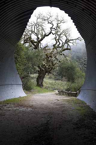
Arastradero Preserve, officially known as Enid W. Pearson–Arastradero Preserve, is a 622 acres nature preserve that protects most of the Arastradero Creek watershed, including its ephemeral Mayfly Creek tributary. It also includes the upper reach of the Felt Creek tributary to Stanford's Felt Reservoir. The preserve is owned and operated by the City of Palo Alto, California. The main parking lot hosts an interpretive center and is located at 1530 Arastradero Road.

Sooke Potholes Provincial Park is a 7.28 hectare provincial park in British Columbia, Canada. It is adjacent to the Sooke River and Sooke Potholes Regional Park, near Victoria, B.C. Intended primarily to provide access to the Sooke River and the associated potholes, it also offers wildlife viewing and other day-use activities.

Daylighting can be defined as "opening up buried watercourses and restoring them to more natural conditions". An alternative definition refers to "the practice of removing streams from buried conditions and exposing them to the Earth's surface in order to directly or indirectly enhance the ecological, economic and/or socio-cultural well-being of a region and its inhabitants". The term is used to refer to the restoration of an originally open-air watercourse, which had at some point been diverted below ground, back into an above-ground channel. Typically, the rationale behind returning the riparian environment of a stream, wash, or river to a more natural state is to reduce runoff, create habitat for species in need of it, or improve an area's aesthetics. In the UK, the practice is also known as deculverting.

The Capital Area Greenbelt is a looping trail located in the area of Harrisburg, Pennsylvania. This 20-mile loop around Pennsylvania's capital city provides visitors and tourists with opportunities to hike, ride bicycles, skate, jog, fish, walk their dogs, spot rare birds, learn about history, enjoy native flora and fauna, and appreciate nature. While parts of the trail are shared with roads, most of the loop is a dedicated path. The Trail, as it is commonly referred to by locals, passes along the Susquehanna River through Reservoir Park, Riverfront Park, Five Senses Garden, and Wildwood Park and Nature Center. In addition to parks, the Capital Area Greenbelt passes alongside attractions including the grave site of John Harris Sr., the Governor's Mansion, Fort Hunter, Harrisburg State Hospital, and the National Civil War Museum.

Rancho San Antonio County Park and Rancho San Antonio Open Space Preserve are a conjoined public recreational area in the Santa Cruz Mountains, in the northwest quadrant of Santa Clara County, California. The County Park is bordered by Los Altos with some parts of the eastern part of the County Park in western Cupertino. The Open Space Preserve is on the west side of the County Park, also bordered by Los Altos Hills, Monte Bello Open Space Preserve, and the Permanente Quarry.

Capitol View is a historic in-town southwest Atlanta neighborhood 2.5 miles from downtown Atlanta, Georgia that was named for its view of the Georgia State Capitol building. Its boundaries include Metropolitan Parkway to the east, Lee Street to the west, and the Beltline to the north. On the south, the border follows Arden Street, Deckner Avenue, and Perkerson Park.

The Streissguth Gardens are a family-maintained hillside garden covering approximately one acre on the northwest side of Capitol Hill in Seattle, Washington.
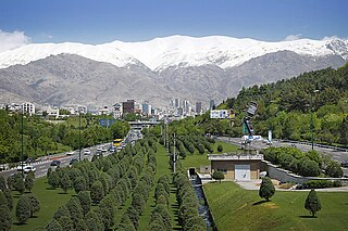
Downtown Boise is the central business district of Boise, Idaho, located north of the Boise River. It is the largest city center in the state of Idaho.

Scioto Audubon Metro Park is a public park and nature preserve in Columbus, Ohio. The park is managed by the Columbus and Franklin County Metro Parks and is part of the Scioto Mile network of parks and trails around Downtown Columbus. The park features numerous trails, wetlands, rock climbing, volleyball and bocce courts, and numerous other amenities. At the western edge is the Grange Insurance Audubon Center, considered the first nature center built in close proximity to a downtown area.

