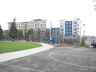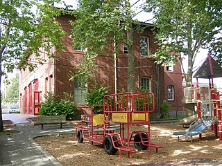
Capitol Hill is a densely populated residential district in Seattle, Washington, United States. One of the city's most popular nightlife and entertainment districts, it is home to a historic gay village and vibrant counterculture community.

Volunteer Park is a 48.3-acre (19.5 ha) park in the Capitol Hill neighborhood of Seattle, Washington, United States.

Wallingford is a neighborhood in north central Seattle, lying on a hill above the north shore of Lake Union about four miles from the downtown core. The neighborhood developed quickly during the early 20th century after the establishment of the University of Washington to the east. With trolley tracks laid through the neighborhood as early as 1907, Wallingford is a classic streetcar suburb, typified by its many 1920s era box houses and bungalows. Commercial development is primarily concentrated along North 45th Street where a number of iconic structures stand including the neon "WALLINGFORD" sign, the Wallingford Center, and the original Dick's Drive-In. With its central location, numerous public amenities, including the world-renowned Gas Works Park, and views of both the Olympic and Cascade mountains, Wallingford has long been home to many middle and upper-class families. While Wallingford is mostly residential in nature, the neighborhood's southern edge, along Lake Union, has historically been an industrial and commercial business strip. In recent years, numerous office buildings have been developed as an extension of the burgeoning business center in neighboring Fremont. In 2014 Brooks Sports moved its headquarters from Bothell to a new six-story office building at the southwestern edge of Wallingford.

Dick's Drive-In Restaurants, Inc., or simply Dick's, is an American regional chain of fast-food restaurants located in the Seattle metropolitan area. It was founded in Seattle's Wallingford neighborhood in 1954 by Dick Spady, H. Warren Ghormley, and Dr. B.O.A. Thomas. Dick's currently operates nine locations, of which all but one are drive-ins.

King County Metro, officially the King County Metro Transit Department and often shortened to Metro, is the public transit authority of King County, Washington, which includes the city of Seattle. It is the eighth-largest transit bus agency in the United States. In 2022, the system had a ridership of 66,022,200, or about 244,500 per weekday as of the third quarter of 2023. Metro employs 2,716 full-time and part-time operators and operates 1,540 buses.

Cascade is an urban neighborhood abutting Downtown Seattle, Washington, United States, located adjacent to South Lake Union. It is bounded by: Fairview Avenue North on the west, beyond which is the rest of the Cascade Neighborhood; the Interstate 5 interchange for Mercer St to the north, beyond which is Eastlake; Interstate 5 on the east, beyond which is Capitol Hill; and Denny Way on the south, beyond which is Denny Triangle. It is surrounded by thoroughfares Mercer Street (eastbound), Fairview Avenue N. and Eastlake Avenue E., and Denny Way. The neighborhood, one of Seattle's oldest, originally extended much further: west to Terry Avenue, south to Denny Hill on the South, and east to Melrose Avenue E through the area now obliterated by Interstate 5. Some recent writers consider Cascade to omit the northern "arm", while others extend it westward to cover most of South Lake Union.

The Central Area, commonly called the Central District or The CD, is a mostly residential district in Seattle located east of downtown and First Hill ; west of Madrona, Leschi and Mt. Baker; south of Capitol Hill, and north of Rainier Valley. Historically, the Central District has been one of Seattle's most racially and ethnically diverse neighborhoods, and was once the center of Seattle's black community and a major hub of African-American businesses.

Capitol Hill station is a light rail station in the Capitol Hill neighborhood of Seattle, Washington, United States. The station is served by Sound Transit's Link light rail system and is located near the intersection of Broadway and East John Street. It is situated between the Westlake and University of Washington stations on the 1 Line. The station consists of an island platform approximately 65 feet (20 m) under street level, connected to three surface entrances via two mezzanines. It contains pieces of public art, including Mike Ross's sculpture Jet Kiss and two murals by cartoonist Ellen Forney.

The following outline is provided as an overview of and topical guide to District of Columbia:

Broadway is a major north–south thoroughfare in Seattle, Washington. The 1.6-mile-long (2.6 km) arterial runs north from Yesler Way at Yesler Terrace through the First Hill and Capitol Hill neighborhoods to East Roy Street. Broadway East continues north to East Highland Drive. North of there the street is made up of shorter segments: one from just south of East Blaine Street to just north of East Miller Street, another from East Roanoke Street to East Shelby Street, and the last from East Allison Street to Fuhrman Avenue East.
Denny Way is an east–west arterial street in downtown Seattle, Washington, United States. It forms the northern end of the Belltown street grid as well as the boundaries of Belltown, Lower Queen Anne, South Lake Union, Denny Triangle, and Cascade. The street continues east through Capitol Hill to Madrona as a minor neighborhood street, ending near Madrona Park on Lake Washington.

The city of Seattle experienced protests over the murder of George Floyd in 2020 and 2021. Beginning on May 29, 2020, demonstrators took to the streets throughout the city for marches and sit-ins, often of a peaceful nature but which also devolved into riots. Participants expressed opposition to systemic racism, police brutality and violence against people of color.

The Capitol Hill Autonomous Zone (CHAZ) or Capitol Hill Organized Protest (CHOP), originally Free Capitol Hill and occasionally the Capitol Hill Occupied Protest (CHOP), was an unlawful occupation protest and self-declared autonomous zone in the Capitol Hill neighborhood of Seattle, Washington. The zone, originally covering two intersections at the corners of Cal Anderson Park and the roads leading up to them, was established on June 8, 2020 by George Floyd protesters after the Seattle Police Department (SPD) left its East Precinct building. The zone was cleared of occupants by police on July 1, 2020.

Pine Street is a major east–west street in Seattle, Washington, United States. It travels parallel to Pike Street between Downtown Seattle and the retail core to Capitol Hill, the Central District, and Madrona.
Omari Salisbury is an American journalist, videographer, and business man from Seattle, Washington who founded Converge Media, a local independent production company for local news and entertainment, in 2017. Salisbury was reporting live for Converge to cover Seattle's protest response to the murder of George Floyd, when he captured the "pink umbrella video" that was described as an early flashpoint of the 2020 protests in Seattle.

A "Black Lives Matter" street mural was painted in Capitol Hill, Seattle, in the U.S. state of Washington in June 2020. Maintained by the Seattle Department of Transportation, the artwork has survived longer than many Black Lives Matter street murals across the United States.

Molly Moon's Homemade Ice Cream is an ice cream parlor with multiple locations in the Seattle metropolitan area, in the U.S. state of Washington. The business was founded by chief executive officer Molly Moon Neitzel in 2008.

Momiji is a Japanese restaurant with two locations in Seattle, in the U.S. state of Washington. The business operates on Capitol Hill and in South Lake Union.


