
Southwark is a district of Central London situated on the south bank of the River Thames, forming the north-western part of the wider modern London Borough of Southwark. The district, which is the oldest part of South London, developed due to its position at the southern end of the early versions of London Bridge, the only crossing point for many miles.

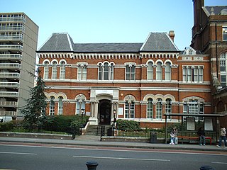
Newington is a district of South London, just south of the River Thames, and part of the London Borough of Southwark. It was an ancient parish and the site of the early administration of the county of Surrey. It was the location of the County of London Sessions House from 1917, in a building now occupied by the Inner London Crown Court.
The Metropolitan Borough of Southwark was a metropolitan borough in the County of London from 1900 to 1965. It was created to cover the western section of the ancient borough of Southwark and the parish of Newington. In common with the rest of inner London, the borough experienced a steady decline in population throughout its existence. The borough council made an unsuccessful attempt to gain city status in 1955. Its former area is now the northwestern part of the current London Borough of Southwark.

The Metropolitan Borough of Bermondsey was a Metropolitan borough in the County of London, created in 1900 by the London Government Act 1899. It was abolished and its area became part of the London Borough of Southwark in 1965.
The County of London was a county of England from 1889 to 1965, corresponding to the area known today as Inner London. It was created as part of the general introduction of elected county government in England, by way of the Local Government Act 1888. The Act created an administrative County of London, which included within its territory the City of London. However, the City of London and the County of London formed separate ceremonial counties for "non-administrative" purposes. The local authority for the county was the London County Council (LCC), which initially performed only a limited range of functions, but gained further powers during its 76-year existence. The LCC provided very few services within the City of London, where the ancient Corporation monopolised local governance. In 1900, the lower-tier civil parishes and district boards were replaced with 28 new metropolitan boroughs. The territory of the county was 74,903 acres (303.12 km2) in 1961. During its existence there was a long-term decline in population as more residents moved into the outer suburbs; there were periodic reviews of the local government structures in the greater London area and several failed attempts to expand the boundaries of the county. In 1965, the London Government Act 1963 replaced the county with the much larger Greater London administrative area.

Lambeth was a civil parish and metropolitan borough in south London, England. It was an ancient parish in the county of Surrey. The parish was included in the area of responsibility of the Metropolitan Board of Works in 1855 and became part of the County of London in 1889. The parish of Lambeth became a metropolitan borough in 1900, following the London Government Act 1899, with the parish vestry replaced by a borough council.

Battersea was a civil parish and metropolitan borough in the County of London, England. In 1965, the borough was abolished and its area combined with parts of the Metropolitan Borough of Wandsworth to form the London Borough of Wandsworth. The borough was administered from Battersea Town Hall on Lavender Hill. That building is now Battersea Arts Centre.
The Metropolis Management Act 1855 was an Act of the Parliament of the United Kingdom that created the Metropolitan Board of Works, a London-wide body to co-ordinate the construction of the city's infrastructure. The Act also created a second tier of local government consisting of parish vestries and district boards of works. The Metropolitan Board of Works was the forerunner of the London County Council.

Southwark St John Horsleydown was a small parish on the south bank of the River Thames in London, opposite the Tower of London. The name Horsleydown, apparently derived from the "horse lie-down" next to the river, is no longer used. The parish was created by splitting St Olave's parish in 1733.
Bermondsey was a parish in the metropolitan area of London, England.

Brixton Hundred or the Hundred of Brixton was for many centuries a group of parishes (hundred) used for meetings and taxation of their respective great estates in the north east of the county of Surrey, England. Its area has been entirely absorbed by the growth of London; with its name currently referring to the Brixton district. Its area corresponds to London Boroughs: Southwark, Lambeth, Wandsworth and parts of Lewisham, Merton and Richmond upon Thames.

Strand was a local government district within the metropolitan area of London, England, from 1855 to 1900.
Southwark St George the Martyr was a civil parish in the metropolitan area of London, England and part of the ancient Borough of Southwark. In 1855 the parish vestry became a local authority within the area of responsibility of the Metropolitan Board of Works. It became part of the Metropolitan Borough of Southwark in 1900 and was abolished as a civil parish in 1930.

Southwark St Saviour was a civil parish in the metropolitan area of London, England, and part of the ancient Borough of Southwark. It was formed in 1541 from the union of the parishes of St Margaret and St Mary. It was abolished in 1930, however residents of the former parish receive a rebate against local taxation because of the presence of Borough Market. It included the Liberty of the Clink which was a special jurisdiction until 1889.
Christchurch was a civil parish in the metropolitan area of London, England. It was located south of the River Thames straddling either side of Blackfriars Road. It originated as the manor of Paris Garden in the parish of St Margaret, Southwark. The parish of St Margaret was replaced by St Saviour in 1541 and then in 1670 the area was split off as a parish in its own right when Christ Church was constructed. It was prone to flooding and was not heavily built upon until after 1809. In 1855 the parish was included in the metropolitan area of London where local government was reformed. The parish was united with St Saviour to form part of the St Saviour's District. When the district was abolished in 1900 the parish became part of the Metropolitan Borough of Southwark. It was abolished as a civil parish in 1930. The area now forms the northwestern part of the London Borough of Southwark.

St Olave's Church, Southwark was a church in Southwark, England which is believed to be mentioned in the Domesday Book. It was located on Tooley Street which is named after the church, i.e. 't'olous'. It became redundant in 1926 and was demolished. It is now the location of St Olaf House, which houses part of the London Bridge Hospital.
St Saviour's was a local government district within the metropolitan area of London, England from 1855 to 1900. It was formed by the Metropolis Management Act 1855 and was governed by the St Saviour's District Board of Works, which consisted of elected vestrymen.

Southwark St Olave was an ancient civil and ecclesiastical parish on the south bank of the River Thames, covering the area around where Shard London Bridge now stands in the modern London Borough of Southwark. The boundaries varied over time but in general the parish stretched east from London Bridge past Tower Bridge to St Saviour's Dock. Southwark St Olave and St Thomas replaced the civil parish in 1896. It was abolished in 1904 and absorbed by Bermondsey parish.

Woolwich, also known as Woolwich St Mary, was an ancient parish containing the town of Woolwich on the south bank of the Thames and North Woolwich on the north bank. The parish was governed by its vestry from the 16th century to 1852, based in the Church of St Mary until 1842, after which in the purpose-built Woolwich Town Hall. The parish adopted the Public Health Act 1848 and was governed by the Woolwich Local Board of Health from 1852. When the parish became part of the district of the Metropolitan Board of Works in 1855 the local board was treated as if it were an incorporated vestry. It was in the county of Kent until it was transferred to London in 1889. In 1900 it was amalgamated with other parishes to form the Metropolitan Borough of Woolwich and had only nominal existence until it was abolished as a civil parish in 1930. Since 1965 it has been split between the Royal Borough of Greenwich and the London Borough of Newham.

Deptford St Nicholas was a civil parish in the metropolitan area of London, England. The creation of the parish accompanied the building of the Church of St Paul's, Deptford, constructed by the Commission for Building Fifty New Churches to meet the demands of the growing population. The ancient parish of Deptford was split in 1730 with the southern part around the new church becoming Deptford St Paul. St Nicholas parish included the old maritime settlement and the dockyard adjacent to the River Thames. Civil parish administration was in the hands of the vestry until 1855 when the parish was grouped into the Greenwich District and the parish elected vestrymen to Greenwich District Board of Works. The parish was transferred from the County of Kent to the County of London in 1889. It became part of the Metropolitan Borough of Greenwich in 1900 and the local authority became Greenwich Borough Council. The civil parish had only nominal existence until 1930 when it was abolished. The area became part of the London Borough of Greenwich in 1965 and following boundary changes in 1994, part of the former parish is now in the London Borough of Lewisham.

