The London Borough of Islington is a London borough which forms part of Inner London, England. Islington has an estimated population of 215,667. It was formed in 1965, under the London Government Act 1963, by the amalgamation of the metropolitan boroughs of Islington and Finsbury.

Holborn, an area in central London, covers the south-eastern part of the London Borough of Camden and a part of the Ward of Farringdon Without in the City of London.

The County of London was a county of England from 1889 to 1965, corresponding to the area known today as Inner London. It was created as part of the general introduction of elected county government in England, by way of the Local Government Act 1888. The Act created an administrative County of London, which included within its territory the City of London. However, the City of London and the County of London formed separate ceremonial counties for "non-administrative" purposes. The local authority for the county was the London County Council (LCC), which initially performed only a limited range of functions, but gained further powers during its 76-year existence. The LCC provided very few services within the City of London, where the ancient Corporation monopolised local governance. In 1900, the lower-tier civil parishes and district boards were replaced with 28 new metropolitan boroughs. The territory of the county was 74,903 acres (303.12 km2) in 1961. During its existence, there was a long-term decline in population as more residents moved into the outer suburbs; there were periodic reviews of the local government structures in the greater London area and several failed attempts to expand the boundaries of the county. In 1965, the London Government Act 1963 replaced the county with the much larger Greater London administrative area.

St Pancras was a civil parish and metropolitan borough in London, England. It was an ancient parish in the county of Middlesex, governed by an administrative vestry. The parish was included in the area of responsibility of the Metropolitan Board of Works in 1855 and became part of the County of London in 1889. The parish of St Pancras became a metropolitan borough in 1900, following the London Government Act 1899, with the parish vestry replaced by a borough council. In 1965 the borough was abolished and its former area became part of the London Borough of Camden in Greater London.

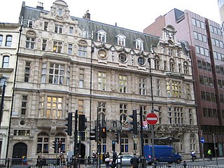
The Metropolitan Borough of Holborn was a metropolitan borough in the County of London between 1900 and 1965. The borough included most of Holborn as well as Bloomsbury and St Giles.

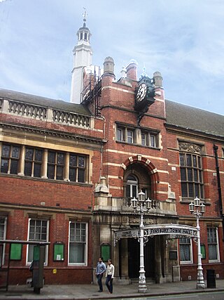
The Metropolitan Borough of Finsbury was a metropolitan borough within the County of London from 1900 to 1965, when it was amalgamated with the Metropolitan Borough of Islington to form the London Borough of Islington.

Islington was a civil parish and metropolitan borough in London, England. It was an ancient parish within the county of Middlesex, and formed part of The Metropolis from 1855. The parish was transferred to the County of London in 1889 and became a metropolitan borough in 1900. It was amalgamated with the Metropolitan Borough of Finsbury to form the London Borough of Islington in Greater London in 1965.

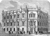
Battersea was a civil parish and metropolitan borough in the County of London, England. In 1965, the borough was abolished and its area combined with parts of the Metropolitan Borough of Wandsworth to form the London Borough of Wandsworth. The borough was administered from Battersea Town Hall on Lavender Hill. That building is now Battersea Arts Centre.

The London Government Act 1899 was an act of the Parliament of the United Kingdom that reformed the administration of the capital. The act divided the County of London into 28 metropolitan boroughs, replacing the 42 local authorities administering the area. The legislation also transferred a few powers from the London County Council to the boroughs, and removed a number of boundary anomalies. The first elections to the new boroughs were held on 1 November 1900.

The Metropolis Management Act 1855 was an act of the Parliament of the United Kingdom that created the Metropolitan Board of Works, a London-wide body to co-ordinate the construction of the city's infrastructure. The act also created a second tier of local government consisting of parish vestries and district boards of works. The Metropolitan Board of Works was the forerunner of the London County Council.
The Finsbury Division was one of four divisions of the Hundred of Ossulstone, in the historic county of Middlesex, England. The area of the Finsbury Division is now the core of modern north London. The other divisions were named Holborn, Kensington and Tower. Ossulstone hundred was divided in the seventeenth century, with each of the four divisions replacing the hundred for most administrative purposes.
The parliamentary borough of Finsbury was a constituency of the House of Commons of the UK Parliament from 1832 to 1885, and from 1918 to 1950. The constituency was first created in 1832 as one of seven two-seat "metropolis" parliamentary boroughs other than the two which already existed: Westminster and the City of London; the latter until 1885 retained an exceptional four seats. Finsbury was directly north of the City of London and was smaller than the Finsbury division of the Ossulstone hundred but took in land of Holborn division to its southwest in pre-introduction changes by Boundary Commissioners. It included Finsbury, Holborn, Moorfields, Clerkenwell, Islington, Stoke Newington and historic St Pancras. The 1918 constituency corresponded to the smaller Metropolitan Borough of Finsbury ; it was a seat, thus electing a single member, fulfilling a longstanding aim of Chartism which underscored the 1832 reforms.

Strand was a local government district within the metropolitan area of London, England, from 1855 to 1900.

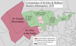
St Giles District was a local government district in the metropolitan area of London, England from 1855 to 1900. The district was created by the Metropolis Management Act 1855, and comprised the civil parish of St Giles in the Fields and St George Bloomsbury, Middlesex: the two parishes had been combined for civil purposes in 1774. The district was abolished in 1900 and its former area became part of the Metropolitan Borough of Holborn. The civil parish was abolished in 1930. It is now part of the London Borough of Camden.

The London Borough of Camden is a borough in Inner London, England. Camden Town Hall, on Euston Road, lies 1.4 mi (2.3 km) north of Charing Cross. The borough was established on 1 April 1965 from the former metropolitan boroughs of Holborn, St Pancras and Hampstead.

Woolwich, also known as Woolwich St Mary, was an ancient parish containing the town of Woolwich on the south bank of the Thames and North Woolwich on the north bank. The parish was governed by its vestry from the 16th century to 1852, based in the Church of St Mary until 1842, after which in the purpose-built Woolwich Town Hall. The parish adopted the Public Health Act 1848 and was governed by the Woolwich Local Board of Health from 1852. When the parish became part of the district of the Metropolitan Board of Works in 1855 the local board was treated as if it were an incorporated vestry. It was in the county of Kent until it was transferred to London in 1889. In 1900 it was amalgamated with other parishes to form the Metropolitan Borough of Woolwich and had only nominal existence until it was abolished as a civil parish in 1930. Since 1965 it has been split between the Royal Borough of Greenwich and the London Borough of Newham.

The Liberty of Glasshouse Yard was an extra-parochial liberty adjacent to the City of London. The liberty took its name from a glass manufacturing works established there. The area now forms part of the London Borough of Islington.

Saffron Hill, Hatton Garden, Ely Rents and Ely Place was a liberty and from 1866 to 1930 a civil parish in the metropolitan area of London, England. It was part of the ancient parish of St Andrew Holborn.

The Metropolis Management Amendment Act 1885 was an act of the Parliament of the United Kingdom that amended the Metropolis Management Act 1855 and other Metropolis Management Acts.


