Southwark St George the Martyr was a civil parish in the metropolitan area of London, England and part of the ancient Borough of Southwark. In 1855 the parish vestry became a local authority within the area of responsibility of the Metropolitan Board of Works. It became part of the Metropolitan Borough of Southwark in 1900 and was abolished as a civil parish in 1930.[1]
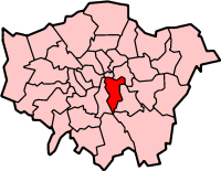
A map showing the St George the Martyr wards of Southwark Metropolitan Borough as they appeared in 1916.
Governance
In 1855 the parish vestry became a local authority within the area of responsibility of the Metropolitan Board of Works.
Under the Metropolis Management Act 1855 any parish that exceeded 2,000 ratepayers was to be divided into wards; as such the incorporated vestry of St George the Martyr was divided into three wards (electing vestrymen): No. 1 or St Michael (18), No. 2 or St Paul (15) and No. 3 or St George (15).[3][4]
It became part of the Metropolitan Borough of Southwark in 1900 and the vestry was abolished, replaced by the Southwark Metropolitan Borough Council. The civil parish was abolished in 1930.[1]
Ecclesiastical parish
The ancient parish, dedicated to St George, was in the Diocese of Winchester until 1877, then the Diocese of Rochester until 1905, and then finally in the Diocese of Southwark. From 1843, as housing increased and moreover the population of Southwark St George the Martyr increased rapidly, six small parishes taking over most of its population were created:[5]
This page is based on this Wikipedia article Text is available under the CC BY-SA 4.0 license; additional terms may apply. Images, videos and audio are available under their respective licenses.