Bermondsey (parish)

Last updated

Bermondsey
St Mary Magdalen
Ancient parish
Area
  1851688 acres (2.78 km2) [1]
  1901626 acres (2.53 km2) [1]
Population
  180117,169 [1]
  185148,128 [1]
  190182,483 [1]
Density
  185170/acre
  1901132/acre
History
  OriginAncient parish
  Abolished1965
  Succeeded byCoterminous with Metropolitan Borough of Bermondsey from 1904
Replaced by London Borough of Southwark
Status Civil parish
GovernmentVestry of the Parish of Bermondsey (1855—1900)
   HQ Vestry Hall, Spa Road

Bermondsey (also known as St. Mary Magdalen, Bermondsey) was a parish in the metropolitan area of London, England.

Contents

The ancient parish was part of Hundred of Brixton and County of Surrey. In 1855, it was included in the area of responsibility of the Metropolitan Board of Works (MBW). The act, establishing the MBW, also incorporated a new elected local authority for the parish known as The Vestry of the Parish of Bermondsey in the County of Surrey. [2]

The population of the parish in 1896 was 84,632, and it had adopted the Public Libraries Act 1850 in 1887. For electoral purposes, the parish was divided into four wards and had 120 elected vestrymen.

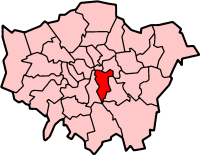
In 1889, the area of the Metropolitan Board was reconstituted as the County of London, and Bermondsey was transferred to the new county. In 1900, the County of London was divided into twenty-eight metropolitan boroughs. The parish became the core part of the Metropolitan Borough of Bermondsey, which also covered the parish of Rotherhithe, and the area of the St Olave's District Board of Works (consisting of the two parishes of Southwark St John Horsleydown and Southwark St Olave and St Thomas). A borough council replaced the vestries and board, and in 1904, all four parishes in the borough were merged as the single civil parish of Bermondsey. [3]

Ecclesiastical parish

The ancient parish, dedicated to St Mary Magdalene and centred on the church of St Mary Magdalen Bermondsey, was in the Diocese of Winchester until 1877, then the Diocese of Rochester until 1905, and then finally in the Diocese of Southwark. From 1840, as the population of Bermondsey increased, a number of new parishes were formed: [4]

In addition, as the population of neighbouring Camberwell increased, parts of Bermondsey parish were included in the new parish of

Politics

A map showing the wards of Bermondsey Metropolitan Borough as they appeared in 1916. Bermondsey Met. B Ward Map 1916.svg
A map showing the wards of Bermondsey Metropolitan Borough as they appeared in 1916.

Under the Metropolis Management Act 1855 any parish that exceeded 2,000 ratepayers was to be divided into wards; as such the incorporated vestry of St Mary Magdalen Bermondsey was divided into four wards (electing vestrymen): No. 1 (9), No. 2 (9), No. 3 (9) and No. 4 (9). [5] [6]

In 1894 as its population had increased the incorporated vestry was re-divided into six wards (electing vestrymen): No. 1 (21), No. 2 (24), No. 3 (21), No. 4 (21), No. 5 (18) and No. 6 (15). [7] [8]

Related Research Articles

<span class="mw-page-title-main">Southwark</span> District of Central London, England

Southwark is a district of Central London situated on the south bank of the River Thames, forming the north-western part of the wider modern London Borough of Southwark. The district, which is the oldest part of South London, developed due to its position at the southern end of the early versions of London Bridge, for centuries the only dry crossing on the river. Around 43 AD, engineers of the Roman Empire found the geographic features of the south bank here suitable for the placement and construction of the first bridge.

<span class="mw-page-title-main">Newington, London</span> Human settlement in England

Newington is a district of South London, just south of the River Thames, and part of the London Borough of Southwark. It was an ancient parish and the site of the early administration of the county of Surrey. It was the location of the County of London Sessions House from 1917, in a building now occupied by the Inner London Crown Court.

<span class="mw-page-title-main">Metropolitan Borough of Southwark</span>

The Metropolitan Borough of Southwark was a metropolitan borough in the County of London from 1900 to 1965. It was created to cover the western section of the ancient borough of Southwark and the parish of Newington. In common with the rest of inner London, the borough experienced a steady decline in population throughout its existence. The borough council made an unsuccessful attempt to gain city status in 1955. Its former area is now the northwestern part of the current London Borough of Southwark.

<span class="mw-page-title-main">Metropolitan Borough of Camberwell</span> Former Metropolitan Borough in England

Camberwell was a civil parish and metropolitan borough in south London, England. Camberwell was an ancient parish in the county of Surrey, governed by an administrative vestry from 1674. The parish was included in the area of responsibility of the Metropolitan Board of Works in 1855 and became part of the County of London in 1889. The parish of Camberwell became a metropolitan borough in 1900, following the London Government Act 1899, with the parish vestry replaced by a borough council. In 1965 the borough was abolished and its former area became part of the London Borough of Southwark in Greater London.

<span class="mw-page-title-main">Metropolitan Borough of Bermondsey</span>

The Metropolitan Borough of Bermondsey was a Metropolitan borough in the County of London, created in 1900 by the London Government Act 1899. It was abolished and its area became part of the London Borough of Southwark in 1965.

<span class="mw-page-title-main">Metropolitan Borough of Lambeth</span> Metropolitan borough of England

Lambeth was a civil parish and metropolitan borough in south London, England. It was an ancient parish in the county of Surrey. The parish was included in the area of responsibility of the Metropolitan Board of Works in 1855 and became part of the County of London in 1889. The parish of Lambeth became a metropolitan borough in 1900, following the London Government Act 1899, with the parish vestry replaced by a borough council.

<span class="mw-page-title-main">Metropolitan Borough of Hampstead</span> Former local authority in London

Hampstead was a civil parish and metropolitan borough in London, England. It was an ancient parish in the county of Middlesex, governed by an administrative vestry. The parish was included in the area of responsibility of the Metropolitan Board of Works in 1855 and became part of the County of London in 1889. The parish of Hampstead became a metropolitan borough in 1900, following the London Government Act 1899, with the parish vestry replaced by a borough council. In 1965 the borough was abolished and its former area became part of the London Borough of Camden in Greater London.

<span class="mw-page-title-main">Metropolitan Borough of Islington</span> Former local authority of London, England

Islington was a civil parish and metropolitan borough in London, England. It was an ancient parish within the county of Middlesex, and formed part of The Metropolis from 1855. The parish was transferred to the County of London in 1889 and became a metropolitan borough in 1900. It was amalgamated with the Metropolitan Borough of Finsbury to form the London Borough of Islington in Greater London in 1965.

<span class="mw-page-title-main">Metropolitan Borough of Chelsea</span> Former borough of London

The Metropolitan Borough of Chelsea was a metropolitan borough of the County of London between 1900 and 1965. It was created by the London Government Act 1899 from most of the ancient parish of Chelsea. Following the London Government Act 1963, it was amalgamated with the Royal Borough of Kensington in 1965 to form the Royal Borough of Kensington and Chelsea.

<span class="mw-page-title-main">Metropolitan Borough of Battersea</span>

Battersea was a civil parish and metropolitan borough in the County of London, England. In 1965, the borough was abolished and its area combined with parts of the Metropolitan Borough of Wandsworth to form the London Borough of Wandsworth. The borough was administered from Battersea Town Hall on Lavender Hill. That building is now Battersea Arts Centre.

<span class="mw-page-title-main">Metropolitan Borough of Poplar</span> Former metropolitan borough of the County of London, in the United Kingdom

Poplar was a local government district in the metropolitan area of London, England. It was formed as a district of the Metropolis in 1855 and became a metropolitan borough in the County of London in 1900. It comprised Poplar, Millwall, Bromley-by-Bow and Bow as well as Old Ford, Fish Island and Cubitt Town.

<span class="mw-page-title-main">Hackney (parish)</span>

Hackney was a parish in the historic county of Middlesex. The parish church of St John-at-Hackney was built in 1789, replacing the nearby former 16th-century parish church dedicated to St Augustine. The original tower of that church was retained to hold the bells until the new church could be strengthened; the bells were finally removed to the new St John's in 1854. See details of other, more modern, churches within the original parish boundaries below.

<span class="mw-page-title-main">Hundred of Brixton</span> Historic area of London

Brixton Hundred or the Hundred of Brixton was for many centuries a group of parishes (hundred) used for meetings and taxation of their respective great estates in the north east of the county of Surrey, England. Its area has been entirely absorbed by the growth of London; with its name currently referring to the Brixton district. Its area corresponds to London Boroughs: Southwark, Lambeth, Wandsworth and parts of Lewisham, Merton and Richmond upon Thames.

<span class="mw-page-title-main">Southwark St George the Martyr</span>

Southwark St George the Martyr was a civil parish in the metropolitan area of London, England and part of the ancient Borough of Southwark. In 1855 the parish vestry became a local authority within the area of responsibility of the Metropolitan Board of Works. It became part of the Metropolitan Borough of Southwark in 1900 and was abolished as a civil parish in 1930.

Plumstead (1855–1894) and then Lee (1894–1900) was a local government district within the metropolitan area of London from 1855 to 1900. It was formed as the Plumstead district by the Metropolis Management Act 1855 and was governed by the Plumstead District Board of Works, which consisted of elected vestrymen.

<span class="mw-page-title-main">Greenwich District (Metropolis)</span>

Greenwich was a local government district within the metropolitan area of London, England from 1855 to 1900. It was formed by the Metropolis Management Act 1855 and was governed by the Greenwich District Board of Works, which consisted of elected vestrymen.

Hackney was a local government district within the metropolitan area of London, England from 1855 to 1894. It was formed by the Metropolis Management Act 1855 and was governed by the Hackney District Board of Works, which consisted of elected vestrymen. It was in the part of the county of Middlesex that was within the area of the Metropolitan Board of Works. In 1889 it became part of the County of London and the district board functioned as a local authority under the London County Council.

<span class="mw-page-title-main">Whitechapel District (Metropolis)</span>

Whitechapel was a local government district within the metropolitan area of London, England from 1855 to 1900.

<span class="mw-page-title-main">St Saviour's District (Metropolis)</span>

St Saviour's was a local government district within the metropolitan area of London, England from 1855 to 1900. It was formed by the Metropolis Management Act 1855 and was governed by the St Saviour's District Board of Works, which consisted of elected vestrymen.

<span class="mw-page-title-main">St Olave District (Metropolis)</span>

St Olave was a local government district within the metropolitan area of London, England from 1855 to 1900. It was formed by the Metropolis Management Act 1855 and was governed by the St Olave District Board of Works, which consisted of elected vestrymen.

References

  1. 1 2 3 4 5 Vision of Britain - Bermondsey population (area and density Archived April 10, 2009, at the Wayback Machine )
  2. 18 & 19 Vict. c.120, S.42
  3. F A Youngs Jr., Guide to the Local Administrative Units of England, Volume I: Southern England, London, 1978
  4. , 'Parishes: Bermondsey', A History of the County of Surrey: Volume 4 (1912), pp. 17-24. Date accessed: 10 March 2014.
  5. The London Gazette Issue: 21802. 20 October 1855. pp. 3894–3895. Retrieved 8 April 2015.
  6. "H.M.S.O. Boundary Commission Report 1885 Southwark Map". Vision of Britain. Retrieved 8 April 2015.
  7. The London Gazette Issue: 26526. 26 June 1894. p. 3668. Retrieved 8 April 2015.
  8. The London Gazette Issue: 26548. 4 September 1894. pp. 5149–5150. Retrieved 8 April 2015.

51°29′31″N0°03′54″W / 51.492°N 0.065°W / 51.492; -0.065