Related Research Articles

Weld County is a county located in the U.S. state of Colorado. As of the 2020 census, the population was 328,981. The county seat is Greeley.

The Town of Erie is a Statutory Town located in Boulder and Weld counties, Colorado, United States. The town population was 30,038 at the 2020 United States Census, a +65.64% increase since the 2010 United States Census. Erie is a part of the Denver-Aurora, CO Combined Statistical Area and the Front Range Urban Corridor.
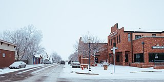
Frederick is a Statutory Town in Weld County, Colorado, United States. The population was 8,709 at the 2010 census.

The Laramie Formation is a geologic formation of Late Cretaceous (Maastrichtian) age, named by Clarence King in 1876 for exposures in northeastern Colorado, in the United States. It was deposited on a coastal plain and in coastal swamps that flanked the Western Interior Seaway. It contains coal, clay and uranium deposits, as well as plant and animal fossils, including dinosaur remains.

St. Vrain State Park, formerly known as Barbour Ponds is a Colorado state park. The park hosts year-round camping. It is a popular birding destination, hosting the states largest rookery of Blue Heron, it is home to several other bird species as well including migrating waterfowl, songbirds and the occasional bald eagle. Other park activities include year round fishing and hiking. There are plans for a reservoir to be built at the park named Blue Heron Reservoir.

Leyner is an unincorporated community and a census-designated place (CDP) located in and governed by Boulder County, Colorado, United States. The CDP is a part of the Boulder, CO Metropolitan Statistical Area. The population of the Leyner CDP was 29 at the United States Census 2010. The Lafayette post office serves the area.

Pikeview is a neighborhood of Colorado Springs, annexed to the city as the "Pike View Addition" on August 1, 1962. In 1896 there was a Denver and Rio Grande Western Railroad station in Pikeview, and miners had begun digging a shaft for the Pikeview Coal Mine. Pikeview also had a quarry beginning 1905 for the mining of limestone for concrete. Coal mining ended in 1957, but the Pikeview Quarry continues to operate. Quarry operations, though, have created a gash or scar in the landscape and efforts have been made since the late 1980s to reclaim the hillside landscape. The Greg Francis Bighorn Sheep Habitat in what had been Queens Canyon Quarry was founded in 2003 in recognition of the individuals and organizations that have worked to create a nature hillside habitat.
Masters is an extinct town in Weld County, in the U.S. state of Colorado. The GNIS classifies it as a populated place.
In the mid-19th century, Colorado Springs was a center of mining industry activity. Coal was mined in 50 mines in the area and towns, now annexed to Colorado Springs, were established to support residents of the coal mining industry.
Liggett is an unincorporated community in Boulder County, Colorado, United States. It is to the northwest of Lafayette.
Tabor is an unincorporated community in Boulder County, in the U.S. state of Colorado.
Yoxall is a ghost town in Weld County, in the U.S. state of Colorado.
Sligo is a ghost town in Weld County, in the U.S. state of Colorado.
Dick is a ghost town in Weld County, in the U.S. state of Colorado.
References
- ↑ United States Geological Survey (1940). TopoView - Derby, Colorado (Map). United States Department of the Interior. Retrieved September 7, 2021.
- 1 2 "Postal History. Jim Forte Postal History" . Retrieved September 8, 2021.
- ↑ Fraser, Clayton, B. (August 31, 1997), The History and Evolution of Colorado's Railroads: 1858-1948 (PDF), Loveland: United States Department of the Interior, p. 101
- ↑ United States Geological Survey (1950). Frederick Quadrangle, Colorado (Map). United States Department of the Interior. Retrieved September 7, 2021.
- ↑ Roberts, S., Hynes, L. Woodward, C. (November 30, 2016). Map Showing the Extent of Mining, Locations of Mine Shafts, Adits, Air Shafts, and Bedrock Faults, and Thickness of Overburden Above Abandoned Coal Mines in the Boulder-Weld Coal Field, Boulder, Weld, and Adams Counties, Colorado (PDF) (Map). United States Geological Survey. § Geologic Investigations Series I-2735. Retrieved September 8, 2021.CS1 maint: multiple names: authors list (link)
- ↑ United States Geological Survey (1967). Brighton Quadrangle, Colorado (Map). United States Department of the Interior. Retrieved September 7, 2021.
- ↑ United States Geological Survey (1994). Frederick Quadrangle, Colorado (Map). United States Department of the Interior. Retrieved September 7, 2021.
- ↑ Campbell, Rachel; Gardner, Derrick (October 23, 2012). "Union Pacific Railroad Company-Abandonment Exemption-in Adams, Weld and Boulder Counties, Colorado". Federal Register. Retrieved September 8, 2021.
- ↑ North Metro Corridor - Final Environmental Impact Statement and Final Section 4(f) Evaluation - Executive Summary (PDF), Regional Transportation District, January 2010, p. 6
Municipalities and communities of Weld County, Colorado, United States | ||
|---|---|---|
| Cities |  | |
| Towns | ||
| CDPs | ||
| Unincorporated communities | ||
| Ghost towns | ||
| Footnotes | ‡This populated place also has portions in an adjacent county or counties | |