
The Town of Erie is a Statutory Town located in Weld and Boulder counties, Colorado, United States. The town population was 30,038 at the 2020 United States Census, a +65.64% increase since the 2010 United States Census. At the 2020 census, 17,387 (58%) Erie residents lived in Weld County and 12,651 (42%) lived in Boulder County. Erie is a part of the Denver-Aurora, CO Combined Statistical Area and the Front Range Urban Corridor.
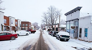
The City of Lafayette is a home rule municipality located in southeastern Boulder County, Colorado, United States. The city population was 24,453 at the 2010 United States Census.

The Laramie Formation is a geologic formation of Late Cretaceous (Maastrichtian) age, named by Clarence King in 1876 for exposures in northeastern Colorado, in the United States. It was deposited on a coastal plain and in coastal swamps that flanked the Western Interior Seaway. It contains coal, clay and uranium deposits, as well as plant and animal fossils, including dinosaur remains.

The National Mine Map Repository (NMMR) is part of the United States Department of the Interior (DOI), Office of Surface Mining Reclamation and Enforcement. The NMMR resides in the Pittsburgh suburb of Green Tree, Pennsylvania, and collects and maintains mine map information and images for the entire country, including data and maps of coal mines in the anthracite coal region of northeastern Pennsylvania. The Green Tree facility provides and stores, digitally and in microfilm, over 182,000 maps of abandoned mines. This repository contains maps of mine workings from the 1790s to the present day. It serves as a point of reference for mine maps and other information for both surface and underground mines throughout the United States. It also serves as a location to retrieve mine maps in an emergency. The NMMR provides services ranging from retrieving mine related data for economic analysis to assessing the potential risk associated with underground mining. Through analysis of mine maps and related information, the repository assists private and public sectors in industrial and commercial development, highway construction, and the preservation of public health, safety, and welfare. In addition, they collect, reproduce, and maintain a national inventory of mine maps and supporting documentation for private and public interests.

The United States Geological Survey, abbreviated USGS and formerly simply known as the Geological Survey, is a scientific agency of the United States government. The scientists of the USGS study the landscape of the United States, its natural resources, and the natural hazards that threaten it. The organization's work spans the disciplines of biology, geography, geology, and hydrology. The USGS is a fact-finding research organization with no regulatory responsibility.

Leyner is an unincorporated community and a census-designated place (CDP) located in and governed by Boulder County, Colorado, United States. The CDP is a part of the Boulder, CO Metropolitan Statistical Area. The population of the Leyner CDP was 29 at the United States Census 2010. The Lafayette post office serves the area.
Horse Creek is a tributary of Goose Creek river in Clay County in the U.S. state of Kentucky. The Cumberland and Manchester Railway built a spur line up the creek, and it has been the site of operations of at least eight coal mining companies. The name comes, according to local tradition, from the proliferation of "horseweed" in the creek valley.

Pikeview is a neighborhood of Colorado Springs, annexed to the city as the "Pike View Addition" on August 1, 1962. In 1896 there was a Denver and Rio Grande Western Railroad station in Pikeview, and miners had begun digging a shaft for the Pikeview Coal Mine. Pikeview also had a quarry beginning 1905 for the mining of limestone for concrete. Coal mining ended in 1957, but the Pikeview Quarry continues to operate. Quarry operations, though, have created a gash or scar in the landscape and efforts have been made since the late 1980s to reclaim the hillside landscape. The Greg Francis Bighorn Sheep Habitat in what had been Queens Canyon Quarry was founded in 2003 in recognition of the individuals and organizations that have worked to create a nature hillside habitat.
McCauley Mountain is a mountain in Columbia County, Pennsylvania, in the United States. Its official elevation is 1,571 feet (479 m) above sea level. The mountain is a synclinal mountain. Main rock formations on and near it include the Mauch Chunk Formation and the Pottsville Formation. There are also coal deposits on it. The coal deposits were discovered in 1826 and mining of them began in the 1850s. However, coal mining on the east side of the mountain proved to be a commercial failure. There are a number of ponds on the mountain, some of which were created during the mining. However, others are natural vernal pools. Some of the ponds are surrounded by hemlocks and deciduous trees. Major streams near the mountain include Scotch Run, Beaver Run, and Catawissa Creek. The mountain is named after Alexander McCauley, who settled there in 1774.
Masters is an extinct town in Weld County, in the U.S. state of Colorado. The GNIS classifies it as a populated place.

Gooding is an unincorporated community in Boulder County, Colorado, United States.
In the mid-19th century, Colorado Springs was a center of mining industry activity. Coal was mined in 50 mines in the area and towns, now annexed to Colorado Springs, were established to support residents of the coal mining industry.
Liggett is an unincorporated community in Boulder County, Colorado, United States. It is to the northwest of Lafayette.
Tabor is an unincorporated community in Boulder County, in the U.S. state of Colorado.
St Vrains is a ghost town in Weld County, in the U.S. state of Colorado.
Dick is a ghost town in Weld County, in the U.S. state of Colorado.
