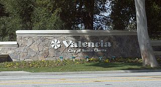
Valencia is a neighborhood in Santa Clarita located within Los Angeles County, California. It is one of the four unincorporated communities that merged to create the city of Santa Clarita in 1987. It is situated in the western part of Santa Clarita, stretching from Lyons Avenue to the south to north of Copper Hill Drive, and from Interstate 5 east to Bouquet Canyon and Seco Canyon Roads. Valencia was founded as a master-planned community with the first development, Old Orchard I, built on Lyons Avenue behind Old Orchard Elementary School.
The Millionaires' Mile, Millionaires' Row, Billionaires Row, Golden Mile or Alpha Street are the exclusive residential neighborhoods of various cities, often along one scenic strip such as a riverside or hilltop drive, or a wide city boulevard.
SouthPark is an area edge city in Charlotte, North Carolina, United States. Its name is derived from the upscale SouthPark Mall, which opened on February 12, 1970. At nearly 1.8 million square feet, SouthPark Mall is the largest shopping mall in Charlotte and all of the Carolinas. The area is geographically centered at the intersection of Fairview Road and Sharon Road in the south central sector of the city, about six miles south of Uptown Charlotte. In addition to being home to the mall, SouthPark is also a residential area and one of the larger business districts in Charlotte.

The neighborhoods of Milwaukee include a number of areas in southeastern Wisconsin within the state's largest city at nearly 600,000 residents.
Columbus, the state capital and Ohio's largest city, has numerous neighborhoods within its city limits. Neighborhood names and boundaries are not officially defined. They may vary or change from time to time due to demographic and economic variables.

Archdale is a light rail station in Charlotte, North Carolina. The elevated island platform is a stop along the Lynx Blue Line and serves Montclaire South and nearby Montclaire and Starmount neighborhoods. It also features a 432-space park and ride and local bus connections.

U.S. Route 1 (US 1) is a major north–south U.S. Route, extending from Key West, Florida, in the south to Fort Kent, Maine, at the Canada–United States border in the north. In the U.S. state of Pennsylvania, US 1 runs for 81 miles (130 km) from the Maryland state line near Nottingham northeast to the New Jersey state line at the Delaware River in Morrisville, through the southeastern portion of the state. The route runs southwest to northeast and serves as a major arterial road through the city of Philadelphia and for many of the suburbs in the Delaware Valley metropolitan area. South of Philadelphia, the road mostly follows the alignment of the Baltimore Pike. Within Philadelphia, it mostly follows Roosevelt Boulevard. North of Philadelphia, US 1 parallels the route of the Lincoln Highway. Several portions of US 1 in Pennsylvania are freeways, including from near the Maryland state line to Kennett Square, the bypass of Media, the concurrency with Interstate 76 and the Roosevelt Expressway in Philadelphia, and between Bensalem Township and the New Jersey state line.
Steele Creek is primarily considered to be a community and neighborhood in the southwestern part of Mecklenburg County in North Carolina. It is generally defined geographically by the original boundaries of Steele Creek Township. Most of Steele Creek is within the city limits of Charlotte but the areas that have not yet been annexed are also recognized as a Township of North Carolina.
Sedgefield is a neighborhood of Charlotte, North Carolina, United States. It is situated between Park Rd. and South Blvd and belongs to popular South End.
The Lynx Silver Line is a proposed east–west light rail line in Charlotte, North Carolina. The Silver Line would connect the outlying cities and towns of Belmont, Matthews, Stallings and Indian Trail to Uptown Charlotte and the Charlotte Douglas International Airport. In the refined locally preferred alternative (LPA), released in early 2021, the route is estimated to be around 29 miles (47 km), with 29 stations and one maintenance facility.

The city of Davenport, Iowa, United States has neighborhoods dating back to the 1840s. The Davenport Plan and Zoning Commission divided the city into five areas: downtown, central, east end, near north, and northwest and west end. The neighborhoods contain many architectural designs, including Victorian, Queen Anne, and Tudor Revival. Many of the original neighborhoods were first inhabited by German settlers.
Cherry Hill is a Roanoke, Virginia neighborhood located in far western Roanoke. It borders the neighborhoods of Ridgewood Park and Wilmont on the north, Greater Deyerle, Raleigh Court, Norwich and Hurt Park to the south and Shenandoah West on the east. The western border is shared with the city of Salem. Today the neighborhood is bisected by Virginia State Route 117 and is bordered by the Norfolk Southern Railway right of way on the south.
Holmby Hills is a neighborhood on the Westside of Los Angeles, California, United States.
The community of Forest Park consists of almost 2900 private residential properties, plus apartments, condominiums, commercial properties, city-owned parks and schools, in approximately 1.4 square miles (3.6 km2) of the Northland area of northeast Columbus, Ohio. These properties adjoin a total of 132 distinct streets and courts maintained by the City of Columbus. The community's approximate center is near the intersection of Karl Road and Sandalwood Place in Columbus.
Madison Park, a neighborhood in Charlotte, North Carolina, United States, is primarily made up of single-family and multi-family residential homes. It is commonly referred to as the Montford/Madison Park/Park Road Shopping Center area; acknowledged in a 2018 survey of more than 5,000 Charlotte residents. The zip-codes that make up Madison Park include 28217, 28210, and 28209. The neighborhood is located between South Boulevard, East Woodlawn Road, Park Road, and slightly extends beyond Tyvola Road. It has a Neighborhood Association, whereby the board of directors help determine the neighborhood boundaries.

The Kensington Boulevard Historic District is a historic district on the National Register of Historic Places in Fort Wayne, Indiana, added in 2019. The district contains more than 170 homes built between 1917 and 1955, with one home dating to approximately 1870. The boundaries of the district stretch from Niagara Drive along Maumee River in the south to East State Boulevard, its present northern boundary. To the west, it is bounded by the North Anthony Boulevard Historic District, and to the east, by Pemberton Drive. The entire length of this portion of Kengsington features esplanades planted with trees. The district was platted in two separate phases, the south phase in 1917 and the north phase in 1921, on a grid plan.

York Road, and recently referred to as Lower South End (LoSo) by redevelopers and businesses wanting to emulate the Charlotte neighborhoods of NoDa and South End, is a mixed-use development neighborhood of commercial, industrial, and residential in Charlotte, North Carolina. Located along South Tryon Street (NC 49), it is bounded by Woodlawn Road to the south, Bill Lee Freeway (I-77/US 21) to the west, Clanton Road to the north, and South Boulevard to the east.
There are several neighborhoods in the city of Pasadena, California
