Stibb (Cornish: Stok) [1] is a hamlet near Bude in Cornwall, England, United Kingdom. [2]
Stibb lies within the Cornwall Area of Outstanding Natural Beauty (AONB).

Stibb (Cornish: Stok) [1] is a hamlet near Bude in Cornwall, England, United Kingdom. [2]
Stibb lies within the Cornwall Area of Outstanding Natural Beauty (AONB).

North Cornwall is an area of Cornwall, England, United Kingdom. It is also the name of a former local government district, which was administered from Bodmin and Wadebridge 50.516°N 4.835°W. Other towns in the area are Launceston, Bude, Padstow, and Camelford.

Stibb Cross is a small village in north Devon, England. It is included in the civil parish of Langtree and is located about one mile from that village. Its population in 2001 was 677.

Maer is a coastal hamlet in north Cornwall, England, United Kingdom. It is situated one mile (1.6 km) northeast of Bude at grid reference SS 205 075 in the civil parish of Bude-Stratton.

North Cornwall is a constituency represented in the House of Commons of the UK Parliament by Scott Mann, a Conservative since the 2015 general election. Like all British constituencies, the seat elects one Member of Parliament (MP) by the first past the post system of election at least every five years. The seat was created in 1918. Since 1950, the constituency has been held by MPs from either the Conservative Party or the Liberal Democrats.

Bude–Stratton is a coastal civil parish with a town council in Cornwall, England, United Kingdom. According to the 2001 census it had a population of 9,242. In 2011 this population had increased to 9,934.

Morwenstow is a civil parish in north Cornwall, England, UK. The parish abuts the west coast, about six miles (10 km) north of Bude and within the Cornwall Area of Outstanding Natural Beauty (AONB).

Whitstone is a village and civil parish in east Cornwall, United Kingdom. It is roughly halfway between the towns of Bude and Launceston. The population at the 2011 census was 590.

Sandymouth is a beach three miles north of Bude in Cornwall, England, United Kingdom.
The Okehampton–Bude line was a railway line built to serve Holsworthy in Devon, and Bude on the Cornish coast near the Devon border in England. The line branched from the main line at Meldon Junction to the west of Okehampton on the northern edge of Dartmoor. The line opened in 1879 to Holsworthy and in 1898 to Bude. It is now closed.

North Tamerton is a village and civil parish in east Cornwall, England, UK. The village is situated approximately eight miles (13 km) southeast of Bude and eight miles (13 km) north of Launceston.

Otterham is a village and a civil parish in north Cornwall, England, United Kingdom. The village is situated approximately ten miles (16 km) south of Bude and six miles (9.7 km) north of Camelford.

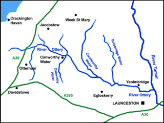
The River Ottery is a small river in northeast Cornwall, United Kingdom. The river is about twenty miles (32 km) long from its source southeast of Otterham to its confluence with the River Tamar at Nether Bridge, two miles (3.2 km) northeast of Launceston.

The De Lank River is a small river in north Cornwall, England. It is a tributary of the River Camel and is approximately nine miles (14.5 km) long from its source on Bodmin Moor to its confluence with the Camel two miles (3 km) south of St Breward.
Bush is a hamlet in the parish of Bude-Stratton, Cornwall, England, UK.

Eastcott is a hamlet 6 miles (9.7 km) north-east of Bude in Cornwall, England. The hamlet is 1 mile (1.6 km) east of Gooseham in the civil parish of Morwenstow and lies within the Cornwall Area of Outstanding Natural Beauty (AONB).

Grimscott is a village in north Cornwall, England, UK. It is situated in the civil parish of Launcells, 3 miles (4.8 km) east of the town of Bude.

Lynstone is a hamlet near Bude in north Cornwall, England. At the 2011 census the population at the 2011 census was included in the civil parish of Bude-Stratton.

Northcott is a hamlet in Cornwall, England. Northcott is north of Bude and on the coast close to Northcott Mouth.

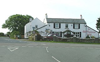
Wainhouse Corner is a hamlet in north Cornwall, England, United Kingdom. It is at a crossroads on the A39 main road, between Camelford and Bude. Canworthy Water and Crackington Haven are the destinations of the B road.
Lymsworthy Meadows is a Site of Special Scientific Interest (SSSI) in north Cornwall, England, UK, noted for its biological characteristics.
| Wikimedia Commons has media related to Stibb . |
Coordinates: 50°52′11″N4°31′22″W / 50.8696124°N 4.522766°W
| | This Cornwall location article is a stub. You can help Wikipedia by expanding it. |