South Africa occupies the southern tip of Africa, its coastline stretching more than 2,850 kilometres from the desert border with Namibia on the Atlantic (western) coast southwards around the tip of Africa and then northeast to the border with Mozambique on the Indian (eastern) coast. The low-lying coastal zone is narrow for much of that distance, soon giving way to a mountainous escarpment that separates the coast from the high inland plateau. In some places, notably the province of KwaZulu-Natal in the east, a greater distance separates the coast from the escarpment. Although much of the country is classified as semi-arid, it has considerable variation in climate as well as topography. The total land area is 1,220,813 km2 (471,359 sq mi). It has the 23rd largest Exclusive Economic Zone of 1,535,538 km2 (592,875 sq mi).

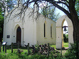
Dordrecht is a town situated in the Eastern Cape Province of South Africa. Dordrecht was founded in 1856 by Baron Smiddolff, a minister of the Dutch Reformed Church. The town was named for the city of the same name in the South-Western Netherlands and had a population of about 8,741 people in 2001.

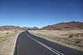
The Karoo is a semi-desert natural region of South Africa. No exact definition of what constitutes the Karoo is available, so its extent is also not precisely defined. The Karoo is partly defined by its topography, geology and climate, and above all, its low rainfall, arid air, cloudless skies, and extremes of heat and cold. The Karoo also hosted a well-preserved ecosystem hundreds of million years ago which is now represented by many fossils.

The R56 is a provincial route in South Africa that connects Middelburg with Pietermaritzburg via Molteno, Maclear and Kokstad. It is co-signed with the N2 between Kokstad and Stafford's Post for 39 kilometres.
Stutterheim is a town with a population of 46,730 in South Africa, situated in the Border region of the Eastern Cape province. It is named after Richard von Stutterheim.

Amatola, Amatole or Amathole are a range of densely forested mountains, situated in the Eastern Cape province of South Africa. The word Amathole means ‘calves’ in Xhosa, and Amathole District Municipality, which lies to the south, is named after these mountains.

The Karoo Supergroup is the most widespread stratigraphic unit in Africa south of the Kalahari Desert. The supergroup consists of a sequence of units, mostly of nonmarine origin, deposited between the Late Carboniferous and Early Jurassic, a period of about 120 million years.

The Great Escarpment is a major topographical feature in Africa that consists of steep slopes from the high central Southern African plateau downward in the direction of the oceans that surround southern Africa on three sides. While it lies predominantly within the borders of South Africa, in the east the escarpment extends northward to form the border between Mozambique and Zimbabwe, continuing on beyond the Zambezi river valley to form the Muchinga Escarpment in eastern Zambia. In the west, it extends northward into Namibia and Angola. It is the combination of this escarpment and the aridity of Southern Africa that leads to the lack of navigable rivers in South Africa.

Grabouw is a town located in the Western Cape province of South Africa.Grabouw is located some 65 km south-east of Cape Town, over Sir Lowry's Pass from Somerset West, along the N2 highway. The town is the commercial centre for the vast Elgin Valley, the largest single export fruit-producing area in Southern Africa, which extends between the Hottentots-Holland, Kogelberg, Groenland, and Houwhoek Mountains. The town's population has grown rapidly, with 44 593 people in 2019 from 21 593 as listed by the 2001 census.

Sir John Charles Molteno was a politician and businessman who served as the first Prime Minister of the Cape Colony from 1872 to 1878.

The Molteno Formation is a geological formation found in several localities in Lesotho and South Africa. It lies mainly south of Maseru, near Burgersdorp, Aliwal North, Dordrecht, Molteno, and Elliot. It extends as far north as Matatiele in the Eastern Cape. The formation's localities lie along the Drakensberg Mountains in Kwazulu-Natal, and near Ladybrand in the Free State of South Africa. The Molteno Formation is the lowermost of the three formations in the Stormberg Group of the greater Karoo Supergroup. The Molteno Formation represents the initial phase of preserved sedimentation of the Stormberg Group.

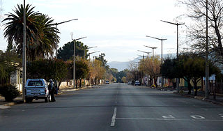
Molteno is a town in the Eastern Cape province of South Africa.

The Stormberg Group is one of the four geological groups that comprises the Karoo Supergroup in South Africa. It is the uppermost geological group representing the final phase of preserved sedimentation of the Karoo Basin. The Stormberg Group rocks are considered to range between Lower Triassic (Olenekian) to Lower Jurassic (Pliensbachian) in age. These estimates are based on means of geological dating including stratigraphic position, lithostratigraphic and biostratigraphic correlations, and palynological analyses.

Kogelberg Nature Reserve is a nature reserve of 3,000 ha comprising the Kogelberg Mountain Range, to the east of Cape Town, South Africa.
Sterkstroom is a settlement in Enoch Mgijima Local Municipality of the Chris Hani District in the Eastern Cape province of South Africa.

The Cape Government Railways 3rd Class 4-4-0 of 1884 was a South African steam locomotive from the pre-Union era in the Cape of Good Hope.

The Cape Government Railways 4th Class 4-6-0TT of 1882 was a South African steam locomotive from the pre-Union era in the Cape of Good Hope.

The Cape Government Railways 4th Class 4-6-0TT of 1884 was a South African steam locomotive from the pre-Union era in the Cape of Good Hope.

The geology of South Africa is highly varied including cratons, greenstone belts, large impact craters as well as orogenic belts. The geology of the country is the base for a large mining sector that extracts gold, diamonds, iron and coal from world-class deposits. The geomorphology of South Africa consists of a high plateau rimmed to west, south and southeast by the Great Escarpment, and the rugged mountains of the Cape Fold Belt. Beyond this there is strip of narrow coastal plain.