Related Research Articles

Prairies are ecosystems considered part of the temperate grasslands, savannas, and shrublands biome by ecologists, based on similar temperate climates, moderate rainfall, and a composition of grasses, herbs, and shrubs, rather than trees, as the dominant vegetation type. Temperate grassland regions include the Pampas of Argentina, Brazil and Uruguay, and the steppe of Ukraine, Russia and Kazakhstan. Lands typically referred to as "prairie" tend to be in North America. The term encompasses the area referred to as the Interior Lowlands of Canada, the United States, and Mexico, which includes all of the Great Plains as well as the wetter, hillier land to the east.

The Wisconsin Glacial Episode, also called the Wisconsin glaciation, was the most recent glacial period of the North American ice sheet complex. This advance included the Cordilleran Ice Sheet, which nucleated in the northern North American Cordillera; the Innuitian ice sheet, which extended across the Canadian Arctic Archipelago; the Greenland ice sheet; and the massive Laurentide Ice Sheet, which covered the high latitudes of central and eastern North America. This advance was synchronous with global glaciation during the last glacial period, including the North American alpine glacier advance, known as the Pinedale glaciation. The Wisconsin glaciation extended from approximately 75,000 to 11,000 years ago, between the Sangamonian Stage and the current interglacial, the Holocene. The maximum ice extent occurred approximately 25,000–21,000 years ago during the last glacial maximum, also known as the Late Wisconsin in North America.

Halton Hills is a town in the Regional Municipality of Halton, located in the northwestern end of the Greater Toronto Area, Ontario, Canada with a population of 61,161 (2016).

Nobleton is an unincorporated community in southwestern King, Ontario, Canada. It is the third-largest community in the township, after King City and Schomberg. Located south of the Oak Ridges Moraine, Nobleton is surrounded by hills and forests. Many horse farms are found on Nobleton's eastern periphery.
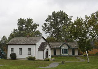
King City is an unincorporated Canadian community in the township of King, Ontario, located north of Toronto. It is the largest community in King township, with 2,730 dwellings and a population of 8,396 as of the 2021 Canadian census.

Oak Ridges is an unincorporated community of Richmond Hill, Ontario, Canada, and has been part of that city since 1971. It forms the northern portion of the municipality's boundary, where it borders Aurora. Located about 20 km north of Toronto, it has a population of 38,140 (2016). The community developed around Lake Wilcox, the largest lake in the area, and has continued to expand slowly since its annexation by the Town of Richmond Hill. In the 1990s, Oak Ridges experienced moderate growth, which spurred environmental action by numerous organizations. Population has grown significantly as a result of development initiatives along Bayview Avenue. The Oak Ridges Community Center was built and completed in June 2012 to accommodate community demand.

Schomberg is an unincorporated village in northwestern King, Ontario, Canada. It is located north of the Oak Ridges Moraine and south of the Holland River.
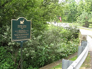
Kettleby is an unincorporated community in the northeastern part of King Township in Ontario, Canada. It is located about 1.5 kilometres (0.93 mi) east of Highway 400, 25 kilometres (16 mi) north of Toronto, about 40 kilometres (25 mi) south of Barrie, 6 kilometres (3.7 mi) west of Newmarket, and about 50 kilometres (31 mi) east of Orangeville.
The Trafalgar Moraine is a geological landform straddling Oakville and Milton in Ontario, Canada. A small portion of the moraine extends into Burlington at Milton's southern border. It is a subtler topological feature than the better-known Oak Ridges Moraine, primarily because it was formed as an end moraine at the terminus of a glacial ice sheet, instead of between two retreating ice lobes. The ice sheet pushed material to form the ridge, which is composed of Halton Till sediment, rich in silt and clay. By contrast, the Oak Ridges Moraine is primarily sand and gravel. The ridge was probably formed during a pause in the retreat of the ice sheet. The moraine covers an area of 892.5 hectares of primarily private land, though a small portion is public.
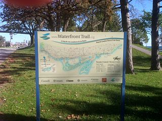
Stretching over 3600 km from Prince Township, west of Sault Ste. Marie, to the Quebec border, the Great Lakes Waterfront Trail is a signed route of interconnecting roads and off-road trails joining over 150 communities and First Nations along the Canadian shores of the Great Lakes and St. Lawrence River. A celebration of nature and culture, the Great Lakes Waterfront Trail is part of a strategy to protect and connect people to the largest group of freshwater lakes on earth. It is a legacy project of the Waterfront Regeneration Trust, a charity, and its community partners. Through Toronto, the trail is called the Martin Goodman Trail. The Waterfront Trail is also used by commuters in parts of Southern Ontario.

The Valparaiso Moraine is a recessional moraine that forms an immense U around the southern Lake Michigan basin in North America. It is the Longest moraine. It is a band of hilly terrain composed of glacial till and sand. The Valparaiso Moraine forms part of the Saint Lawrence River Divide, bounding the Great Lakes Basin. It begins near the border of Wisconsin and Illinois and extends south through Lake, McHenry, Cook, DuPage and Will counties in Illinois, and then turns southeast, going through northwestern Indiana. From this point, the moraine curves northeast through Lake, Porter, and LaPorte counties of Indiana into Michigan. It continues into Michigan as far as Montcalm County.
The Glenville Hills Kames is a 345 hectare provincially significant Earth Science Area of Natural and Scientific Interest in Ontario, Canada.
The Uxbridge Forest Kames is a 644-hectare (1,591-acre) provincially significant Earth Science Area of Natural and Scientific Interest in Ontario, Canada. The land is owned and managed by the Toronto and Region Conservation Authority.
The Fleetwood Kames is a 939 hectare provincially significant Earth Science Area of Natural and Scientific Interest in Ontario, Canada. The topographical feature is located on the north slope of the Oak Ridges Moraine, in the city of Kawartha Lakes. Part of the parcel, known as Fleetwood Creek, is owned by the Ontario Heritage Foundation.
The Mississinawa Moraine begins in Ohio east of Lima in Hardin County, then running in a shallow arc to the south of Grand Lake St. Marys and St. Marys in Mercer County towards Fort Recovery, Ohio. Just west of Fort Recovery, the moraine again arches southward towards the Mississinewa River. The moraine follows the eastern bank of the river northwestward to where it enters the Wabash River at Wabash, Indiana. Angling towards the north and a little east, the Mississinawa moraine merges with the Packerton Moraine north of the Eel River in Whitley County near Columbia City. The moraine does not end here, but continues in a northeasterly direction through the three corners area of Michigan, Indiana, and Ohio until reaching Ann Arbor, Michigan where numerous moraines intermingle. Note: There are two common spellings of the name. Mississinawa is commonly used in the older reports. Mississinewa is the modern usage and the spelling used on modern maps and projects associated with the river. Both spellings are used interchangeably in this article, based on the source material.
The Union Moraine begins in Ohio, east of Bellefontaine and the highest point in that state, towards Greenville in Darke County. Traveling southwestward and arcing a little northward, the moraine reaches Union City, Ohio for which it is named. From here, it travels almost directly westward to Muncie, Indiana. From Muncie, the moraine runs northwest ending in the bluffs overlooking Pipe Creek at Bunker Hill, Indiana, just south of Peru on the Wabash River.

The Mixedwood Plains Ecozone is the Canadian ecozone with the most southern extent, covering all of southwestern Ontario, and parts of central and northeastern Ontario and southern Quebec along the Saint Lawrence River. It was originally dominated by temperate deciduous forest growing mostly on limestone covered by glacial till. It is the smallest ecozone in Canada, but it includes the country's most productive industrial and commercial region, and is home to nearly half of Canada's population, including its two largest cities, Toronto, Ontario and Montreal, Quebec. Hence, little of the original forest cover remains, making protection of the remaining forests a high conservation priority. This ecozone includes two regions described by J.S. Rowe in his classic Forest Regions of Canada: the entire Deciduous Forest Region, and the southern portions of the Great Lakes-St. Lawrence Forest Region. In the province of Ontario, the Ontario Ministry of Natural Resources maps this area as Site Regions 6E and 7E.

Lake Kankakee formed 14,000 years before present (YBP) in the valley of the Kankakee River. It developed from the outwash of the Michigan Lobe, Saginaw Lobe, and the Huron-Erie Lobe of the Wisconsin glaciation. These three ice sheets formed a basin across Northwestern Indiana. It was a time when the glaciers were receding, but had stopped for a thousand years in these locations. The lake drained about 13,000 YBP, until reaching the level of the Momence Ledge. The outcropping of limestone created an artificial base level, holding water throughout the upper basin, creating the Grand Kankakee Marsh.

The Lake Border Moraine is a complex group of moraines bordering the southern end of Lake Michigan. It can be traced north along the eastern shore of the lake basin and across the highlands between the northern Lake Michigan and Saginaw Bay. It continues around the Saginaw Basin into the "thumb" of Michigan, and south through southeastern Michigan on the eastern side of the "thumb." Along Lake Michigan, north to Holland the system is close to the shore. From Holland north to Oceana County it is 15 miles (24 km) to 25 miles (40 km) east of the shore. In Oceana County it forms the prominent "clay banks" along the shoreline of Lake Michigan. It again bears inland from Hart, where more recent moraines reside between it and Lake Michigan. It runs north of the great interlobate moraine that exists between the Lake Michigan and Saginaw lobes of the Laurentian ice sheet. A little north of Cadillac turns to the east. A short distance from Cadillac, it splits with the southern ridge or outer member heading to the Saginaw basin. The northern ridge heads towards Lake Huron, but turns south before reaching the shore. In Newaygo and Lake counties it rest on an earlier interlobate moraine. It separates in Wexford and Missaukee counties to continue south along the west side of the Saginaw basin.

The Erie Plain is a lacustrine plain that borders Lake Erie in North America. From Buffalo, New York, to Cleveland, Ohio, it is quite narrow, but broadens considerably from Cleveland around Lake Erie to Southern Ontario, where it forms most of the Ontario peninsula. The Erie Plain was used in the United States as a natural gateway to the North American interior, and in both the United States and Canada the plain is heavily populated and provides very fertile agricultural land.
References
King, Ontario | |
|---|---|
| Municipality | |
| Government | |
| Geography | |
| Education | |
| Culture | |
| Business and services | |
| Sport | |
| Transportation | |
Coordinates: 43°56′9″N79°34′55″W / 43.93583°N 79.58194°W
| | This Ontario geographical article about a location in the Golden Horseshoe is a stub. You can help Wikipedia by expanding it. |