Subic Bay Freeport Zone

Last updated
Subic Bay Freeport Zone
Subic Bay Yacht Club.jpg
Subic Bay Yacht Club
Philippines location map (square).svg
Red pog.svg
Subic Bay Freeport Zone
Location within the Philippines
Coordinates: 14°48′25″N120°17′13″E / 14.807°N 120.287°E / 14.807; 120.287 Coordinates: 14°48′25″N120°17′13″E / 14.807°N 120.287°E / 14.807; 120.287
Country Flag of the Philippines.svg  Philippines
Region Central Luzon (Region III)
Province Zambales, Bataan
City and municipalities
FoundedNovember 24, 1992
Founded byRepublic Act No. 7227
Government
Time zone UTC+8 (PST)
ZIP code
2222
IDD : area code +63 47
Website Subic Bay Freeport Official Website

Subic Bay Freeport Zone (SBFZ), which is known simply as Subic Bay or Subic is a special economic zone covering portions of Olongapo City and the towns of Subic in Zambales and Morong and Hermosa in Bataan. [1] It is the Philippines' first successful case of a military base converted through volunteerism into a tax and duty-free zone, operated and managed by the Subic Bay Metropolitan Authority or SBMA. It covers the fenced area of the former U.S. Naval Base Subic Bay located in the southwest of Luzon Island in the Philippines.The harbor faces the Zambales Mountain Range to the west and the Subic Bay opening to the West Philippine Sea. It is northwest of the Bataan Peninsula and southeast of Zambales Province.

Contents

SBFZ is 110 kilometers west of Manila. Manila Bay and the Bataan Peninsula separate SBFZ from Manila. The mountain ranges around the Subic Bay area and the deep natural harbor provide excellent and protected anchorage. In addition, these features make SBFZ naturally sheltered from typhoons as well as from the effects of an eruption of nearby Mt. Pinatubo.

Subic Bay Freeport Zone is in Region III (or Central Luzon Region) of the Philippines. It is one of the points in the growth triangle (and an engine for economic development) in the region. SBFZ is a supplier of services and products for the Central Luzon Development Program, a regional growth area composed of the provinces of Bulacan, Nueva Ecija, Tarlac, Pampanga, Bataan, and Zambales.

History

Subic Bay is surrounded by the town of Subic and Olongapo City, both in the province of Zambales, and Morong in the province of Bataan. Development of Olongapo City was largely tied to the presence of the United States Navy base, once the largest U.S. military naval base in Asia. An arsenal and ship-repair facility was established at Subic Bay in 1885 by the then colonial power, Spain. Following the Spanish–American War, Subic Bay became a U.S. Navy and Marine base, and grew to be a major facility. Until 1991, it was the base of the United States 7th Fleet.

The Official Logo of the Subic Bay Metropolitan Authority Subic Bay Metropolitan Authority (SBMA).svg
The Official Logo of the Subic Bay Metropolitan Authority

In early 1991, after the collapse of protracted negotiations, the Philippine Senate rejected terms for renewal of the lease of the base. The U.S. Navy was already in the process of downsizing its Subic operations in June 1991, when Mount Pinatubo erupted. One of the largest volcanic eruptions in the last 100 years, it covered the Navy Base in volcanic ash and collapsed a significant number of structures. The last ship, USS Belleau Wood, left on November 24, 1992. The presence of the American forces precipitated the start of a red-light district. [2]

Post–Cold War

Subic Bay was converted into a commercial zone largely through the efforts of some 8,000 residents of nearby Olongapo City, under the leadership of their mayor, Richard Gordon, who volunteered to protect and preserve 8 billion dollars worth of facilities and property from looting and destruction. Subic has since been transformed and became a model for bases conversion into commercial use after the Cold War with blue chip companies like Coastal Petroleum, and Fed Ex pumping in over $3 billion of investments creating 70,000 jobs in the free port's first four years. It was host to the 4th APEC Leaders' Summit on November 24, 1996 [3] and FedEx's Asia-Pacific hub, Asia-One, was also located in Subic Bay for almost ten years. [4] [5]

In addition to commercial use, Subic Bay is also a popular destination for weekend visitors from Metro Manila. Attractions include several beaches, an underwater aquarium, jungle survival tours, and duty-free shopping centers.

Subic International Raceway (SIR), the Philippines' first purpose-built motorsports venue, was opened in 1994 and situated near Subic Bay International Airport. It was established by local racing champion, Pocholo Ramirez, and his family. SIR was host to international racing events, such as the Asian Festival of Speed, Asian Formula 2000 and the Asian Formula Three Championship. [6] It also hosted local races, such as the Philippine Touring Car Championship, Run What You Brung (RWYB) and Circuit Showdown. The racetrack ceased operations in 2010 after the end of its lease. [7]

In 2013 Defense Secretary Voltaire Gazmin said that the Philippines intended to move military forces to the base in response to the territorial disputes in the South China Sea. [8] The United States Navy is also seeking access on a rotational basis for ships and Marines, [9] and is already conducting maritime patrol aircraft patrols from bases in the Philippines. [10]

Subic Bay today

Boardwalk Beach Subic Bay Boardwalk.jpg
Boardwalk Beach

Subic Bay, the Philippines' first free port (see, Port of Subic ), continues to be one of the country's major economic engines with more than 700 investment projects, including the 4th largest shipbuilding facility in the world (Hanjin Heavy Industries and Construction). Currently upgrading its port facilities through the Subic Bay Port Development Project and forging ties with the Clark Special Economic Zone in Angeles City to form the Subic-Clark Corridor via the 45-kilometer Subic-Clark-Tarlac Expressway, this historical bastion of western military might is now being positioned to become the most competitive international service and logistics center in Southeast Asia.

As a destination, Subic Bay has maintained its allure that once charmed US servicemen and their families. Its community continues to preserve and protect the bay, its surrounding forests and its flora and fauna. Interesting sights to see are its resident eco-tourism theme parks, the Ocean Adventure, [11] the country's only open-sea marine park, Zoobic Safari, [12] and the Pamulaklakin Nature Park [13] which is home to the indigenous Aetas who once trained the U.S. Navy in jungle survival tactics. [14]

Shopping centers

Harbor Point Harbor Point,Subicjf7562 14.JPG
Harbor Point

Related Research Articles

Bataan Province in Central Luzon, Philippines

Bataan is a province situated in the Central Luzon region of the Philippines. Its capital is the City of Balanga. Occupying the entire Bataan Peninsula on Luzon, Bataan is bordered by the provinces of Zambales and Pampanga to the north. The peninsula faces the South China Sea to the west and Subic Bay to the north-west, and encloses Manila Bay to the east.

Zambales Province in Central Luzon, Philippines

Zambales is a province in the Philippines located in the Central Luzon region in the island of Luzon. Its capital is the Municipality of Iba which is strategically located in the middle of the province. Zambales borders Pangasinan to the north and northeast, Tarlac to the east, Pampanga to the southeast, Bataan to the south and the West Philippine Sea to the west. With a total land area of 3,830.83 square kilometres (1,479.09 sq mi), Zambales is the second largest among the seven provinces of Central Luzon after Nueva Ecija. The province is noted for its mangoes, which are abundant from January to April.

Olongapo Highly Urbanized City in Central Luzon, Philippines

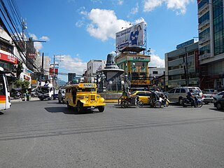
Olongapo, officially the City of Olongapo or simply Olongapo City, is a 1st class highly urbanized city in Central Luzon (Region III), Philippines. Located in the province of Zambales but governed independently from the province, it has a population of 233,040 people according to the 2015 census.

Subic, Zambales Municipality in Central Luzon, Philippines

Subic, officially the Municipality of Subic, is a 1st class municipality in the province of Zambales, Philippines. According to the 2015 census, it has a population of 104,771 people.

Subic Bay International Airport

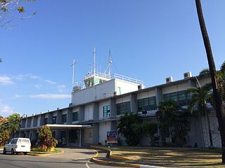
Subic Bay International Airport or SBIA serves as a secondary airport and a main diversion airport of the Ninoy Aquino International Airport. It is also the airport serving the immediate area of the Subic Bay Freeport Zone, the municipality of Morong, Bataan and the general area of Olongapo in the Philippines. This airport was previously Naval Air Station Cubi Point of the United States Navy.

Richard J. Gordon Filipino politician

Richard Juico Gordon, known as Dick Gordon, is a Filipino politician and broadcaster who currently serves as a Senator of the Philippines and the chairman of the Philippine Red Cross.

Subic–Clark–Tarlac Expressway road in the Philippines

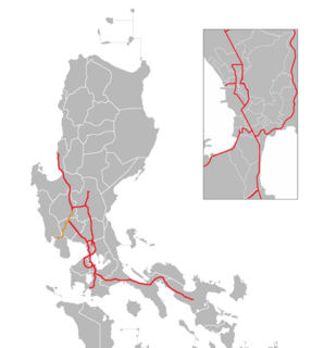
The Subic–Clark–Tarlac Expressway (SCTEx) is a 93.77-kilometer (58.27 mi) four-lane expressway north of Manila, in the Philippines, built by the Bases Conversion and Development Authority (BCDA), a government owned and controlled corporation under the Office of the President of the Philippines. Started on April 5, 2005, the Subic–Clark–Tarlac Expressway (SCTEx) is the country’s longest expressway at 93.77 kilometers (58.27 mi).

Subic Bay bay forming part of Luzon Sea on the west coast of the island of Luzon, Philippines

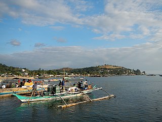
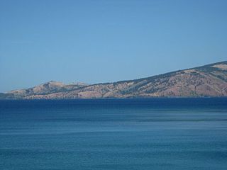
Subic Bay is a bay on the west coast of the island of Luzon in the Philippines, about 100 kilometres (62 mi) northwest of Manila Bay. An extension of the South China Sea, its shores were formerly the site of a major United States Navy facility named U.S. Naval Base Subic Bay, which is now the location of an industrial and commercial area known as the Subic Bay Freeport Zone under the Subic Bay Metropolitan Authority.

Ambala is a Sambalic language spoken in the Philippines. It has more than 2,000 speakers and is spoken within Aeta communities in the Zambal municipalities of Subic, San Marcelino, and Castillejos; in the city of Olongapo; and in Dinalupihan, Bataan (Ethnologue).

Port of Subic

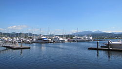
The Port of Subic Bay is in the Subic Bay Freeport Zone, the former U.S. Naval Base Subic Bay, on Subic Bay in the Philippines. It is one of the busiest, largest, historical and most important of ports in the Philippines. The Port is operated and managed by the Subic Bay Metropolitan Authority (SBMA).

Regional Science High School III is a science high school located in East Kalayaan, Subic Bay Freeport Zone, Olongapo City, Zambales province of the Philippines. The school implements a specialized science and mathematics-oriented curriculum, mainly for academically strong adolescents and was established in 1994. RSHS III houses a junior high school and a STEM strand focused senior high school. Most of the student body are residents of nearby cities & provinces, majority of whom are from Olongapo City, Bataan and Zambales.

DWSB-FM

DWSB, broadcasting as 89.5 Subic Bay Radio, is a public radio facility of the Subic Bay Metropolitan Authority. The station's studio and transmitter are located at Bldg. N, Quezon Street, Subic Bay Freeport Zone, Olongapo City.

U.S. Naval Base Subic Bay former naval base in the Philippines used by the United States

Naval Base Subic Bay was a major ship-repair, supply, and rest and recreation facility of the Spanish Navy and subsequently the United States Navy located in Zambales, Philippines. The base was 262 square miles, about the size of Singapore. The Navy Exchange had the largest volume of sales of any exchange in the world, and the Naval Supply Depot handled the largest volume of fuel oil of any navy facility in the world. The naval base was the largest overseas military installation of the United States Armed Forces after Clark Air Base in Angeles City was closed in 1991. Following its closure in 1992, it was transformed into the Subic Bay Freeport Zone by the Philippine government.

Harbor Point is a shopping mall in Subic Bay Freeport Zone in Olongapo City, Zambales, Philippines owned by property development firm Ayala Land, Inc., a real estate subsidiary of Ayala Corporation. It is the first Ayala mall located in Subic Bay, second in Central Luzon and the fourth outside Metro Manila.

Bataan National Park national park

Bataan National Park is a protected area of the Philippines located in the mountainous interior of Bataan province in the Central Luzon Region. The park straddles the northern half of Bataan Peninsula near its border with Subic Bay Freeport Zone, Zambales. The park was first established in 1945 under Proclamation No. 24 with an initial area of 31,000 hectares and included portions in Subic, Zambales. The park was reduced in 1987 to its present size of 23,688 hectares and is now wholly located in Bataan province. The park encompasses the Bataan towns and cities of Hermosa, Orani, Samal, Abucay, Balanga, Bagac and Morong.

Redondo Peninsula

The Redondo Peninsula is a short mountainous peninsula extending about 15 kilometers to the south of Zambales on western Luzon in the Philippines. It separates Subic Bay and the coasts around the Subic Bay Metropolitan Area of Subic and Olongapo from the South China Sea. It is known for its secluded coves, beaches and pine-forested mountains.

Subic Bay Metropolitan Authority

The Subic Bay Metropolitan Authority is governmental agency of the Philippine government. Sometimes abbreviated as SBMA, the agency has played a significant part in the development of the Subic Bay Freeport and the Special Economic Zone into a self-sustainable area that promotes the industrial, commercial, investment, and financial areas of trade in the zone as well as in the country of the Philippines itself.

New Clark City is a planned community under development located in Capas, Tarlac, Philippines. It has an area of approximately 9,450 hectares and will accommodate up to 1.2 million people. It is managed by the Bases Conversion and Development Authority (BCDA). NCC is patterned after the development of Putrajaya, the federal administrative capital of Malaysia.

Jose Abad Santos Avenue major highway in Central Luzon, Philippines

The Jose Abad Santos Avenue, also known as Olongapo–Gapan Road and Gapan–San Fernando–Olongapo Road is a 118-kilometer (73 mi) major highway spanning the provinces of Nueva Ecija, Pampanga, Bataan and Zambales in Central Luzon, Philippines. The highway is designated as the National Route 3 (N3) of the Philippine highway network.

Freeport Area of Bataan Freeport Zone in Central Luzon, Philippines

The Freeport Area of Bataan (FAB), formerly Bataan Export Processing Zone (BEPZ) from 1972 to 2010, is a special economic zone in Mariveles, Bataan, Philippines. It was envisioned by Congressman Pablo Roman, Sr., a representative from Bataan, who authored Republic Act 5490 designating the said location as the first free trade zone in the Philippines.

References

  1. https://businessmirror.com.ph/sbma-plans-extending-subic-freeport-contiguous-towns/
  2. Marquardt, Alexander; Waterfield, Alex (25 February 2013). "Alleged Underage Prostitution in Philippines; Americans Targeted". ABC News. Retrieved 31 January 2019.
  3. "Asia-Pacific Economic Cooperation". www.apec.org. Retrieved 2017-05-05.
  4. "FedEx - About FedEx - Press Releases". www.fedex.com. Retrieved 2017-05-05.
  5. Cruz, Ed Michael Lee. "Brief History". Official Website of the Subic Bay Metropolitan Authority. Retrieved 2017-05-05.
  6. "Improved Subic International Raceway bows this April"
  7. "The Last Lap of Subic Raceway"
  8. "Manila to move air force, navy near disputed sea ."
  9. "Navy wants to expand Philippine presence, create temporary base."
  10. "It’s Boom Time for Naval Spy Planes"
  11. "About Us – Ocean Adventure". www.oceanadventure.ph. Retrieved 2017-05-05.
  12. "Fast Facts About Zoobic Safari | Zoobic". zoobic.com.ph. Retrieved 2017-05-05.
  13. "Pamulaklakin Forest Trail (Subic Bay Freeport Zone, Philippines): Top Tips Before You Go - TripAdvisor". www.tripadvisor.com.ph. Retrieved 2017-05-05.
  14. Waddington, Ray. "Indigenous Peoples of the World — The Aeta". www.peoplesoftheworld.org. Retrieved 2017-05-05.