Sugar Ridge Township | |
|---|---|
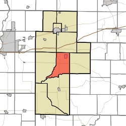 Location of Sugar Ridge Township in Clay County | |
| Coordinates: 39°22′36″N87°06′05″W / 39.37667°N 87.10139°W | |
| Country | United States |
| State | Indiana |
| County | Clay |
| Government | |
| • Type | Indiana township |
| Area | |
• Total | 28.21 sq mi (73.1 km2) |
| • Land | 27.72 sq mi (71.8 km2) |
| • Water | 0.5 sq mi (1.3 km2) |
| Elevation | 581 ft (177 m) |
| Population (2020) | |
• Total | 914 |
| • Density | 33.0/sq mi (12.7/km2) |
| FIPS code | 18-73988 [2] |
| GNIS feature ID | 453887 |
Sugar Ridge Township is one of eleven townships in Clay County, Indiana. As of the 2020 census, its population was 914 (down from 939 at 2010 [3] ) and it contained 438 housing units. [4]
