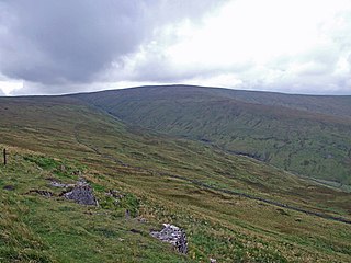
The Pennines, also known as the Pennine Chain or Pennine Hills, are a range of uplands mainly located in Northern England. Commonly described as the "backbone of England" because of its length and position, the range runs from Derbyshire and Staffordshire in the north of the Midlands to Northumberland in North East England. From the Tyne Gap in the north, the range extends south through the North Pennines, Yorkshire Dales, South Pennines, and Peak District to end near the valley of the River Trent. The Border Moors and Cheviot Hills, which lie beyond the Tyne Gap, are included in some definitions of the range.

The Pennine Way is a National Trail in England, with a small section in Scotland. The trail stretches for 268 miles (431 km) from Edale, in the northern Derbyshire Peak District, north through the Yorkshire Dales and Northumberland National Park and ends at Kirk Yetholm, just inside the Scottish border. The path runs along the Pennine hills, sometimes described as the "backbone of England". Although not the United Kingdom's longest National Trail, it is, according to The Ramblers, "one of Britain's best known and toughest".

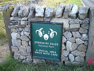
The Yorkshire Dales National Park is a 2,178 km2 (841 sq mi) national park in England which covers most of the Yorkshire Dales, the Howgill Fells, and the Orton Fells. The Nidderdale area of the Yorkshire Dales is not within the national park, and has instead been designated a national landscape. Most of the park is within North Yorkshire, with a sizeable area in Cumbria and a small part in Lancashire. The park was designated in 1954, and extended in 2016. More than 95% of the land in the park is privately owned; there are over 1,000 farms in this area.

High Seat is a fell in the dale of Mallerstang, Cumbria. With a summit at 709 metres (2,326 ft), it is the fourth highest fell in the Yorkshire Dales after Whernside, Ingleborough and Great Shunner Fell. It is in the north-western part of the Dales, overlooking the deep trench of Mallerstang, and is usually climbed from this side.

The Pennine Bridleway is a National Trail in Northern England.

Aisgill is the southernmost of the hamlets that form the parish of Mallerstang in the English county of Cumbria. It is on the B6259 road, at the head of Mallerstang dale, just before the boundary between Cumbria and North Yorkshire.

Mallerstang is a civil parish in the extreme east of Cumbria, and, geographically, a dale at the head of the upper Eden Valley. Originally part of Westmorland, it lies about 6 miles (9.7 km) south of the nearest town, Kirkby Stephen. Its eastern edge, at Aisgill, borders on North Yorkshire; and since August 2016 it has been within the Yorkshire Dales National Park.

Nine Standards Rigg is the summit of Hartley Fell in the Pennine Hills of England. It lies near the boundary between Cumbria and North Yorkshire, a few miles south-east of Kirkby Stephen and approximately 770 yards (700 m) outside the Yorkshire Dales National Park. Nine Standards Rigg lies within the North Pennines Area of Outstanding Natural Beauty (AONB). The name is derived from a group of cairns, the Nine Standards, located near the summit. The fell is listed as Nine Standards Rigg, rather than Hartley Fell, in Alan Dawson's book The Hewitts and Marilyns of England.

Green Hill is a mountain or fell in north west England. Its summit is 628 metres (2,060 ft) above sea level. It is located above Cowan Bridge, Lancashire, near Kirkby Lonsdale, Cumbria, and Ingleton, North Yorkshire. Its summit is about 4 kilometres almost due west of the summit of Whernside. It forms the watershed between the River Dee and the Leck Beck: both are tributaries of the River Lune.

Wild Boar Fell is a mountain in the Yorkshire Dales National Park, on the eastern edge of Cumbria, England. At 2,323 feet (708 m), it is either the 4th-highest fell in the Yorkshire Dales or the 5th, depending on whether nearby High Seat (2,326 ft) is counted or not.

Crag Hill is on the western edge of the Yorkshire Dales in northern England, not to be confused with the higher Crag Hill elsewhere in the county of Cumbria. It lies on the boundary of the Yorkshire Dales national park, but its summit is in South Lakeland district, Cumbria. It is part of a ridge including the neighbouring fells of Great Coum and Gragareth. The summit of Crag Hill is about 0.62 miles (1 km) away from the top of Great Coum, the latter being the highest point on the ridge at 2,254 feet (687 m).

Baugh Fell is a large, flat-topped hill in the northern Pennines of England. It lies in the north-western corner of the Yorkshire Dales National Park, immediately to the east of the Howgill Fells and to the north of Whernside, the highest of the Yorkshire Three Peaks. Formerly in the West Riding of Yorkshire, since 1974 it has been part of the county of Cumbria.

The mountains and hills of England comprise very different kinds of terrain, from a mountain range which reaches almost 1,000 metres high, to several smaller areas of lower mountains, foothills and sea cliffs. Most of the major upland areas have been designated as Areas of Outstanding Natural Beauty (AONB) or national parks. The highest and most extensive areas are in the north and west, while the midlands, south-east and east of the country tend to be low-lying.

Hugh Seat is a mountain, or more accurately a fell, in Mallerstang on the eastern edge of Cumbria, England. It lies on the border between Cumbria and North Yorkshire.

Gregory Chapel is one of the high points of the fells on the border between Cumbria and North Yorkshire.

Fountains Fell is a mountain in the Yorkshire Dales, England. The main summit has a height of 668 metres (2,192 ft) and a relative height or topographic prominence of 243 metres (797 ft) and thus qualifies as a Marilyn. Its subsidiary, Fountains Fell South Top reaches 662 metres (2,172 ft) and qualifies as a Nuttall. A third summit, further south at SD868697, reaches 610 metres (2,001 ft) and is the most southerly 2,000 ft summit in the Pennines.

Dodd Fell Hill is a hill in the Yorkshire Dales, in North Yorkshire, England. It is classed as a Marilyn and its summit is at 668 metres (2,192 ft). The flat summit, known as Dodd Fell Hill, is marked by a concrete trig-point. The hill has a lower summit known as Ten End, which is 1.6-kilometre (1 mi) to the north, and slightly lower at 580 metres (1,910 ft) above sea level.
A National Character Area (NCA) is a natural subdivision of England based on a combination of landscape, biodiversity, geodiversity and economic activity. There are 159 National Character Areas and they follow natural, rather than administrative, boundaries. They are defined by Natural England, the UK government's advisors on the natural environment.

Grisedale is a south east facing Dale in Cumbria, England, 8 miles (13 km) east of Sedbergh, and 7 miles (11 km) west of Hawes. Grisedale Beck, which drains Baugh Fell, flows down the dale eastwards, and on reaching the valley floor at Garsdale, forms the River Clough before turning westwards towards the Irish Sea. A small part of the north-eastern side of the dale is in North Yorkshire, however, until 1974, all of the area around, and including Grisedale, was part of the West Riding of Yorkshire. The dale was largely depopulated of its working farmers during the 20th century, however, some of the houses have been re-occupied by non-agricultural inhabitants.


