Swavesey

Last updated

Swavesey
UK Swavesey.jpg
Village sign
Cambridgeshire UK location map.svg
Red pog.svg
Swavesey
Location within Cambridgeshire
Population2,480 (2001 Census) [1]
2,463 (2011) [2]
OS grid reference TL364684
District
Shire county
Region
Country England
Sovereign state United Kingdom
Post town CAMBRIDGE
Postcode district CB24
Dialling code 01954
Police Cambridgeshire
Fire Cambridgeshire
Ambulance East of England
UK Parliament
List of places
UK
England
Cambridgeshire
52°17′51″N0°00′00″E / 52.2975°N 0.0°E / 52.2975; 0.0 Coordinates: 52°17′51″N0°00′00″E / 52.2975°N 0.0°E / 52.2975; 0.0

Swavesey is a village lying on the Prime Meridian in Cambridgeshire, England, with a population of 2,463. The village is situated 9 miles to the north west of Cambridge and 3 miles south east of St Ives.

Contents

Listed as Suauesye in the Domesday Book, the name Swavesey means "landing place (or island) of a man named Swaef". [3]

History

Swavesey, forming a historical parish of 3982 acres on the border with Huntingdonshire, lies on a narrow clay ridge rising to 18 metres above sea level at one time surrounded by fenland. The village was of importance during the early Middle Ages as the centre of a large 11th-century estate. A castle was built here in the late 11th or early 12th century, though is believed to have been derelict by 1200. Swavesey served as a port and subsequent market town and was fortified at the end of the 12th century. [4]

An alien priory was founded in Swavesey shortly after the Norman Conquest, possibly replacing a Saxon minster.

Roman pottery has been found in the parish.

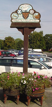
The village motto is "Steadfast in Work and Play". [5]

Church

There was already a church in Swavesey at the time of the Norman Conquest, possibly a minster, when Alan, Count of Richmond, granted it to the Abbey of St Sergius and St Bacchus in Angers, France. The Abbey founded an alien priory there by 1086, but Swavesey Priory was awarded to Alan la Zouche, lord of Swavesey manor, by the start of the 14th century. [4]

The present parish church in Swavesey, dedicated to St Andrew since the 11th century, [6] has a double aisle aspect to its nave. The east window in the Lady Chapel contains a 1967 Tree of Jesse by Francis Skeat. [7] The present building has parts dating from the 11th century, but was substantially improved over the following four centuries.

A Unitarian chapel was built in 1831 on the corner of School Lane and High Street, and the congregation moved to a new Baptist chapel in 1869. The original Unitarian chapel was bought by a group of Methodists and served as their place of worship until it was converted into a bungalow in 1934. [4]

Today, there are three places of worship in Swavesey: St Andrew's parish church in Station Road, the Strict and Particular Baptist Church in Middle Watch, and the Bethel Baptist Church, also in Middle Watch.

Transport

The railway line from Cambridge to St Ives, which passed through Swavesey, was opened in 1847 and closed in 1970, but has reopened as the Cambridgeshire Guided Busway. [4] The parish's north border is formed by the River Great Ouse, formerly an important transport link. The parish's south west border runs along the Via Devana, the old Roman road, that now forms the A14.

Village life

Farming is the main industry in and around Swavesey, although most residents commute to work.[ citation needed ] A sail-less windmill stands in fields near the village and is the location of Shop on the Pond.

There were three pubs listed in the village in 1765, and eight by the early 19th century. By the late 19th century, this number had risen to 16, but had fallen back to eight by 1912, and only three by 1960. Since then the only public house in the village centre has been the White Horse Inn, open since at least 1765, and adjacent to the village post office and shop. Notable former pubs include the Rose and Crown, on the corner of Boxworth End and Rose and Crown Road, which was open by 1765 but closed in the 1880s. The Black Horse on the corner of High Street and Black Horse Lane served from around 1777 until 1910. The Swan, (later the Swan with Two Necks), on Station Road was open from around 1777 to 1917. The Blue Bell was active from the late 18th century until around the Second World War, and the George and Dragon also opened in the late 18th century and closed in the first years of the 20th century.

The village's post office opened in the 1850s. [4] Swavesey has a village magazine called "The Meridian", and holds a biennial village festival. The MG Owners' Club has its UK headquarters just outside the village.

Education

The village contains one primary school, Swavesey Primary School, which claims to be the only school in the United Kingdom to lie on the meridian. [8] Swavesey Village College is a secondary school, which opened in 1958. [4] The school provides secondary education for surrounding villages, including Over, Bar Hill, Longstanton, and Fenstanton, and uses a vertical tutor system. As with other village colleges, Swavesey's institution also provides adult education in the evenings and a myriad of extracurricular after school clubs.

Related Research Articles

St Ives, Cambridgeshire Human settlement in England

St Ives is a market town and civil parish in Cambridgeshire, England, 5 miles (8 km) east of Huntingdon and 12 miles (19 km) north-west of Cambridge. Historically in Huntingdonshire, St Ives is in the non-metropolitan district of the same name which covers a similar area to the historic county.

Burwell, Cambridgeshire Village in Cambridgeshire, England

Burwell is a village and civil parish in Cambridgeshire, England, some 10 miles north-east of Cambridge. It lies on the south-east edge of the Fens. Westward drainage is improved by Cambridgeshire lodes (waterways), including Burwell Lode, a growth factor in the village. A population of 6,309 in the 2011 census was put at 6,417 in 2019.

Bierton Human settlement in England

Bierton is a village and civil parish in Buckinghamshire, England, about half a mile northeast of the town of Aylesbury. It is mainly a farming parish. Together with the hamlets of Broughton, Kingsbrook, Broughton Crossing and Burcott it historically formed the civil parish of Bierton with Broughton within Aylesbury Vale district and form part of the Aylesbury Urban Area, but in 2020 the parish was broken into three, with Bierton becoming its own parish.

Great Wilbraham Human settlement in England

Great Wilbraham is a small village situated in a rural area some seven miles (11 km) to the east of Cambridge, between the edge of an area of low-lying drained fens to the west and north, and higher ground beyond the A11 to the east.

Fordham, Cambridgeshire Human settlement in England

Fordham is a village in rural Cambridgeshire, England. Fordham is part of the East Cambridgeshire district. It is four miles north of Newmarket, as well as being close to the settlements of Soham, Burwell, Isleham, Mildenhall and Chippenham.

Melbourn Village in England

Melbourn is a large, clustered village in the far south-west of Cambridgeshire, England. Its traditional high street is bypassed by the A10, intersecting the settlement's other main axis exactly 3 miles (4.8 km) northwest of the traditional focal point of Royston, Hertfordshire, the nearest larger settlement. It has over 4,400 inhabitants and is in the South Cambridgeshire district and is in the Royston, Hertfordshire post town.

Sutton-in-the-Isle Human settlement in England

Sutton or Sutton-in-the-Isle is village and civil parish in the county of Cambridgeshire in England, near the city of Ely. The "in-the-Isle" suffix refers to the fact that the village is part of the Isle of Ely, once an island in the Fens and also an administrative county until 1965.

Holbeach Market town in Lincolnshire, England

Holbeach is a market town and civil parish in the South Holland District in Lincolnshire, England. The town lies 8 miles (13 km) from Spalding; 17 miles (27 km) from Boston; 20 miles (32 km) from King's Lynn; 23 miles (37 km) from Peterborough; and 43 miles (69 km) by road from the county town of Lincoln. It is on the junction of the A151 and A17. The main High Street is the B1515.

Comberton Village and civil parish in South Cambridgeshire, England

Comberton is a village and civil parish in South Cambridgeshire, England, just east of the Prime Meridian. It was voted the Most Depressing Cambridgeshire Village of 2020.

Over, Cambridgeshire Human settlement in England

Over is a large village near the River Great Ouse in the English county of Cambridgeshire, just east of the Prime Meridian.

Bluntisham Human settlement in England

Bluntisham is a village and civil parish in Cambridgeshire, England. The population of the civil parish as of the 2011 census is 2,003. Bluntisham lies approximately 8 miles (13 km) east of Huntingdon. Bluntisham is situated within Huntingdonshire which is a non-metropolitan district of Cambridgeshire as well as being a historic county of England. The villages of Earith, Colne, Woodhurst, and Somersham are all close by.

Somersham Human settlement in England

Somersham is a village and civil parish in Cambridgeshire, England. Somersham lies approximately 9 miles (14 km) east of Huntingdon and 4 miles (6 km) north of St Ives. Somersham is situated within Huntingdonshire which is a non-metropolitan district of Cambridgeshire as well as being a historic county of England.

Alvescot Human settlement in England

Alvescot is a village and civil parish about 1+12 miles (2.4 km) south of Carterton, Oxfordshire, England. The 2011 Census recorded the parish's population as 472.

Oakington Human settlement in England

Oakington is a small rural Anglo-Saxon village seven miles (11 km) north-west of Cambridge in Cambridgeshire in England, and belongs to the administrative district of South Cambridgeshire. Since 1985 the village has formed part of the parish of Oakington and Westwick.

Lolworth Human settlement in England

Lolworth is a small village and civil parish in the district of South Cambridgeshire, in the county of Cambridgeshire, England, located approximately 8 miles (13 km) northwest of Cambridge city centre. It lies off the A14 between Cambridge towards Huntingdon, via a lane that provides the only traffic access to and from the village.

Toft, Cambridgeshire Human settlement in England

Toft is a village situated in Cambridgeshire, England. It is approximately six miles to the west of Cambridge, and is situated within four miles of the M11 motorway. It has approximately 600 residents and 200 homes. Comberton Village College and Comberton Sixth Form fall within the Toft Parish boundary. The village has two churches, St Andrew's Parish Church and Toft Methodist Church.

Eltisley Human settlement in England

Eltisley is a village and civil parish in South Cambridgeshire, England, on the A428 road about 5.5 miles (9 km) east of St Neots and about 11 miles (18 km) west of the city of Cambridge. The population in 2001 was 421 people, falling slightly to 401 at the 2011 Census.

Little Thetford Human settlement in England

Little Thetford is a small village in the civil parish of Thetford, 3 miles (5 km) south of Ely in Cambridgeshire, England, about 76 miles (122 km) by road from London. The village is built on a boulder clay island surrounded by flat fenland countryside, typical of settlements in this part of the East of England. During the Mesolithic era, the fenland basin was mostly dry and forested, although subject to salt and fresh water incursions. The marshes and meres of this fenland may therefore have been difficult to occupy, other than seasonally, but there is evidence of human settlement on the island since the late Neolithic Age; a Bronze Age causeway linked the village with the nearby Barway, to the south-east. An investigation, prior to a 1995 development in the village, discovered a farm and large tile-kiln of Romano-British origin; further investigations uncovered an earlier settlement of the Pre-Roman Iron Age. The Roman road Akeman Street passed through the north-west corner of the parish, and the lost 7th century Anglo-Saxon village of Cratendune may be nearby.

Nash, Newport Village and community in Wales

Nash is a village and community to the south of the city of Newport, South Wales, in the Liswerry ward.

Little Tew Human settlement in England

Little Tew is an English village and civil parish about 4+12 miles (7 km) northeast of Chipping Norton and 8+12 miles (14 km) southwest of Banbury in Oxfordshire.

References

  1. "2001 Census: Key Statistics: Parish Headcounts: Area: Swavesey CP (Parish)". Office for National Statistics . Retrieved 24 June 2008.
  2. "Civil Parish population 2011". Neighbourhood Statistics. Office for National Statistics. Retrieved 24 July 2016.
  3. A. D. Mills (2003). A Dictionary of British Place-Names.
  4. 1 2 3 4 5 6 A History of the County of Cambridge and the Isle of Ely: Volume 9: Chesterton, Northstowe, and Papworth Hundreds. 1989. pp. 374–381.
  5. village sign
  6. "St Andrews Swavesey - History | 5 Folds". www.5folds.org.uk. Retrieved 27 February 2019.
  7. Low, Malcolm (January 2006). "Swavesey, Cambridgeshire, St Andrew's Church" (PDF). Tree of Jesse. Malcolm Low TSSF. p. 51. Archived from the original (PDF) on 25 October 2010. Retrieved 25 December 2010.
  8. Swavesey Primary School