
Flamborough is a village and civil parish in the East Riding of Yorkshire, England. It is situated approximately 4 miles (6 km) north-east of Bridlington town centre on the prominent coastal feature of Flamborough Head.
Bilton is a village and civil parish in the East Riding of Yorkshire, England. It is situated approximately 5 miles (8 km) east of Hull city centre on the B1238 road and adjoining the village of Wyton. According to the 2011 UK census, Bilton parish had a population of 2,220, a decrease on the 2001 UK census figure of 2,340.
Skirlaugh is a village and civil parish in the East Riding of Yorkshire, England, in an area known as Holderness. It is situated approximately 7 miles (11 km) north-east of Hull city centre on the A165 road. Originally a farming community, it is now primarily a commuter village for Hull.

Ottringham is a village and civil parish in the East Riding of Yorkshire, England, in an area known as Holderness. It is situated approximately 12 miles (19 km) to the east of Hull city centre and 5 miles (8 km) south-west of Withernsea. It lies on the A1033 road from Hull to Withernsea.
Hollym is a small village and civil parish in the East Riding of Yorkshire, England, in an area known as Holderness. It is situated approximately 2 miles (3 km) south of Withernsea and is on the A1033 road.

South Cave is a village and civil parish in the East Riding of Yorkshire, England. It is situated approximately 14 miles (23 km) to the west of Hull city centre on the A1034 road just to the north of the A63 road. North Cave is approximately 2 miles (3 km) to the north-west. South Cave formerly held a town charter that has lapsed and the parish council no longer styles itself as a town.

Eastrington is a small village and civil parish in the East Riding of Yorkshire, England. It is situated approximately 3 miles (5 km) to the east of Howden and 17 miles (27 km) south east of York.
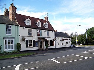
Burton Constable is a village and civil parish in the East Riding of Yorkshire, England. It is located approximately 9 miles (14 km) north-east of Hull city centre and 3 miles (5 km) south-east of the village of Skirlaugh.

Patrington is a village and civil parish in the East Riding of Yorkshire, England, in an area known as Holderness, 9 miles (14 km) south-east of Hedon, 16 miles (26 km) south-east of Kingston upon Hull and 4 miles (6.4 km) south-west of Withernsea on the A1033. Along with Winestead, it was a seat of the ancient Hildyard/Hilliard/Hildegardis family.
Wressle is a village and civil parish in the East Riding of Yorkshire, England, lying on the eastern bank of the River Derwent approximately 3 miles (5 km) north-west of Howden.
Barmby on the Marsh is a village and civil parish in the East Riding of Yorkshire, England. It is situated approximately 4 miles (6.4 km) west of the market town of Howden. It lies on the east bank of the River Ouse, near its confluence with the River Derwent.

Brandesburton is a village and civil parish in the East Riding of Yorkshire, England. It is situated approximately 7 miles (11 km) west of Hornsea and 9 miles (14 km) north-east of the market town of Beverley.

Burstwick is a village and civil parish in the Holderness region of the East Riding of Yorkshire, England. It is situated about 8 miles (13 km) east of Hull city centre. It lies on the B1362 road.

Burton Pidsea is a village and civil parish in the Holderness area of the East Riding of Yorkshire, England. The village is situated approximately 11 miles (18 km) east of Hull city centre.

Withernwick is a village and civil parish in the East Riding of Yorkshire, England. It is situated approximately 10 miles (16 km) north-east of Hull city centre and 5 miles (8 km) south of Hornsea.

Lockington is a small village and civil parish in the East Riding of Yorkshire, England. It is situated approximately 6 miles (10 km) north-west of Beverley town centre.
Rise is a village and civil parish in Holderness, the East Riding of Yorkshire, England. It is situated approximately 7 miles (11 km) east of the town of Beverley and 5 miles (8 km) south-west of Hornsea. It lies to the east of the B1243 road.

Nunburnholme is a village and civil parish in the East Riding of Yorkshire, England. It is approximately 3 miles (5 km) east of the market town of Pocklington. The civil parish is formed by the village of Nunburnholme and the hamlet of Kilnwick Percy. According to the 2011 UK census, Nunburnholme parish had a population of 234, a decrease on the 2001 UK census figure of 253.

North Cave is a village and civil parish in the East Riding of Yorkshire, England. It is situated 15 miles (24 km) to the west of Hull city centre on the B1230 road. South Cave is approximately 2 miles (3 km) to the south-east.
Molescroft is a village and civil parish in the East Riding of Yorkshire, England. It is situated approximately 0.5 miles (0.8 km) north-west of Beverley town centre adjoining its northern border. It lies to the north of the A1174 road.


